Clouds will gather through the day with rain not too far away
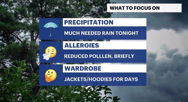
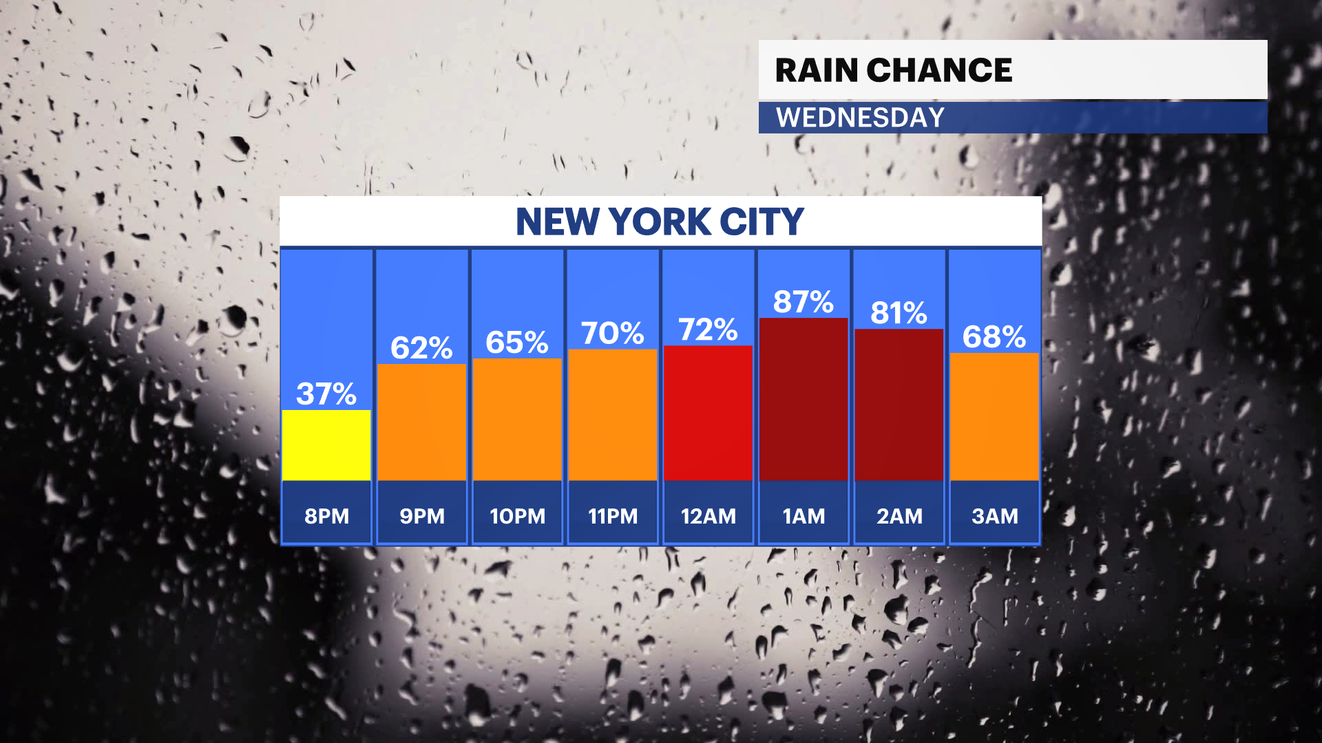
Umbrellas will be needed for any evening plans. And with cooler temperatures in sight, keep those jackets handy.
More Stories


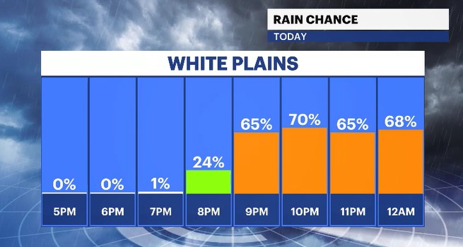
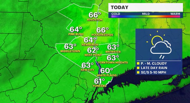
We'll see fair skies at first to start the day, but clouds will roll through the midday hours. Rain showers are on the way for the Hudson Valley, but you won't have to grab the umbrellas just yet.
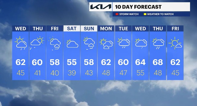
The clouds will eventually bring showers into the region, but not until after the evening rush. If you have any late-night plans, that is when you'll need the umbrella. Temperature wise, we'll see near normal levels, with highs into the low 60s.
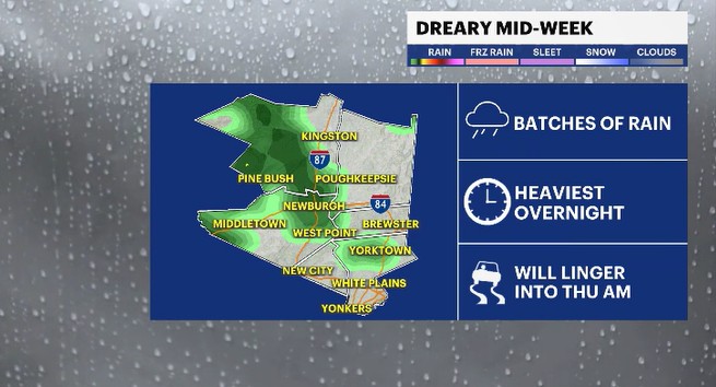
The rain will come down at its heaviest in the overnight hours, where some downpours may lead to some pockets of ponding on the roads. The showers will linger into the Thursday morning rush, but will be tapering off shortly thereafter.
Breezy, drier and cooler conditions will move through for the afternoon to evening hours on Thursday as high pressure gradually moves in.
The breezy winds will linger into Friday with a mix of sun and clouds. Temperatures will unfortunately be cooler than average. That trend will continue through the first weekend of May coming up. Another system was going to try to bring rain to the region for Saturday, but it is likely to form and stay well south of the Hudson Valley. But we'll get mostly cloudy skies and temps about 10 degrees below average.
The following week, next week, will see temperatures on the rise, finally feeling more like Spring. There will also be a rise in rain chances as well along the way.
ALMANAC:
Average High: 64 | Average Low: 45
Record High: 89 (1974) | Record Low: 32 (2019)
Sunrise: 5:55 a.m. | Sunset: 7:49 p.m.
THE FORECAST:
TODAY: Partly sunny to cloudy with a chance for showers in the evening hours. Highs: upper 50s to low 60s.
TONIGHT: Shower batches, quick downpours and slick travel. Lows: mid-40s.
THURSDAY: Showers fade in the morning hours with drier skies and breezy winds to follow. Highs: upper 50s to low 60s. Lows: upper 30s to low 40s.
FRIDAY: MAY 1st - Partly sunny and breezy. Highs: mid to upper 50s. Lows: upper 30s to low 40s.
SATURDAY: Mostly cloudy and cool. Highs: mid-50s. Lows: upper 30s to low 40s.