Summerlike surge: 80s take over, with records at risk in the Hudson Valley
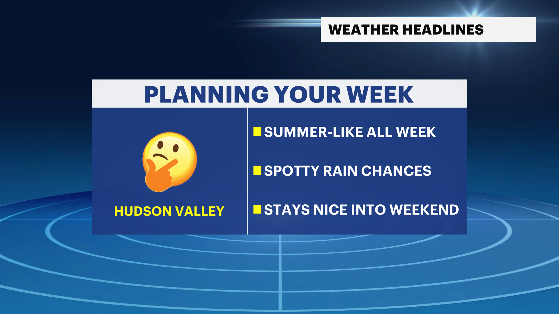
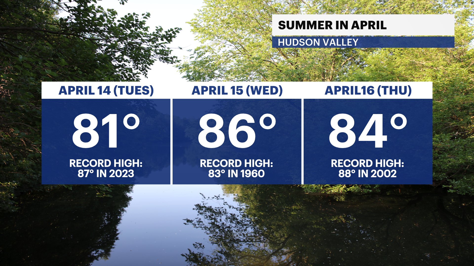
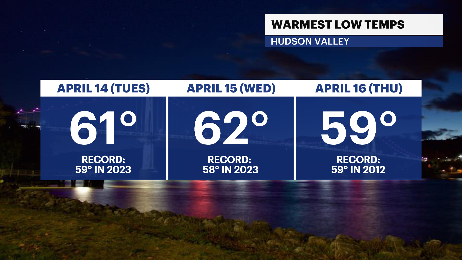
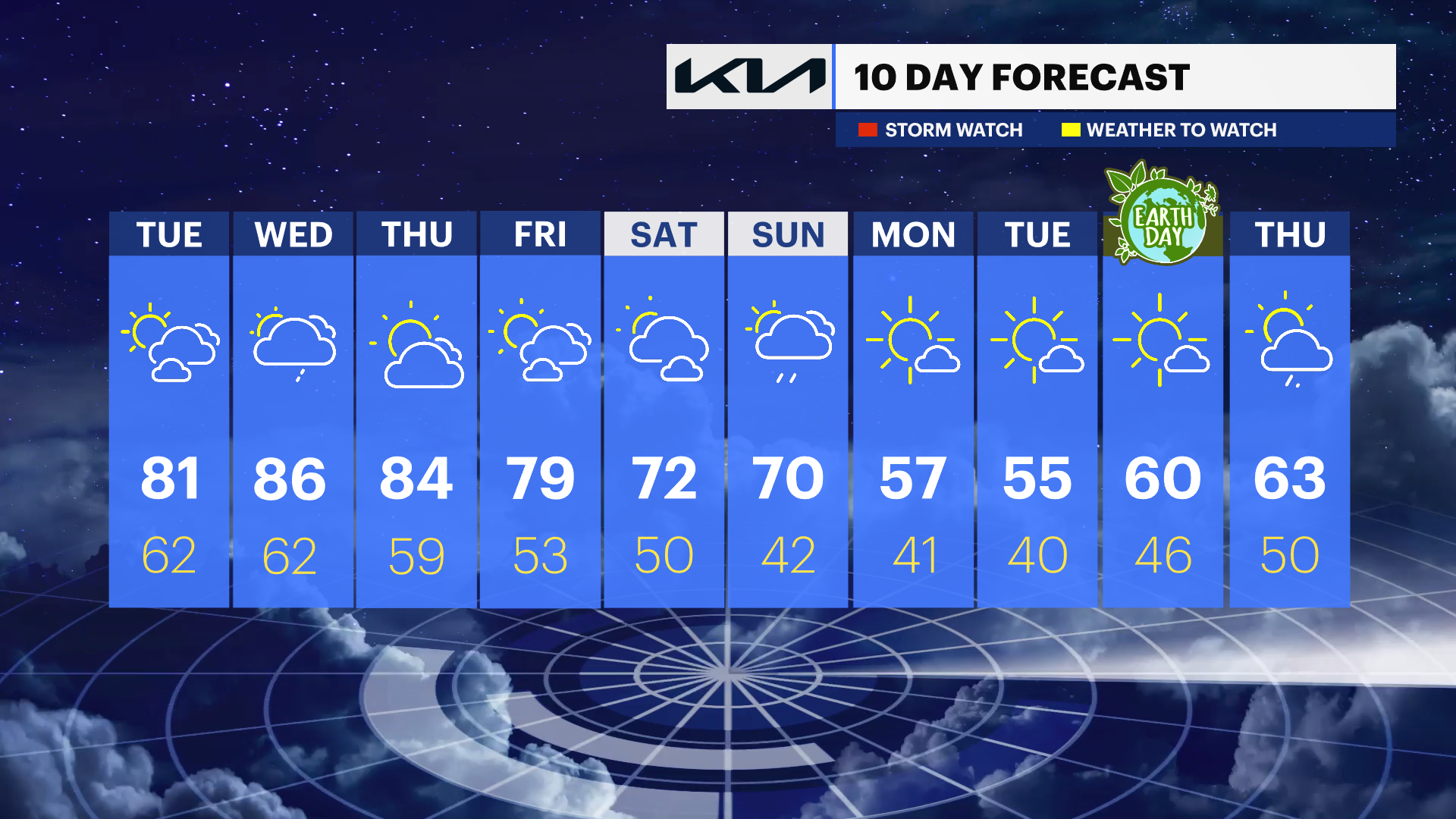
Widespread temperatures in the 80s arrive Tuesday through Thursday, with record-challenging warmth both day and night before cooler air returns.
More Stories


Clouds will gradually clear out overnight, leading to brighter skies heading into Tuesday as a strong warming trend takes hold across the Lower Hudson Valley.
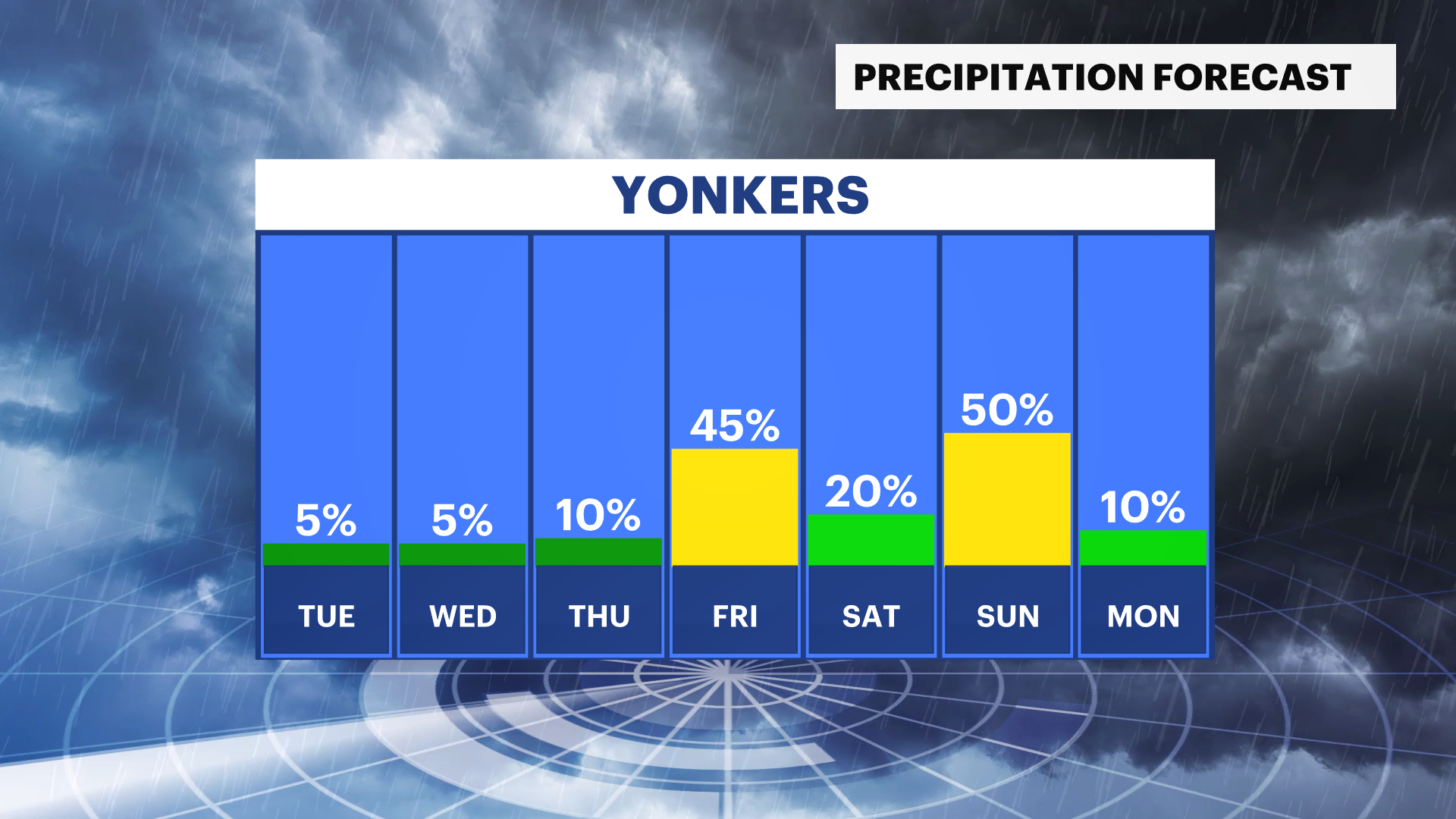
Tuesday marks the beginning of widespread temperatures in the 80s across the region, a significant jump above average for this time of year. Skies will feature a mix of sunshine and clouds and while most of the day remains dry, a few scattered showers or an isolated thunderstorm are possible Tuesday evening. Overnight temperatures will remain unseasonably warm, setting the stage for potentially record-high low temperatures.
The heat continues into Wednesday, which is expected to be one of the warmest days of the stretch. High temperatures will again reach the 80s, with the standing record of 83 within reach. A brief shower or thunderstorm cannot be ruled out early in the afternoon, though most locations will stay dry with intervals of sunshine. Mild nighttime temperatures may also approach or set record-high minimum values.
Warm, early summer-like conditions persist into Thursday, with temperatures continuing in the 80s under a mix of sun and clouds. Nights will remain mild, potentially challenging additional record-high low temperatures across the region.
The overall pattern stays mainly dry through much of the week, reinforcing the prolonged stretch of warmth.
The next opportunity for more organized rainfall arrives by Friday evening, bringing a better chance for showers. Another round of rain is possible Sunday night into early Monday, followed by a shift toward cooler temperatures that will bring an end to the unseasonably warm pattern.
The Hudson Valley overall will experience several days of summer-like warmth with only brief interruptions from passing showers before cooler air returns early next week.