One last taste of summer before temperatures cool and rain comes this weekend
Temperatures are slowly easing heading into the weekend.
Share:
More Stories
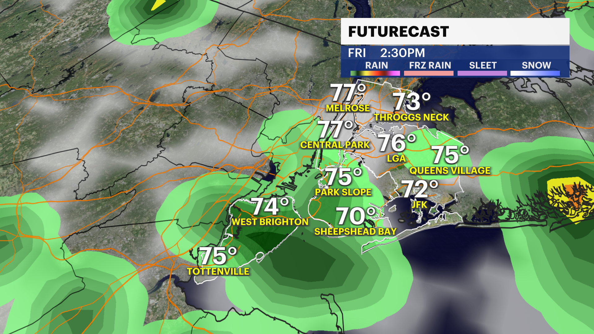

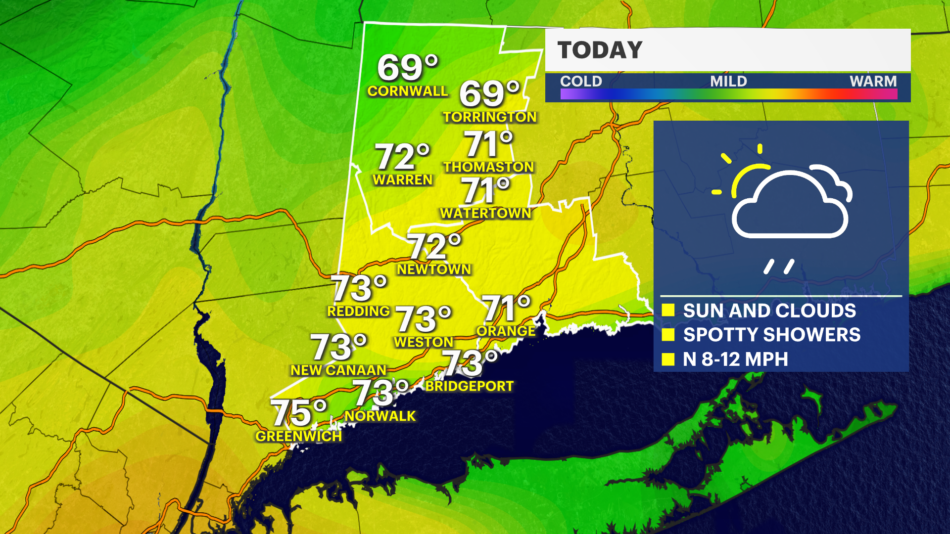

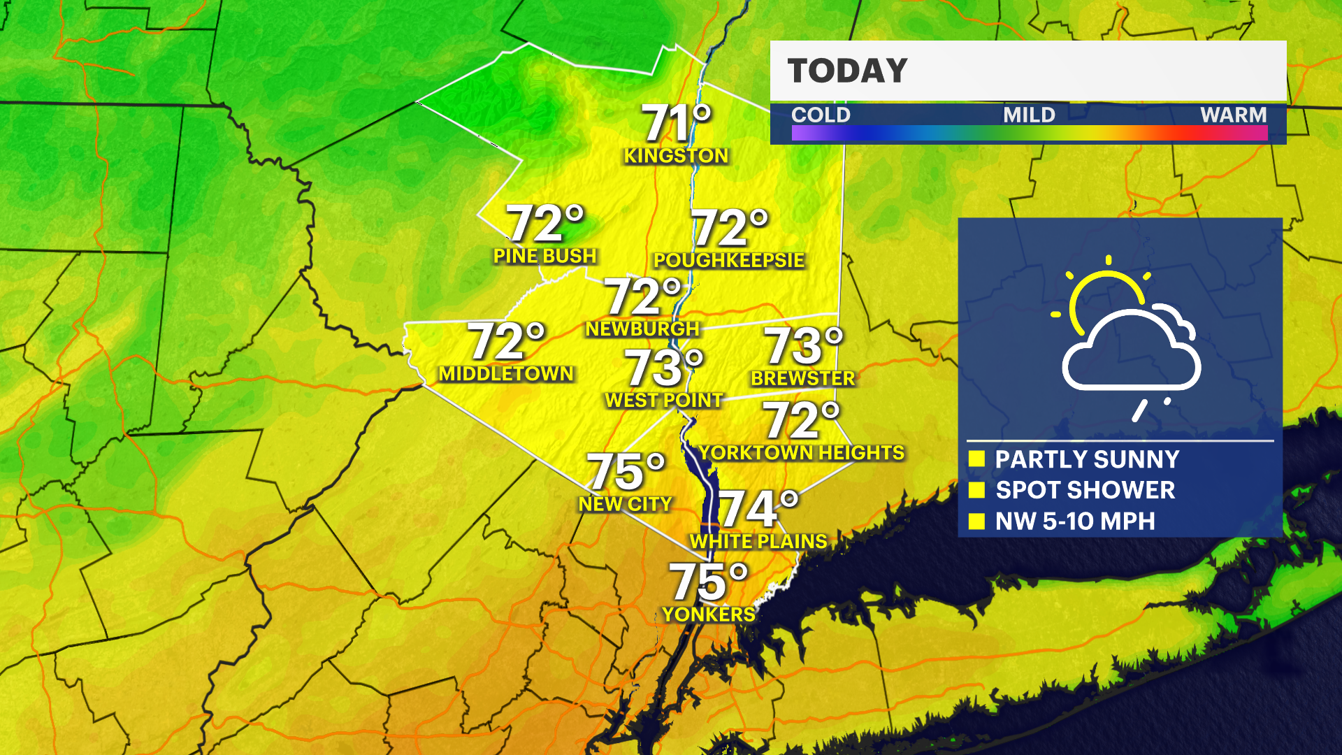
It's still a warm afternoon with highs climbing into the upper 70s, but it's a step down from where we have been. Partly sunny skies with a spot shower possible this afternoon.
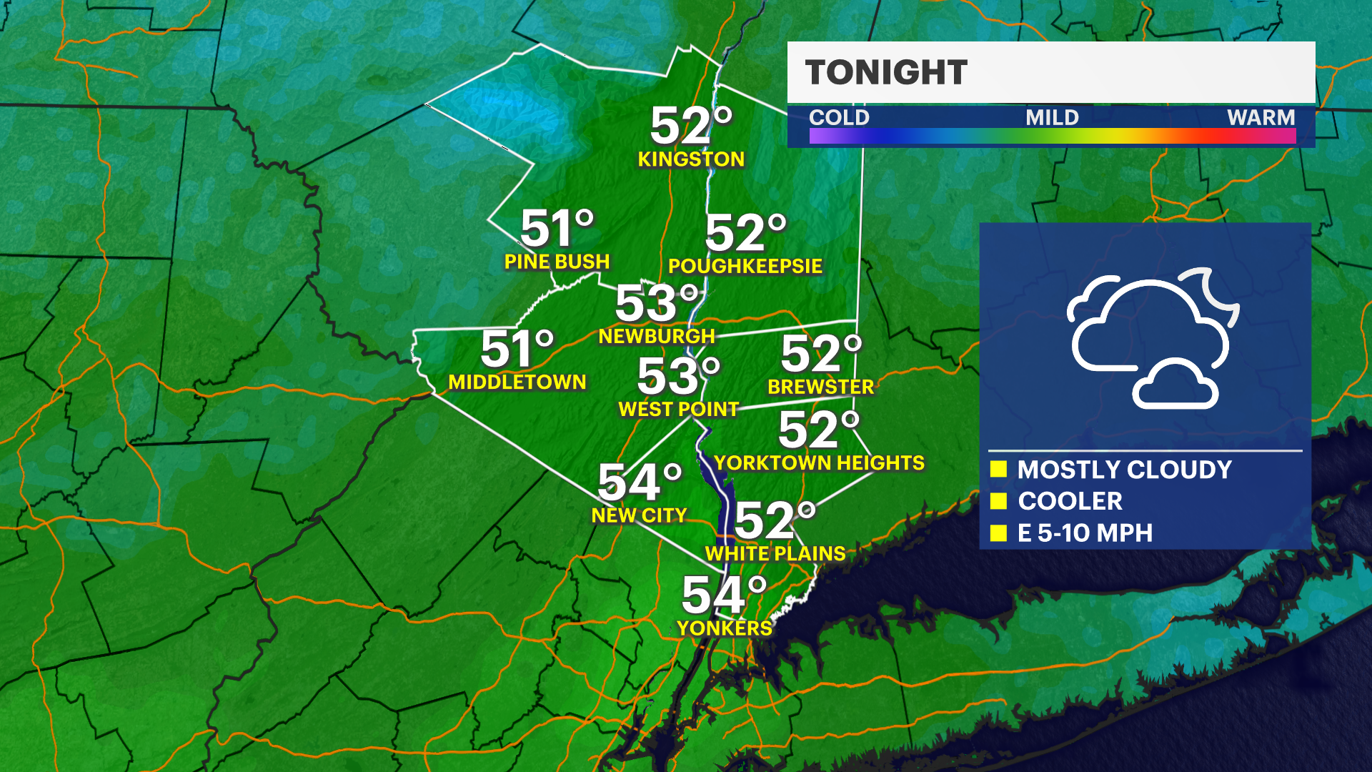
Tonight, will be cooler than past nights and this begins our gradual cool down.
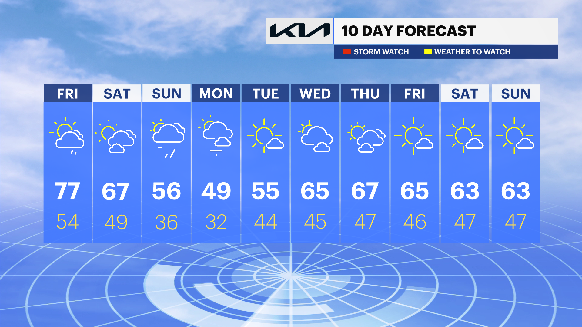
Cooler for the weekend with highs only in the 60s and 50s, which is more seasonable for April. Saturday looks to be nice and dry but steady rain comes early Sunday. Rain totals should be less than an inch.
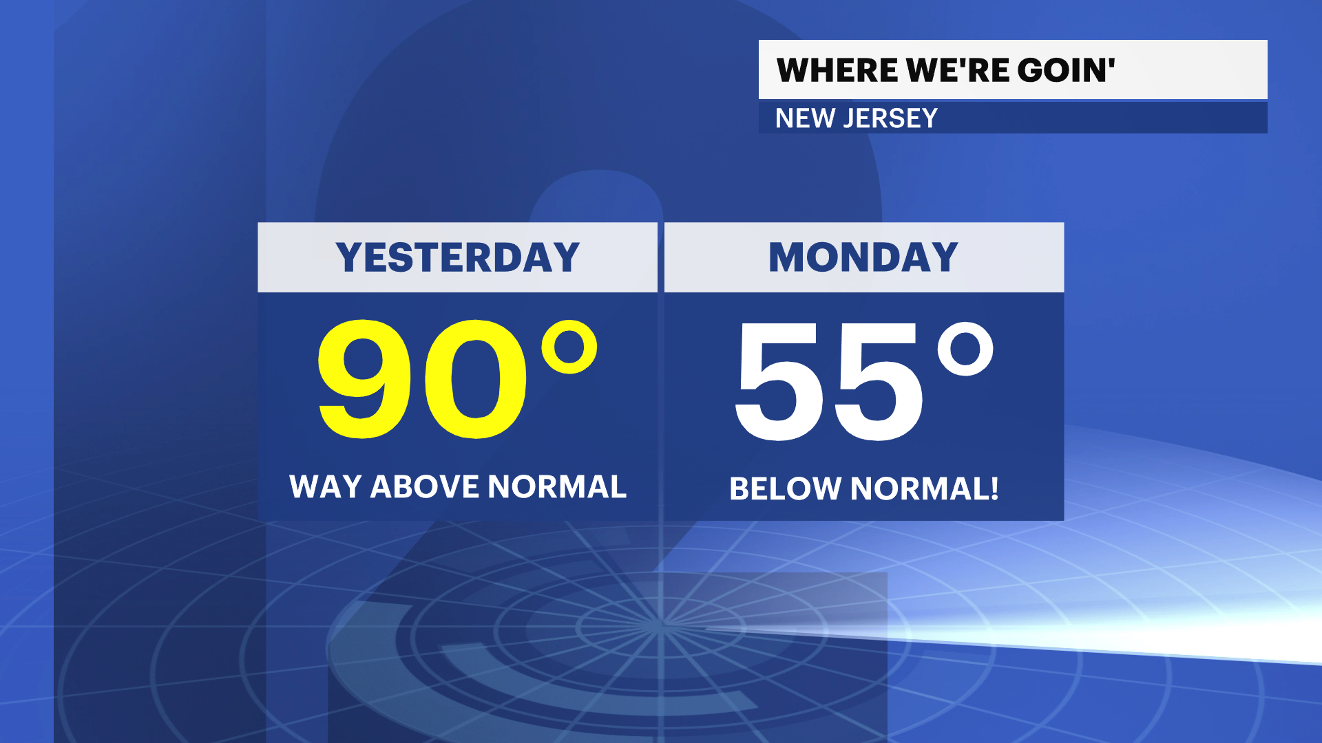
Just a heads up, Monday and Tuesday morning will be in the 30s! Look for a more seasonable week ahead.