STORM WATCH: Severe storms are expected Saturday night on the Hudson Valley
Following a hot, sunny, and dry day. Strong and severe storms threaten the evening for the Hudson Valley
More Stories
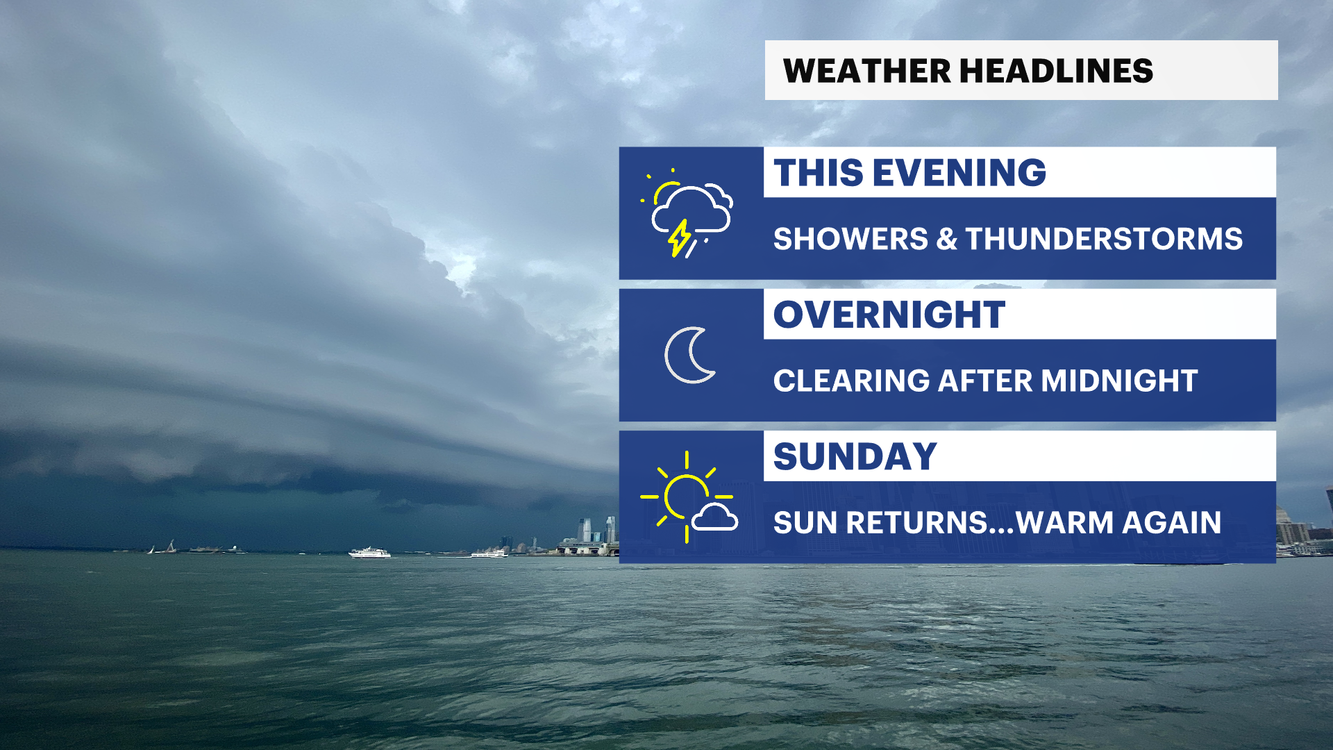


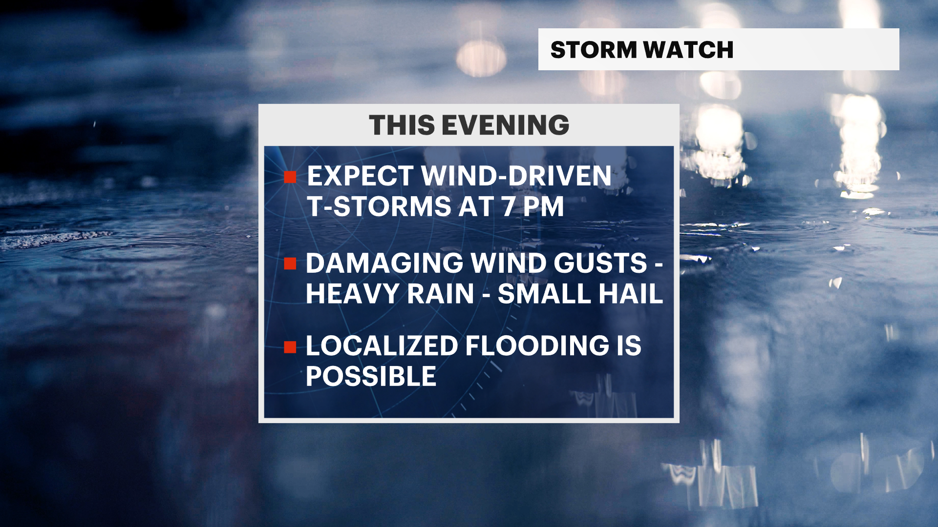
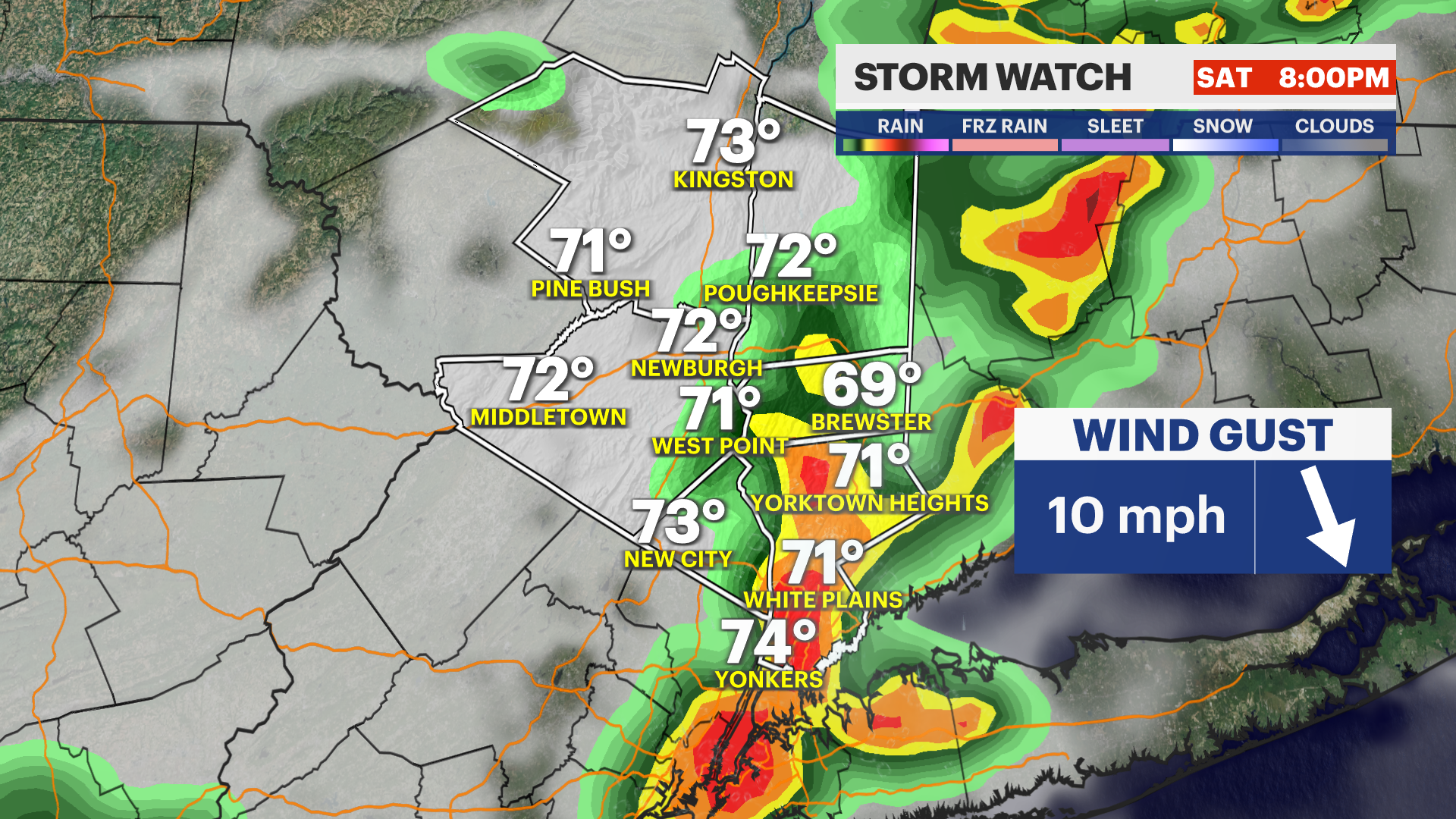
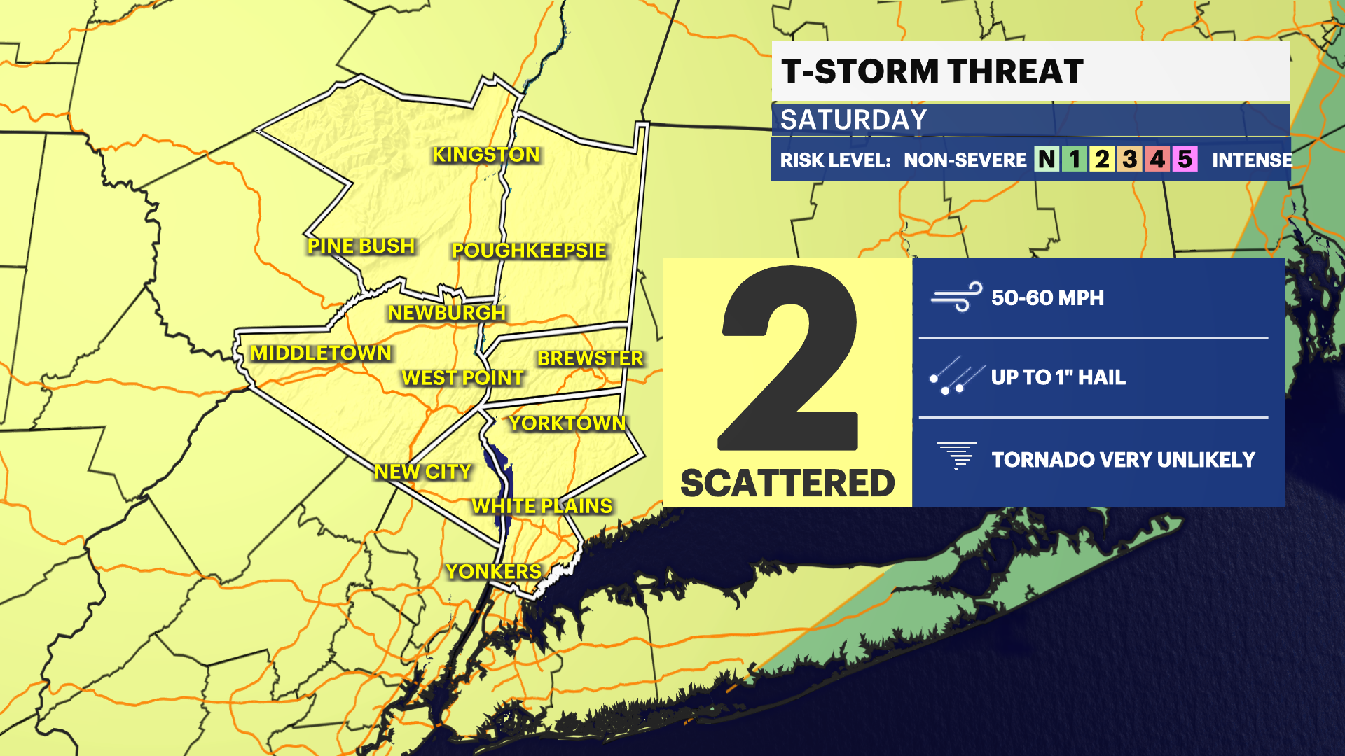
STRONG STORMS SATURDAY NIGHT
The Storm Prediction Center has placed the entire Hudson Valley under a Level 2 out of 5 slight risk for severe weather. Thunderstorms are expected to develop after 7 p.m., with some storms capable of becoming strong to severe.
The primary threats include damaging wind gusts between 50 and 60 mph, small hail, frequent lightning and torrential downpours. Localized flash flooding is also possible, particularly in areas that receive repeated rounds of heavy rain. While not everyone will experience severe weather, residents should remain weather-aware through the evening hours.
AIR QUALITY ALERT REMAINS IN EFFECT
An air quality alert remains in effect until Saturday 11 p.m. due to elevated ground-level ozone concentrations. Sensitive groups, including children, older adults and those with heart or respiratory conditions, should limit prolonged outdoor activity during the hottest part of the day. Everyone is encouraged to stay hydrated and take frequent breaks if spending time outdoors.
SUNDAY TURNS QUIETER
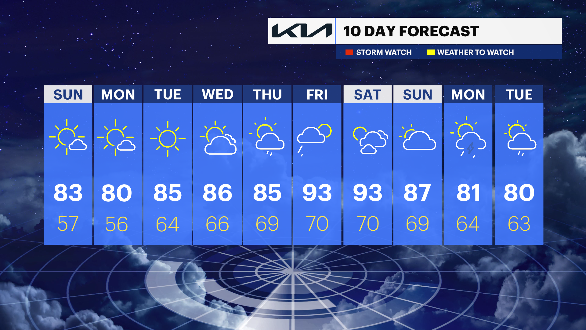
The threat of severe weather ends overnight, leading to a quieter finish to the weekend. Sunday will feature a mix of sun and clouds with warm and humid conditions. Morning temperatures will start in the 60s and low 70s before rising into the mid-80s during the afternoon. Most locations are expected to remain dry.
NEXT WEEK
A prolonged stretch of mainly dry weather is expected through much of next week. High temperatures will begin near 80 on Monday before gradually warming through the week. Another surge of summerlike heat could push temperatures near or above 90 across portions of the Hudson Valley by the end of the week.