STORM WATCH: Heavy rain and thunderstorms overnight and into Monday
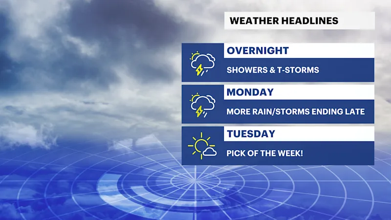
A slow-moving storm system brings widespread showers, thunderstorms and periods of heavy rainfall through Monday before quieter weather briefly returns Tuesday.
More Stories


What to expect:
Showers and thunderstorms become widespread overnight and continue through Monday.
Heavy downpours could produce localized flooding, especially Monday afternoon.
A few stronger thunderstorms may bring gusty winds and frequent lightning.
Dry weather returns Tuesday before additional rounds of showers and thunderstorms arrive later in the week.
Temperatures remain close to seasonal averages.
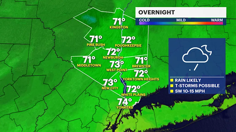
Overnight (Lows: Upper 60s to around 70)
Clouds thicken with showers and thunderstorms becoming widespread overnight. Periods of heavy rain are likely, with localized ponding on roads and isolated flooding possible where the heaviest downpours occur.
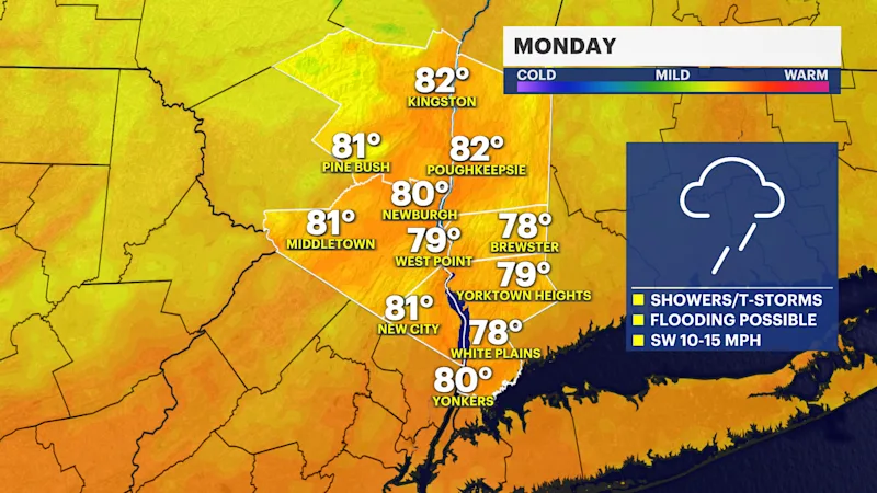
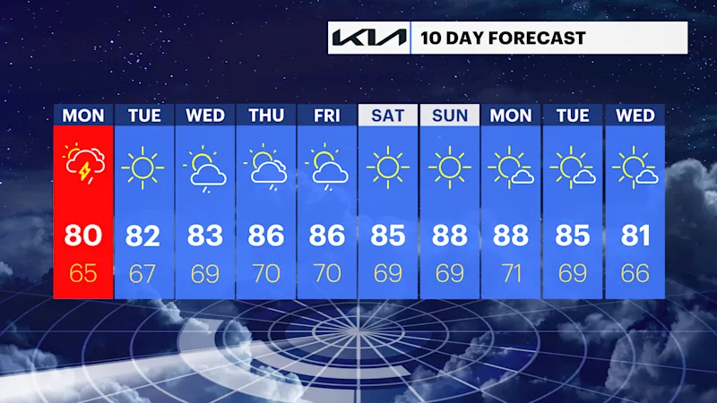
Monday (Highs: Around 80)
A wet day with numerous showers and thunderstorms. Heavy rainfall at times may lead to localized flooding in poor drainage and low-lying areas. A few thunderstorms could also produce gusty winds and dangerous cloud-to-ground lightning.
Monday Night (Lows: Mid-60s)
Showers and thunderstorms gradually taper off during the evening before ending overnight. Skies slowly begin to clear as drier air moves into the region.
Tuesday (Highs: Lower 80s)
Mostly sunny and pleasant with lower humidity. A welcome break from the wet weather.
Wednesday (Highs: Lower to mid-80s)
Intervals of clouds and sunshine with a chance of scattered showers developing during the day. Most locations will not see rain all day, but a few passing showers are possible.
Thursday (Highs: Mid-80s)
Partly sunny, warm, and increasingly humid with scattered afternoon and evening showers and thunderstorms developing.
Friday (Highs: Mid-80s)
Another warm and somewhat unsettled day with scattered showers and thunderstorms possible during the afternoon and evening.
Weather alerts, watches, and hazards
Heavy Rain and Localized Flooding (Tonight through Monday):
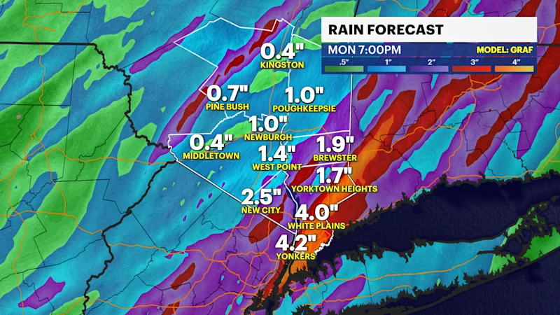
Periods of moderate to heavy rain will overspread the Hudson Valley tonight and continue through Monday. Most locations can expect 1 to 2 inches of rainfall, with locally higher amounts possible where thunderstorms repeatedly track over the same area. Localized flooding of poor drainage areas, small streams, and low-lying roadways is possible.
Thunderstorms (Tonight through Monday):
Embedded thunderstorms will accompany the rain, producing frequent lightning, torrential downpours, and locally gusty winds. While widespread severe weather is not anticipated, a few stronger storms could produce isolated damaging wind gusts.
Wet Pattern Returns Late Week:
After a brief break on Tuesday, another series of disturbances will bring renewed chances for showers and thunderstorms from Wednesday through Saturday. Although it is too early to determine the exact timing or severity, periods of locally heavy rain will again be possible.
Pleasant Break Tuesday:
Tuesday will offer the best weather of the week, with sunshine, lower humidity, and seasonable temperatures before unsettled conditions return during the second half of the week.