STORM WATCH: Damaging winds, heavy downpours and intense lightning moving across SW CT
HEADS UP! Severe storms are likely through late this evening before clearing tomorrow morning.
More Stories


WHAT TO KNOW
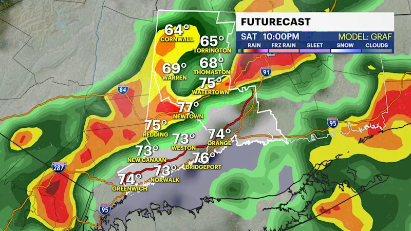
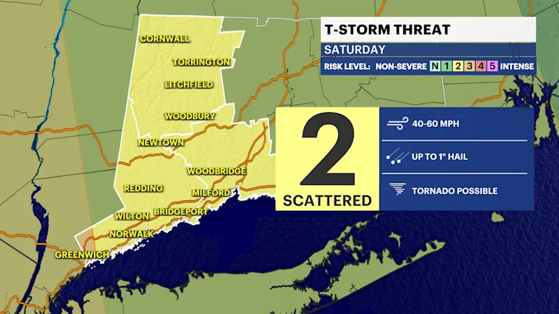
Dangerous storms are in the forecast for late Saturday. Multiple rounds of storms are crossing the tri-state region bringing winds that could gust up to 50-plus mph, heavy downpours, flash flooding and a chance for a tornado. Severe weather to this magnitude is rare for this region. A weather system crossing the region is helping to trigger storms and the Canadian wildfire smoke that has been making for poor air quality all week is enhancing this concern for storms on Saturday.
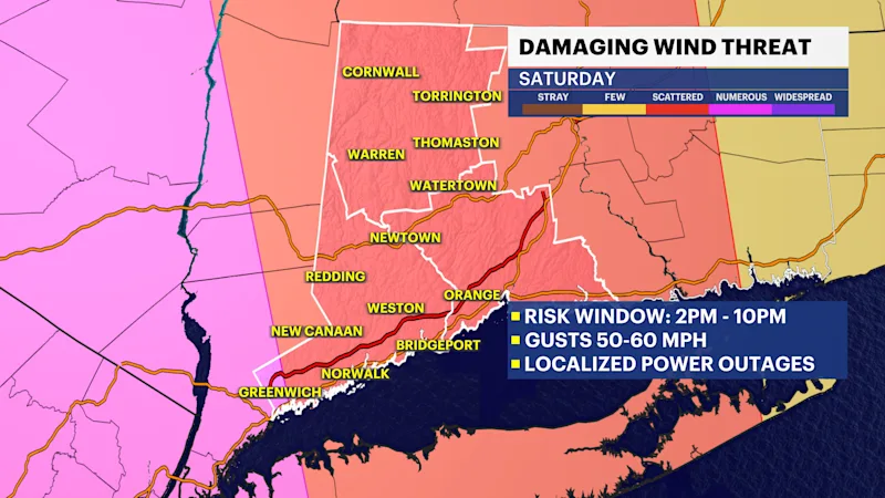
WIND: There is a scattered damaging wind threat. This could lead to local power outages. With some of the strong storms, wind could likely gust up to 50 mph or higher. Storm or not, winds are still likely to be breezy with winds out of the southwest for most of the evening between 25 and 40 mph.
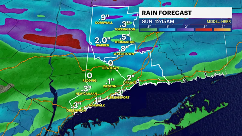
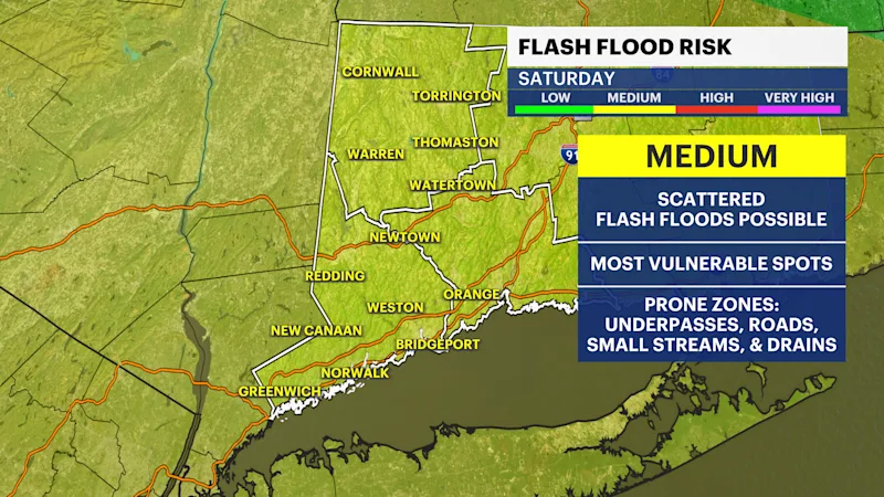
RAIN: Scattered flash floods are possible. These storms will dump significant rain in a short period of time. Rainfall totals differ depending on where the strongest of storms move through. Some towns could see up to 3" of rain and others may just see 1."
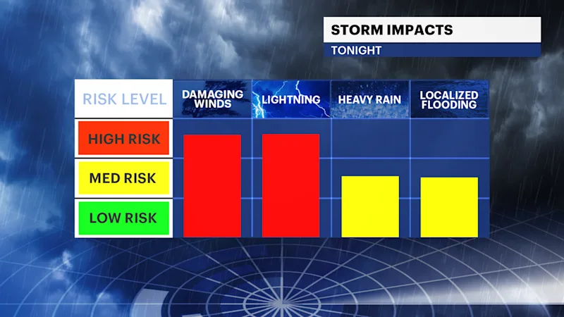
TORNADO: There is a chance for tornadoes. The Storm Prediction Center has portions of the Southwest Connecticut region under a risk for tornadoes which means they are possible with the strongest of storms later on Saturday. If you get a warning, take caution. Tornadoes are the least common to the region but are possible. The best way to respond is to stay calm and move to the most interior space of your home away from windows.
HAIL: Some of the strongest storms could feature hail.
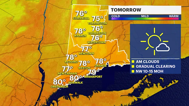
After Saturday's storm exit and shift offshore, expect improved weather for Sunday. Sunday will likely have morning clouds and few lingering showers. The afternoon should be much drier as compared to Sunday, Any Sunday plans should be good to go.