Picture-perfect weather gives way to muggy and murky conditions on Thursday
The sun and pleasant weather stick around for one more day. Clouds begin to close in tomorrow night as storms track in our direction.
More Stories





Skies tonight will be mainly clear, and the wind direction will continue to usher in a comfortable, cooler-feeling air mass. The end result is walking out the door on Wednesday morning with a crisp, fresh feel in the air. Nighttime lows for most of the state will be in the 50s and low 60s.
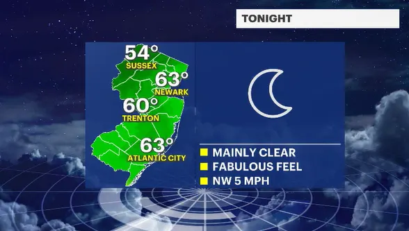
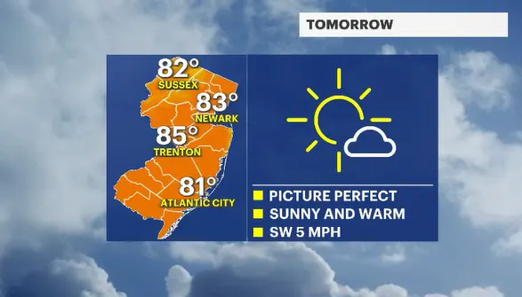
Our New Jersey skies will remain bright and beautiful for tomorrow. The winds will eventually become more southerly as the day wears on. Despite the change in wind direction, it will be the slightest of breezes, so I don't think we will see a major warm-up during the afternoon.
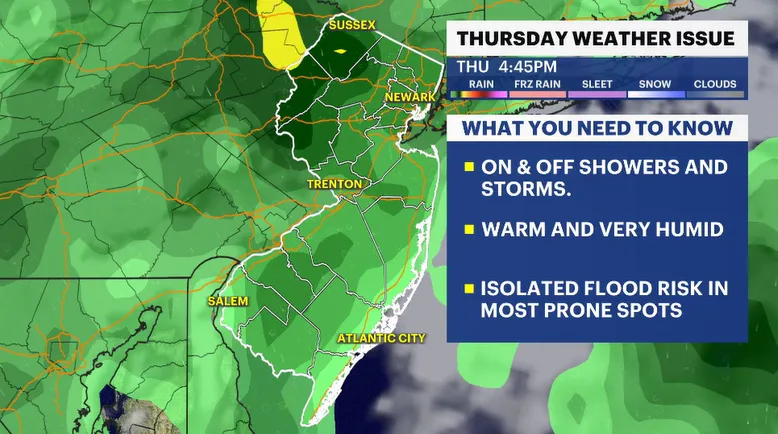
Clouds will be collecting through Wednesday night. By Thursday morning, it will be noticeably warmer and more humid. Storm clouds will be developing through the day. Expect on-and-off showers and thunderstorms for Thursday. Will the entire day be smothered with rain? No. Yet we will have to plan for inclement weather for the duration of the day.
Isolated thunderstorms could contain 1 to as much as 2 inches per hour rain spells. This type of potent precipitation will lead to localized flooding. While I do not think stream or river flooding is imminent, you should be aware of rapidly changing conditions if you live along a flood-prone watershed area.
The weekend looks wonderful. Both Saturday and Sunday should be filled with sunny skies and pleasantly warm temperatures. It is the second-to-last summer weekend. Where did the time go?