Newark Information
☀️
UV Index Today
--
Loading...
🍃
Air Quality
--
Loading...
🌡️
Average High / Low
-- / --
1991-2020 Normals
EWR Climate
🏆
Record High / Low
-- / --
Loading...
EWR Climate
Loading latest Newark information...
Check coastal alerts and tide information
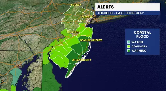
ALERT: The National Weather Service has issued a coastal flood warning from Ocean County south to Cape May County. Coastal flood advisories have been expanded into Monmouth and Middlesex counties.
FORECAST:
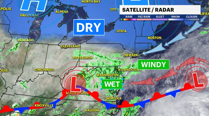
The weather setup is trending a little bit drier this week. Fair weather to our north has a little more influence and will limit the rain showers passing through.
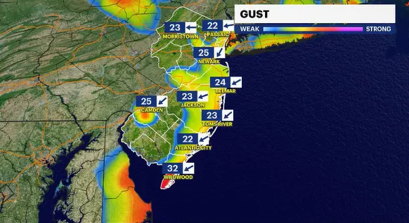
A few passing showers are possible tonight. Roads could be slick and slippery, especially in southern and coastal New Jersey. The bigger story is the developing winds off the ocean and how long those winds are going to stick around in the forecast.
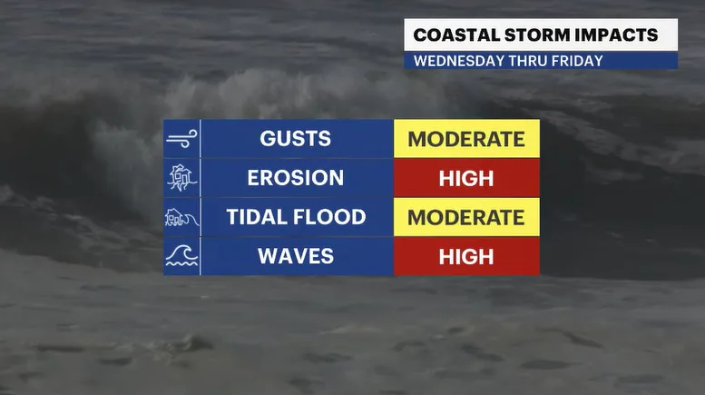
The shore will bear the brunt of this weather event. Gusty winds from 30 to 45 mph off the ocean for the next few days will funnel water back into the back bays and up along the coast. Tides will be running 2-3 feet higher than normal as a result. Beach erosion will be an ongoing threat. Waves in the surf zone will range from 9 to 13 feet.
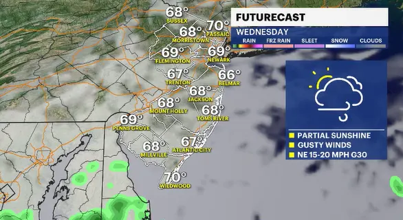
The weather itself tomorrow is pretty good. Partly sunny skies, windy and cooler. Temperatures are still well below average because of those onshore winds.
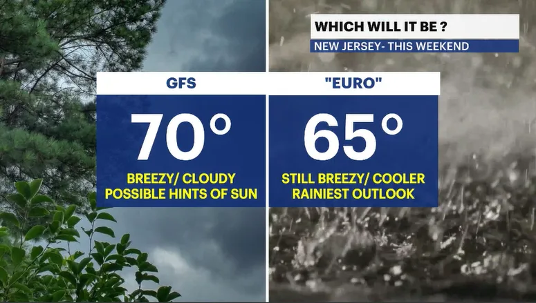
The weekend outlook still needs to be looked at carefully. Right now, computer guidance is all over the place. One set of data suggests sun and clouds and a slightly warmer scenario. Another model suggests we get soaked. We just need to see how the atmosphere evolves over the coming days.
The biggest takeaway in this week's forecast. Residents who live in an area that is prone to any kind of nuisance salt-water flooding are advised to start taking precautions now to get possessions to drier, higher ground. The next few high tide cycles are going to be wet.
Stay with the News 12 Storm Watch Team for updates.
FUTURECAST:
TIDES: