STORM WATCH: Nor’easter slams NYC with windswept rain
Damaging winds and heavy rain will bring hazardous travel this weekend.
More Stories



Bronx Information
FORECAST
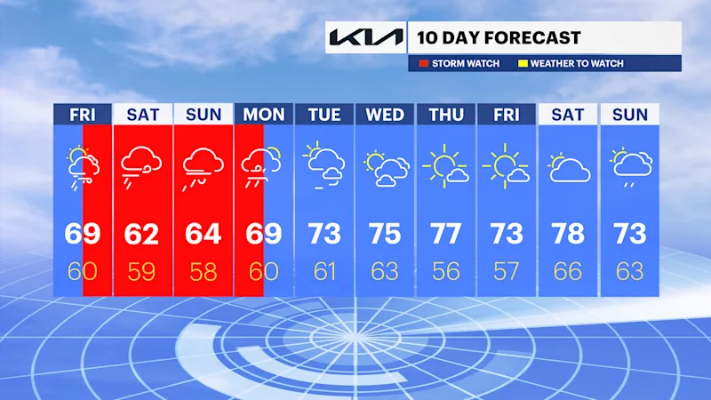
A nor'easter will approach the region with rounds of rain, damaging winds and significant coastal concerns through this weekend. Confidence is growing for a close track tonight into Saturday. The latest guidance retrogrades the storm towards the region on Sunday bringing moderate to heavy rain and strong winds inland with more significant impacts for the coast. It will gradually weaken on Sunday, but still continue to bring waves of rain and gusty winds into Monday before pushing out to sea. Any slight deviation or change in track will cause the forecast to change, so be sure to check back in with the News 12 Team for the latest day-by-day.
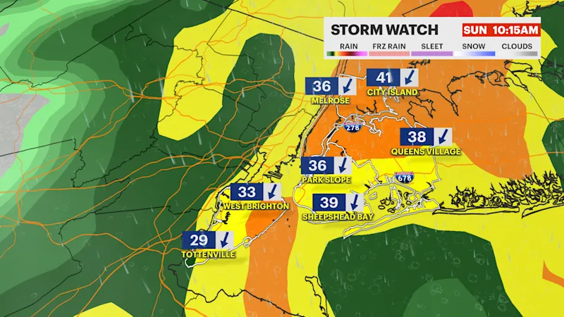
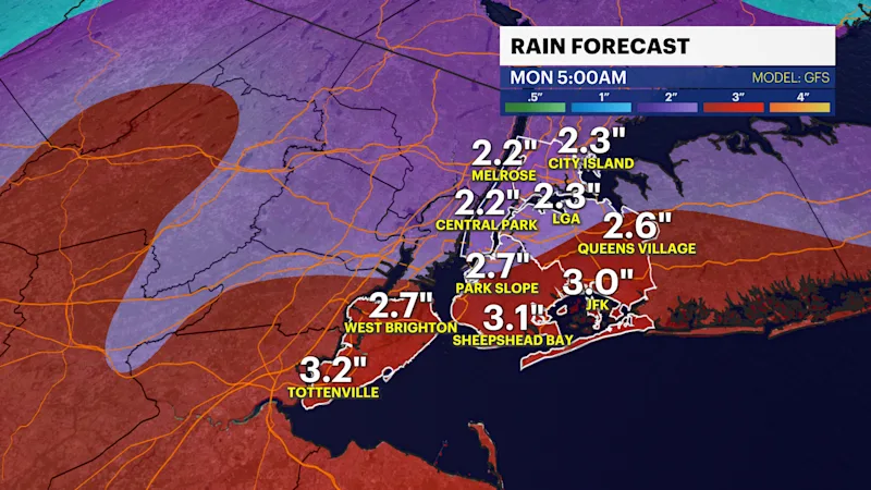
Later on today, after 5PM some light rain will move in from east to west. Winds will be problematic this afternoon through this evening with gusts up to 40-50 MPH. Light steady rain and damaging winds continues into Saturday morning. A few pockets of heavier rainfall is possible Saturday afternoon. As of now, the worst of the storm will be Saturday evening into Sunday afternoon. Drenching rain and whipping winds will bring dangerous travel across the area. With a closer track to the city and a longer duration, rain totals could reach over 2".
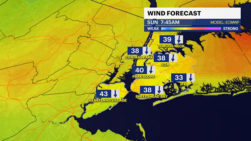
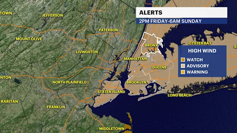
A wind advisory has been issued for this afternoon through early Sunday. Winds will be out of the north-northeast at 25-35 mph with gusts that can go as high as 55 MPH. Strong wind gusts can blow around unsecured objects and even bring tree branches or limbs down. Scattered power outages and downed trees are possible.
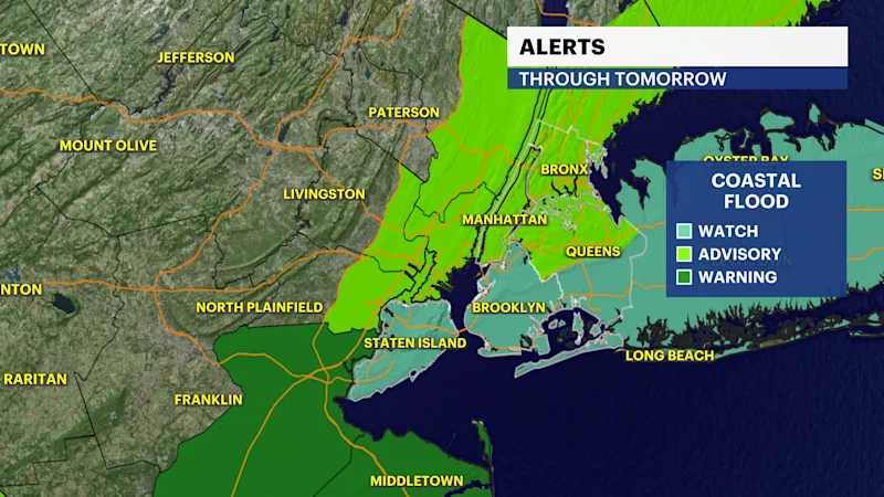
Coastal flood alerts are in effect for New York City through Saturday. Minor to moderate coastal flooding is expected during high today through Saturday. 1-2ft of inundation above ground level expected in vulnerable areas near the waterfront and shoreline. Today will be mostly dry, cool and gusty with highs in the upper 60s. The storm will move closer tonight into tomorrow. The weather will improve late Monday into Tuesday as temperatures warm back up to the low to mid 70s next week.