STORM WATCH: Nor’easter brings heavy rain, damaging winds and significant coastal flooding
A powerful early-season coastal storm will continue to impact the entire tri-state area tonight through Sunday with periods of heavy rain and strong winds. Coastal communities face the greatest threat from flooding, high surf and beach erosion before the storm slowly winds down Monday.
More Stories





White Plains Information
What to expect:
Saturday night into Sunday will feature the worst overall conditions. Expect widespread rain, strong north to northeast winds and areas of heavy rainfall.
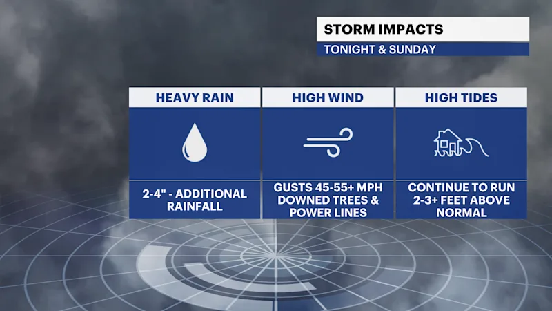
Wind gusts of 40 to 55 mph are possible across much of New York City, Long Island, Southern Connecticut and Northeastern New Jersey, with locally higher gusts possible near the coast.
Coastal flooding is a major concern, especially along Long Island, New York Harbor, coastal New Jersey and portions of Southern Connecticut. Multiple high-tide cycles will be affected.
High surf, dangerous rip currents and significant beach erosion will continue along the Atlantic shoreline.
Rain continues Sunday night, with showers lingering into Monday before the storm finally begins to pull away.
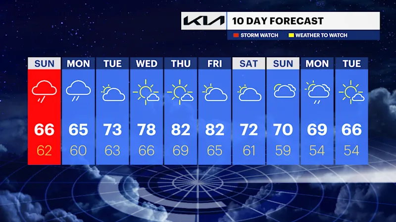
Much quieter and milder weather returns Tuesday through the middle of next week.
Saturday night (Lows: Mid 50s to Low 60s)
Rain continues across the entire tri-state area and will become heavy at times overnight. A few embedded thunderstorms are also possible, particularly closer to the coast. North to northeast winds remain strong, with widespread gusts of 35 to 50 mph and locally higher gusts near exposed coastal areas. Downed tree limbs and scattered power outages are possible. Rainfall Saturday night alone could approach 1" to 2" in portions of Long Island and Southern Connecticut.
Sunday (Highs: Mid- to Upper 60s)
Sunday will be a raw, windy and wet day. Periods of rain continue, occasionally heavy, with embedded thunderstorms possible. Winds gradually decrease somewhat during the day but remain gusty, especially along the coast. Coastal flooding remains a significant concern around the times of high tide.
Sunday Night (Lows: Upper 50s to Low 60s)
Rain and showers continue across much of the region. Winds gradually diminish, although coastal locations remain breezy. Additional rainfall could aggravate areas experiencing poor drainage or coastal flooding.
Monday (Highs: Mid- to Upper 60s)
Cloudy and cool, with periods of rain and showers, particularly during the first half of the day. Conditions slowly improve from southwest to northeast as the nor’easter begins to weaken and pull away.
Monday Night (Lows: Upper 50s to Low 60s)
A few lingering showers are possible early, followed by mostly cloudy skies. Winds will be much lighter as the storm finally loses its influence over the region.
Tuesday (Highs: Upper 60s to Low 70s)
Partly sunny and dry, with lighter winds and seasonably cool temperatures.
Wednesday (Highs: Low to Mid-70s)
Mostly sunny and pleasant, with temperatures beginning to moderate.
Thursday (Highs: Low to Mid-70s)
Mostly sunny and dry with comfortable early-fall temperatures.
Weather alerts, watches & hazards
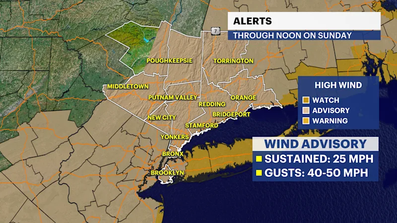
Wind Advisory — Through 6 A.M. Sunday:
A wind advisory covers New York City, Long Island, and much of Southern Connecticut, Westchester and Rockland counties and much of Northeastern New Jersey. Winds of 15 to 35 mph, with gusts of 45 to 55 mph are expected depending on location. Tree limbs may come down and scattered power outages are possible. Driving will also be difficult for high-profile vehicles.
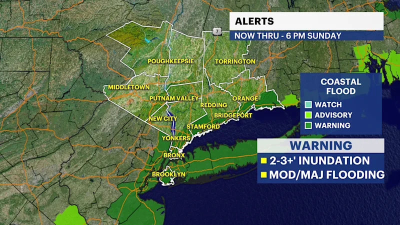
Coastal Flood Warning — Through 6 P.M. Sunday in many coastal locations:
Multiple high-tide cycles will produce coastal flooding. Around New York Harbor, the National Weather Service is forecasting roughly 1' to 2' of inundation above normally dry ground in vulnerable shoreline locations. Flooding of waterfront roads, parking lots and low-lying properties is possible. Conditions vary considerably by coastline, with some locations under advisories rather than warnings.
High Surf Advisory — Through 8 P.M. Sunday at Atlantic beaches:
Large, battering waves will continue along the Atlantic shoreline. Significant beach erosion and dangerous conditions near jetties, piers and other shoreline structures are possible.
High Rip Current Risk — Through Sunday evening at Atlantic beaches:
Powerful surf will create life-threatening rip currents. Ocean swimming is extremely dangerous during this storm.
Heavy Rain and Localized Flooding — Saturday night through Sunday:
The National Weather Service expects storm totals generally around 1" to 3" across much of the region, increasing to roughly 3" to 4" across Central and Eastern Long Island. Locally higher totals are possible. Poor-drainage and low-lying flooding will be possible where the heaviest rain persists.
Strong Winds and Power Outages — Saturday night into Sunday:
The combination of saturated ground and prolonged gusty winds increases the potential for downed limbs and trees. Scattered power outages are possible across the tri-state area, with the greatest concern in exposed coastal locations.
Coastal Flooding and Beach Erosion:
This is one of the storm's most significant hazards. Persistent onshore flow combined with high surf will continue pushing water toward the coast through multiple high-tide cycles. Long Island's South Shore, New York Harbor, the Jersey Shore and vulnerable portions of the Connecticut coastline will need to be watched closely through Sunday.
Improving Weather Early Next Week:
The nor’easter will only slowly weaken, so Monday remains cloudy with lingering rain. A meaningful improvement arrives Tuesday, followed by several quieter and milder days through the middle of the week.