STORM WATCH: Stormy stretch returns to The Bronx
Multiple rounds of showers and thunderstorms are expected Tuesday and into Wednesday.
More Stories


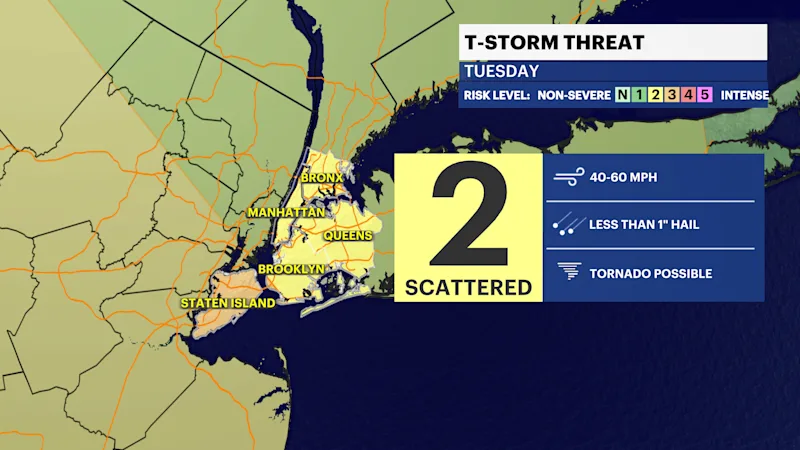
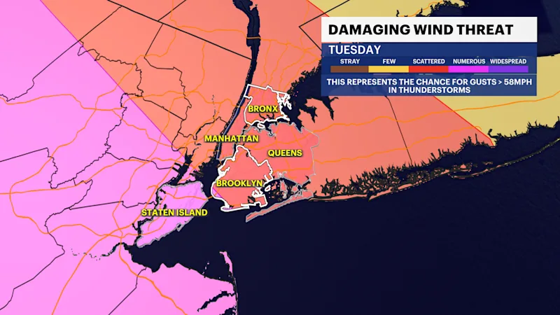
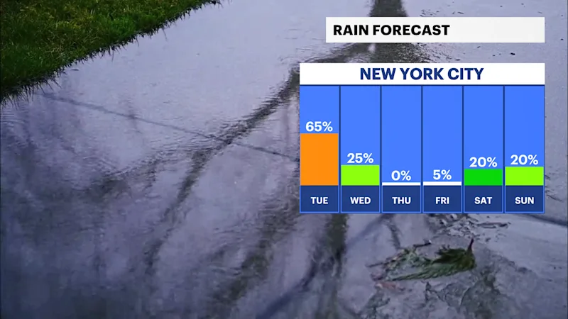
An unsettled weather pattern returns Tuesday and Wednesday as a slow-moving system brings multiple rounds of showers and thunderstorms. Tuesday will feature periods of rain through the day, with thunderstorms becoming more widespread potentially during the afternoon and evening. Some storms could produce heavy downpours, frequent lightning, and locally gusty winds.
The storm threat continues Wednesday. While there will be some breaks in the rain, additional showers and thunderstorms are expected, especially during the afternoon. Rainfall from both days may lead to localized ponding on roadways and reduced visibility during heavier downpours.
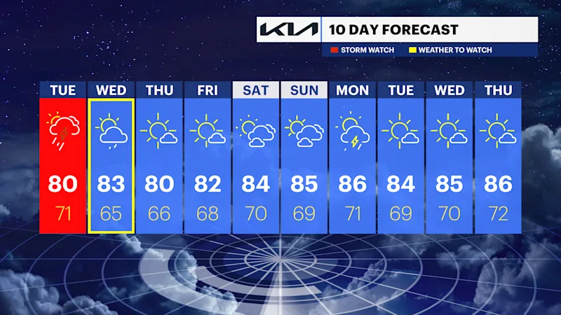
Conditions improve significantly by Thursday as sunshine returns, and humidity begins to drop. Dry, pleasant weather then continues through the weekend with a gradual warming trend.
Tuesday: Mostly cloudy with showers and thunderstorms becoming more widespread, potentially during the afternoon. Highs around 80 degrees.
Wednesday: Partly sunny with scattered showers and thunderstorms, especially during the afternoon. Highs in the low to mid-80s.
Thursday: Sunny and less humid. Highs in the upper 70s.
Friday: Sunny and pleasant. Highs around 80 degrees.
Saturday: Mostly sunny and warm. Highs in the low 80s.
Sunday: Mostly sunny and warmer. Highs in the mid-80s.
Monday: Mostly sunny with a chance of a shower. Highs in the upper 80s.