More Stories


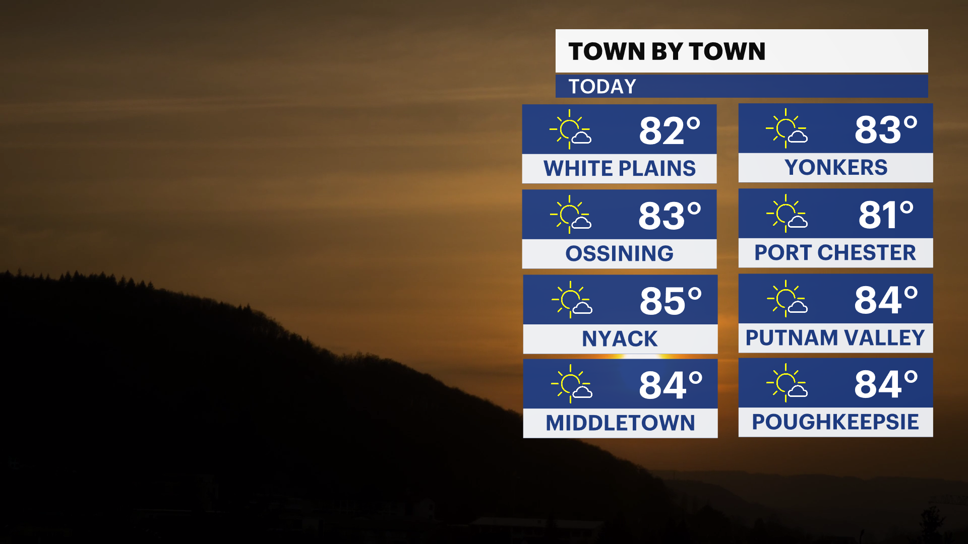
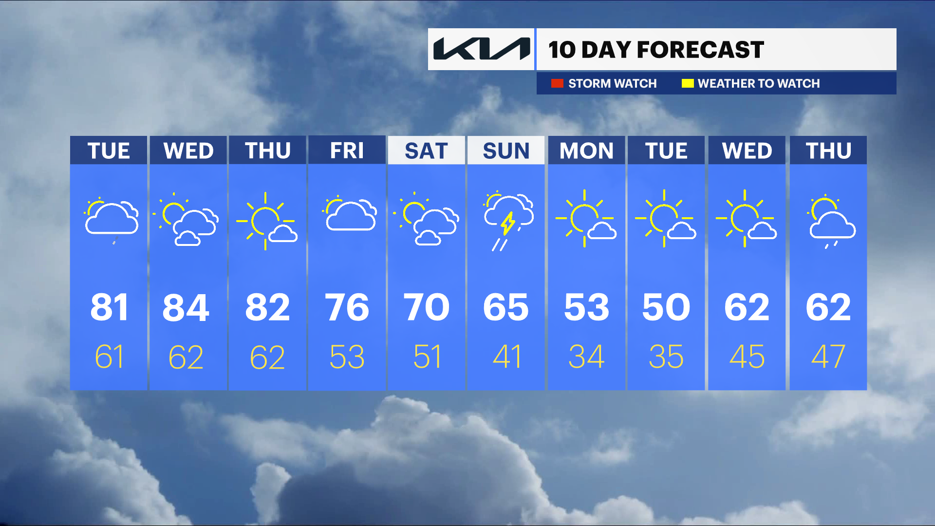
Today, the Hudson Valley kicks off a stretch of much warmer-than-normal weather, with sunshine helping temperatures climb well above what we typically see in April. It will feel more like early summer than mid-spring, setting the stage for an unusually warm week ahead.
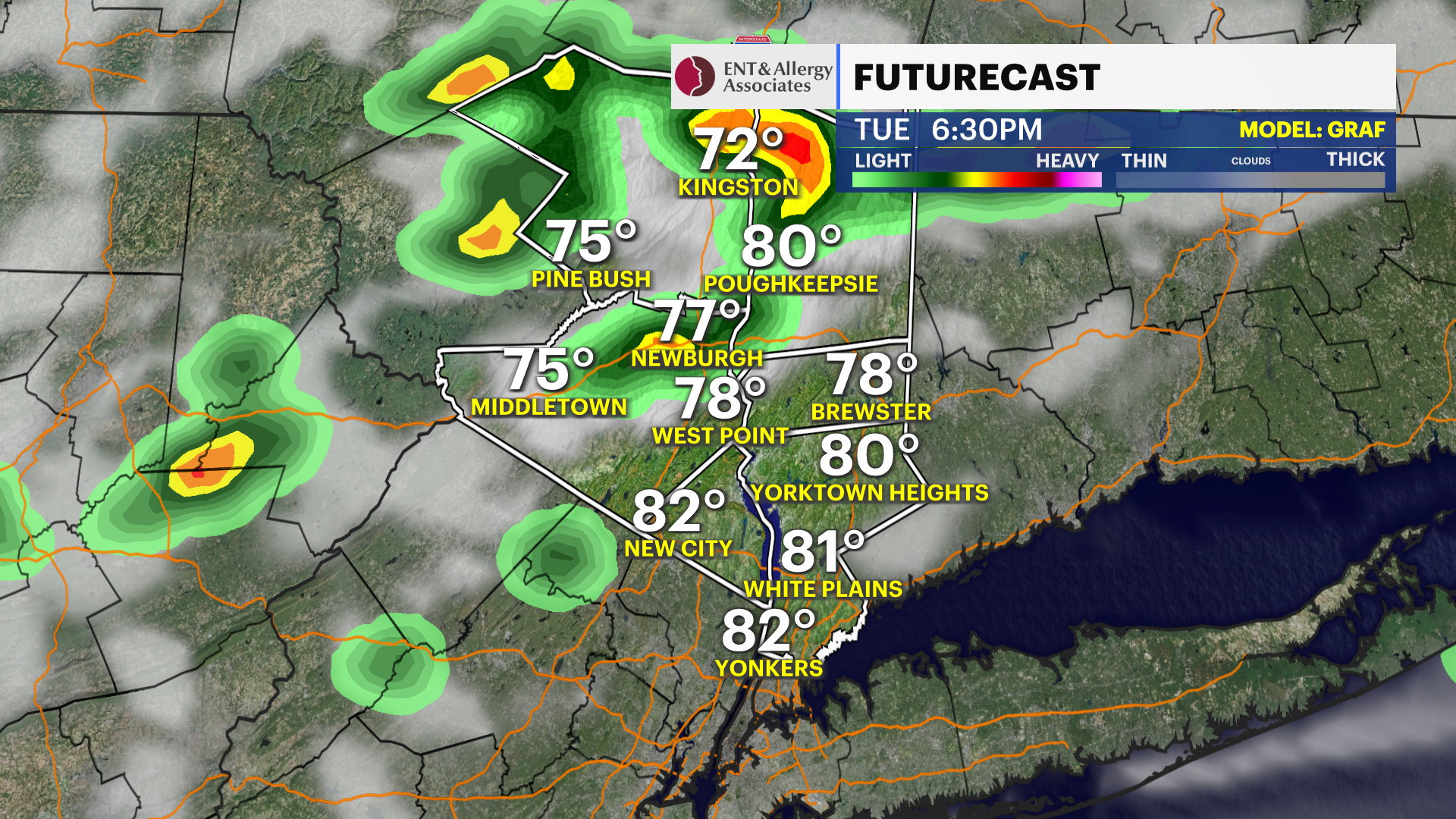
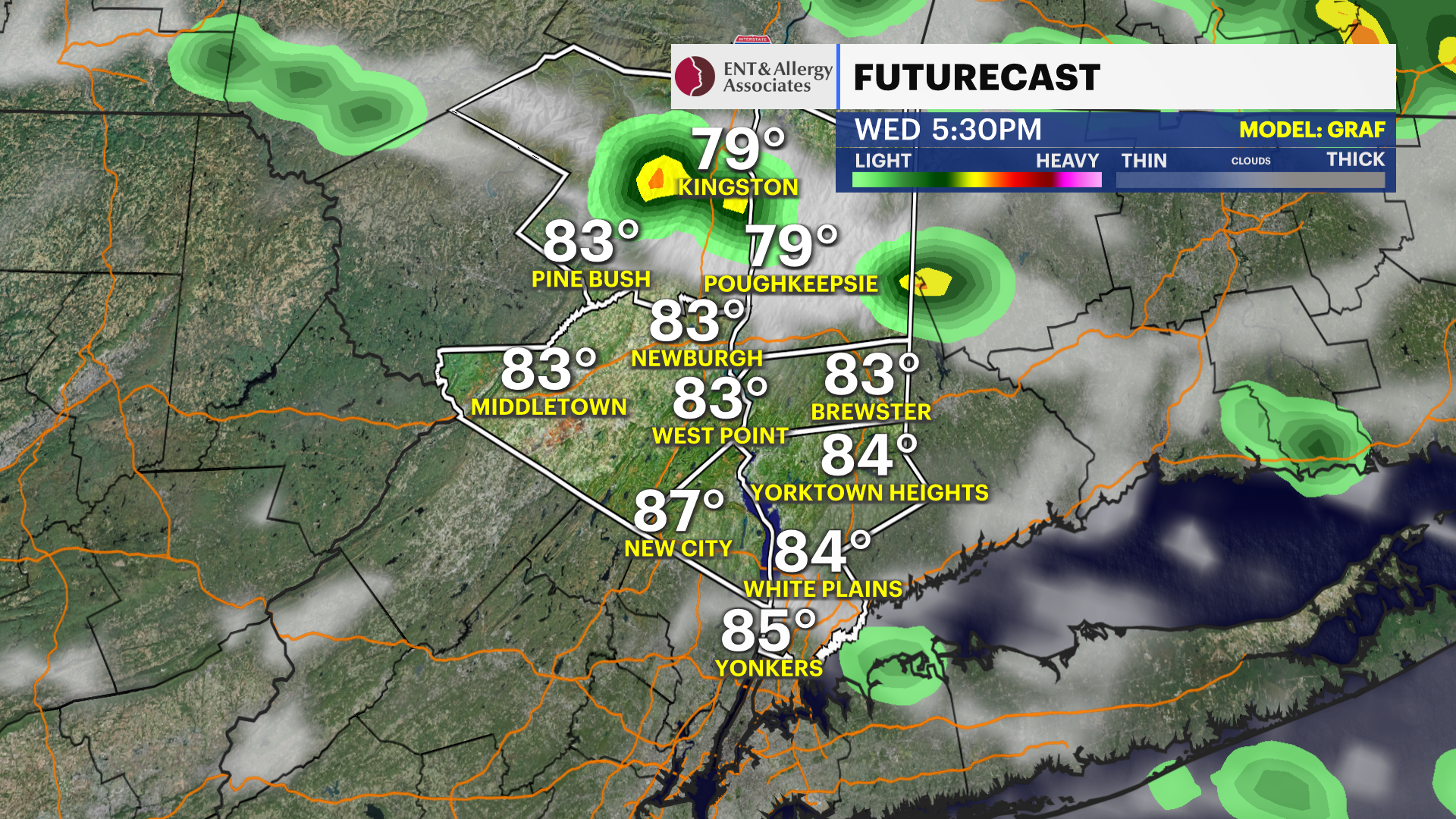
By Wednesday, the warmth peaks, and some areas could challenge or even break record high temperatures. While a stray shower or thunderstorm can’t be ruled out at times through the week, most of the activity should stay north of the Hudson Valley, with only brief or isolated impacts locally.
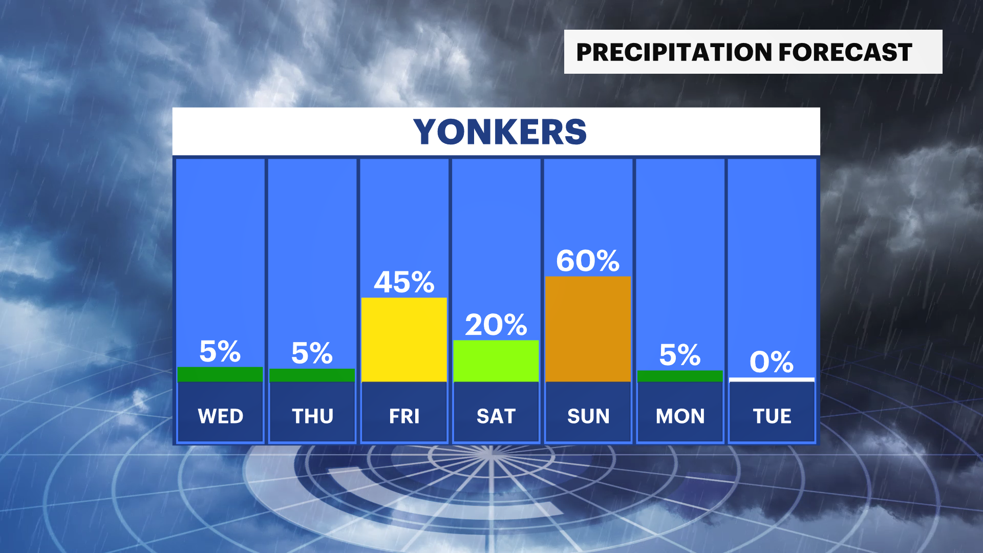
Heading into Thursday and Friday, the warm pattern holds steady. Expect continued above-average temperatures with a mix of sun and clouds. A few late-day showers or storms may drift into the region, but widespread rain is unlikely, and many places will stay dry most of the time.
Changes arrive Sunday as a strong cold front moves through during the afternoon. This will bring a round of showers—and possibly a thunderstorm—followed by a noticeable cooldown. By Sunday night into Monday, temperatures return to near or slightly below normal, bringing a more typical April feel back to the Hudson Valley.