HEAT ALERT: Dangerous heat builds this week along with a few thunderstorm chances
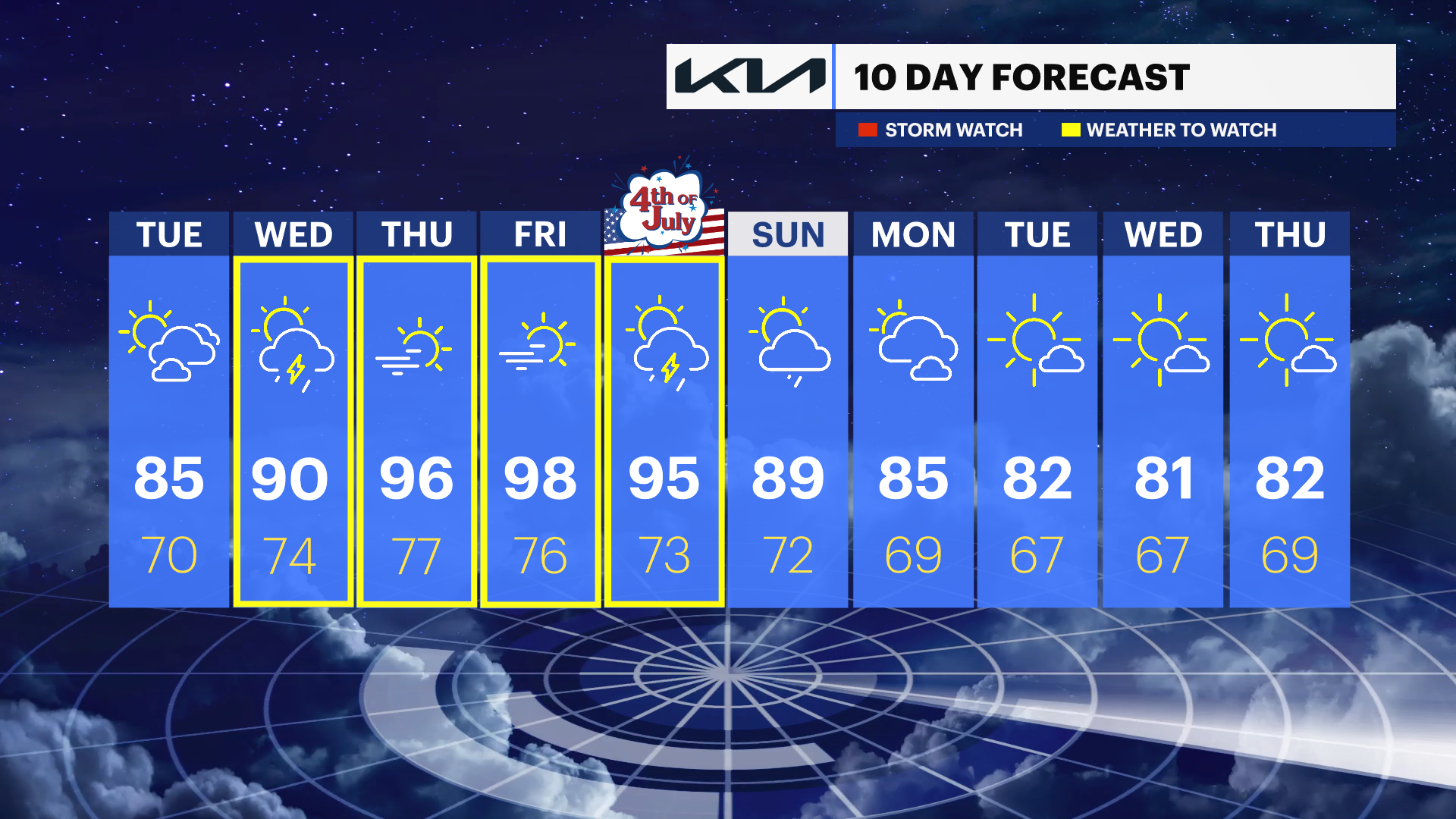
Warm, but nice through Tuesday ahead of it feeling like 95 to 110 degrees from Wednesday through Saturday.
More Stories
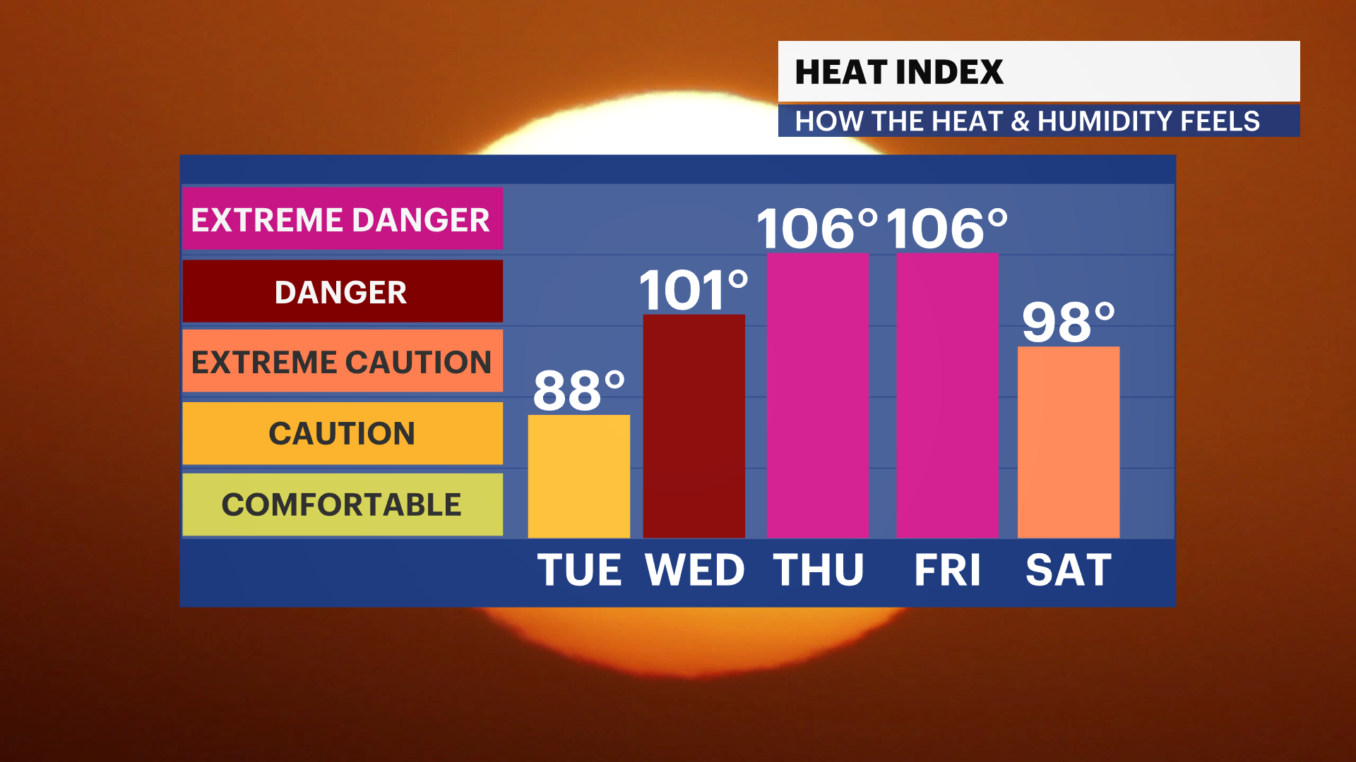


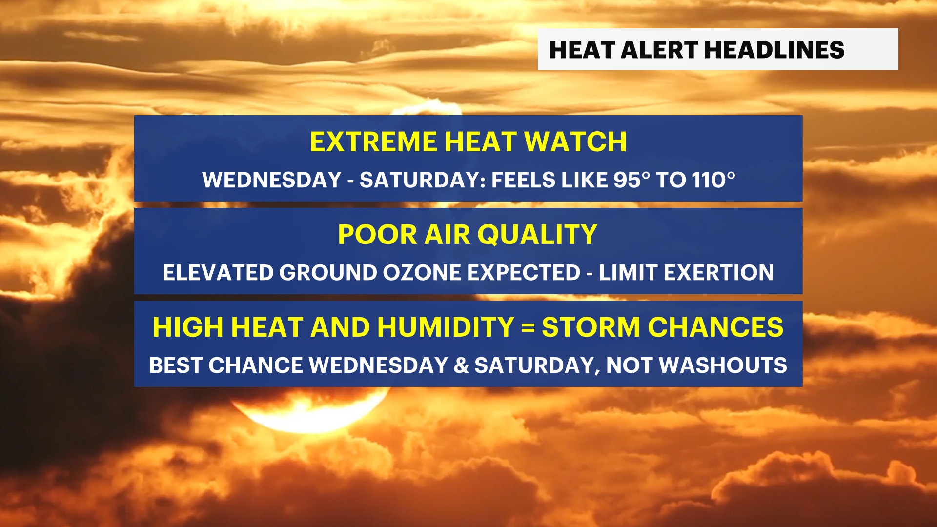
ALERTS: EXTREME HEAT WATCH is in effect from Wednesday afternoon through Saturday evening.
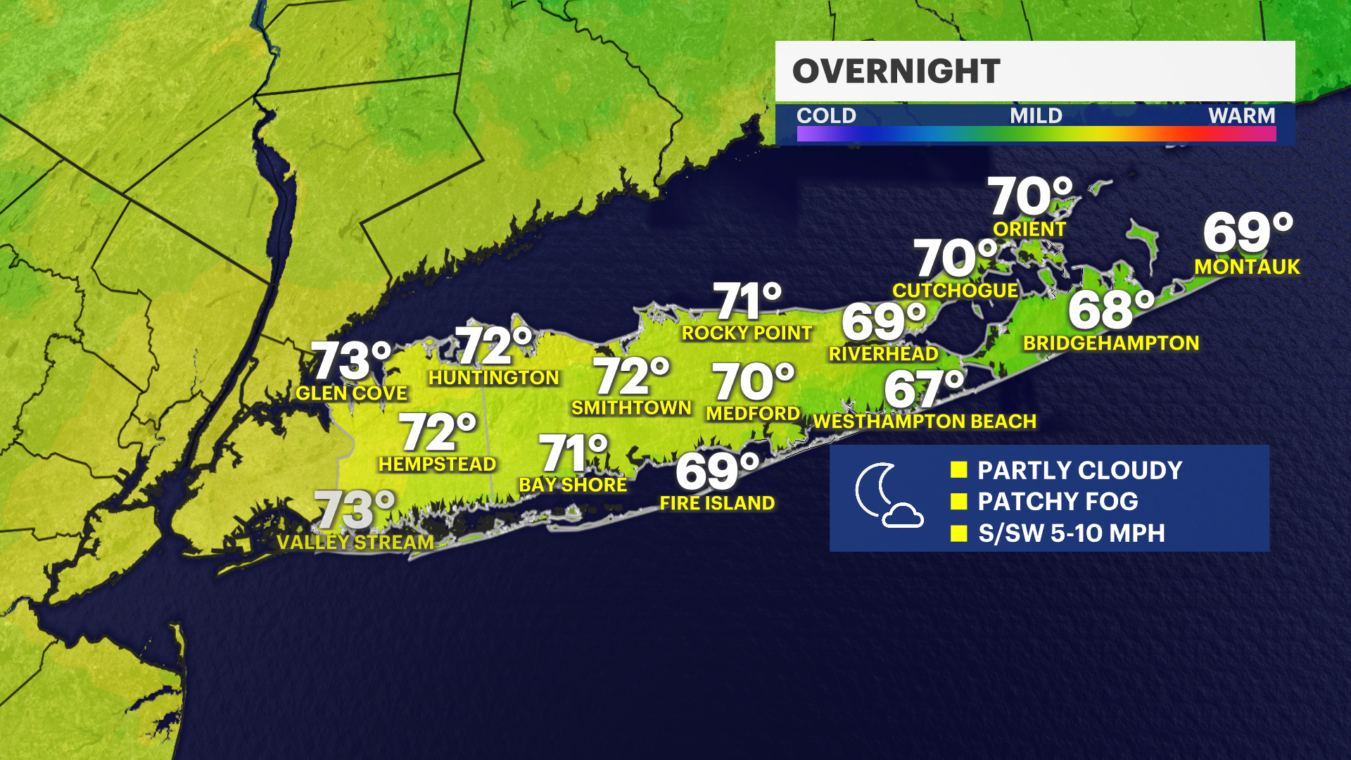
OVERNIGHT THROUGH TUESDAY
Overnight, it will stay partly cloudy with patchy fog and lows in the upper 60s to lower 70s into Tuesday morning.
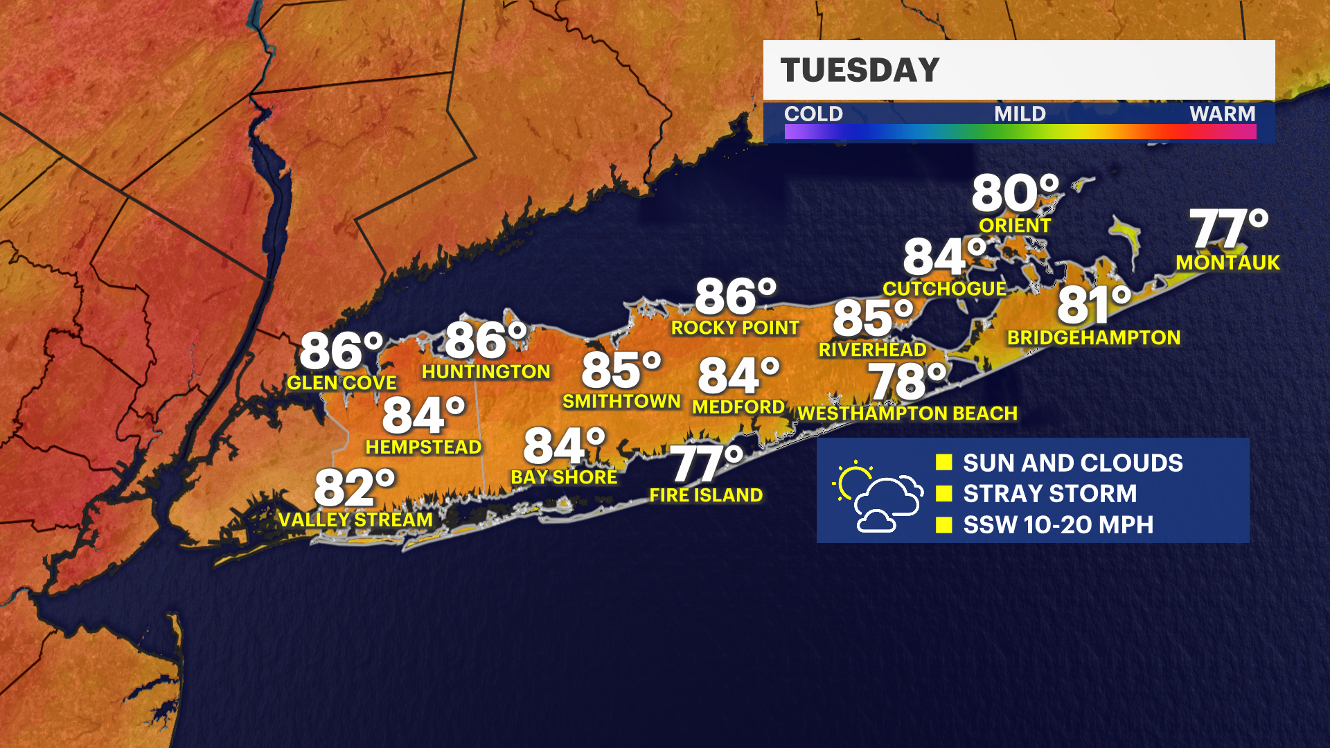
Tuesday will be warm and nice with high temperatures again mostly in the 80s under a mix of sunshine and some clouds.
PEAK HEAT THIS WEEK
Wednesday through at least the Fourth of July on Saturday will be a stretch of sweltering heat and humidity here on Long Island. It should be a priority to use extreme caution outdoors during this stretch, when it can feel like anywhere from 95 to 110 degrees. It will feel a bit better at the South Shore and East End beaches, but you still will need to drink plenty of extra water, take frequent breaks in an air-conditioned environment and limit strenuous outdoor activities.
Air quality is expected to also be poor. Those with pre-existing respiratory or heart-related illnesses will be most affected, but this is the type of heat and humidity that will affect anyone negatively if you are not going about being outdoors safely. Please also check on your pets and remember to check cars for anyone or any pets before walking away.
STORM CHANCES THIS WEEK
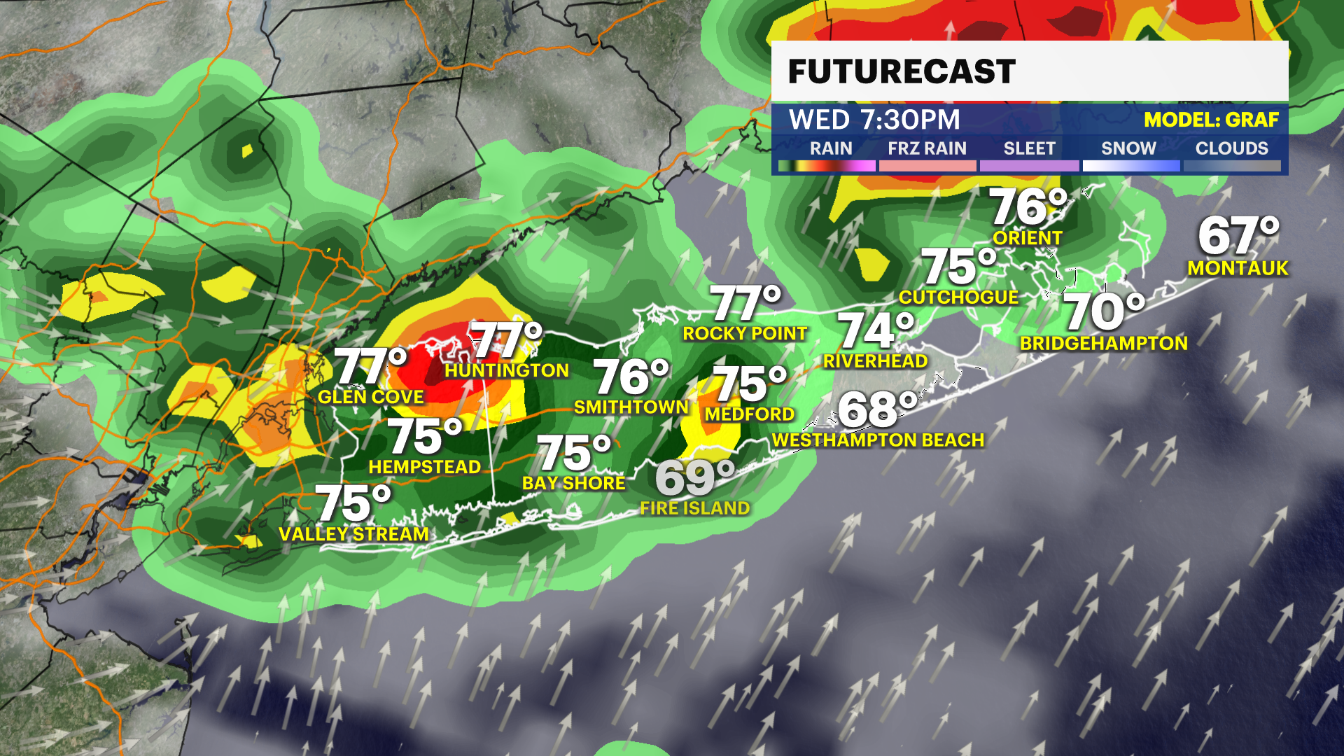
While no day is a washout this week, the building heat and humidity will lead to a few scattered shower and thunderstorm chances. There will be a slight chance for a stray shower on Tuesday, but a much better chance for scattered thunderstorms Wednesday. There can be a brief downpour in the morning, but a better chance for a couple of showers or thunderstorms will be around Wednesday afternoon and evening.
Thursday will likely be dry, as will Friday, other than an isolated shower or thunderstorm. Saturday, the Fourth of July, can have a few pop-up showers or storms in the afternoon or evening that can temporarily impact outdoor plans. Expect a similar passing shower or thunderstorm chance on Sunday, too.
News 12 will keep you updated on all of this through the week, so check the News 12 app for frequent updates.
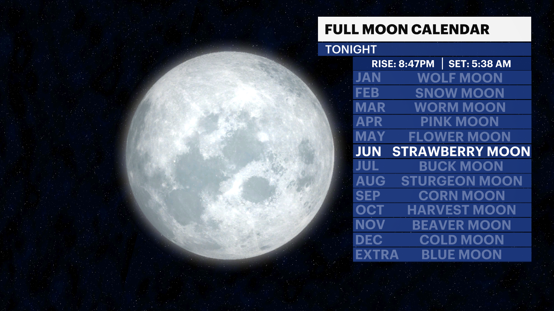
FULL STRAWBERRY MOON OVERNIGHT
If you notice the full moon into early Tuesday morning, it is known as the full "strawberry moon" and is the first of summer. This moon is actually considered a micromoon, and will be slightly smaller in the sky than usual, other than during moonrise and moonset. If you grab a photo, send it to us on social media!
EXTENDED FORECAST
OVERNIGHT: Partly cloudy with patchy fog. Warm and noticeably humid with lows in the upper 60s to lower 70s. Wind: south-southwest 5 to 10 mph.
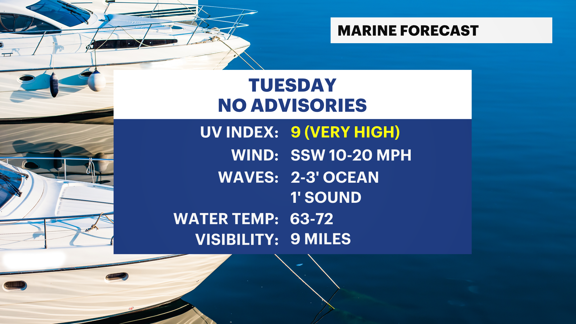
TUESDAY: Sun and clouds. Most of the day is dry, but there is a slight chance for a pop-up shower or isolated non-severe thunderstorm in the afternoon and evening. Highs around the upper 70s to middle 80s. Wind: south-southwest 10 to 20 mph.
WEDNESDAY: HEAT ALERT - STORM CHANCE - Sun and clouds. Hot and humid. Highs around 90 degrees. It will feel like around 95 degrees. Use caution and take breaks from the heat. A few showers and thunderstorms possible. Lows near 74 degrees.
THURSDAY: HEAT ALERT - Hazy, hot and humid. This is the start of the peak of this week's extreme heat. Highs around 96 degrees. It will feel like 95 to 110 degrees. Use caution and take breaks from the heat and stay hydrated. Lows near 77 degrees and humid.
FRIDAY: HEAT ALERT - Hazy, hot and humid. Highs around 98 degrees. It will feel like 95 to 110 degrees. Use extreme caution and take breaks from the heat and stay hydrated. Slight chance for a shower or thunderstorm, but mostly dry. Lows near 75 degrees and humid.
SATURDAY: HEAT ALERT - FOURTH OF JULY - STORM CHANCE - Sun and clouds with a few spotty showers and thunderstorms possible. Hot and humid. Highs around 95 degrees can feel like 95 to 105 degrees. Use extreme caution and take breaks from the heat and stay hydrated. Lows near 73 degrees.
SUNDAY: HOT - A FEW SHOWERS - Sun and clouds with a shower chance. Highs around 89 degrees. Lows near 72 degrees.
MONDAY: Partly sunny with highs around 85 degrees. Lows near 69 degrees.