EXTREME HEAT WARNING: Temperatures approach 100 degrees with heat index more than 100 degrees
Dangerous heat into the weekend with feels like temperatures in the 100s. Tracking Pop up Storms Friday, Saturday and Sunday.
More Stories


ALERTS:
1) EXTREME HEAT WARNING is in effect from now through Saturday at 9 p.m.
2) AIR QUALITY ALERT is in effect Today from 11 a.m. to 11 p.m.
3) HIGH RIP CURRENT RISK at Ocean Beaches
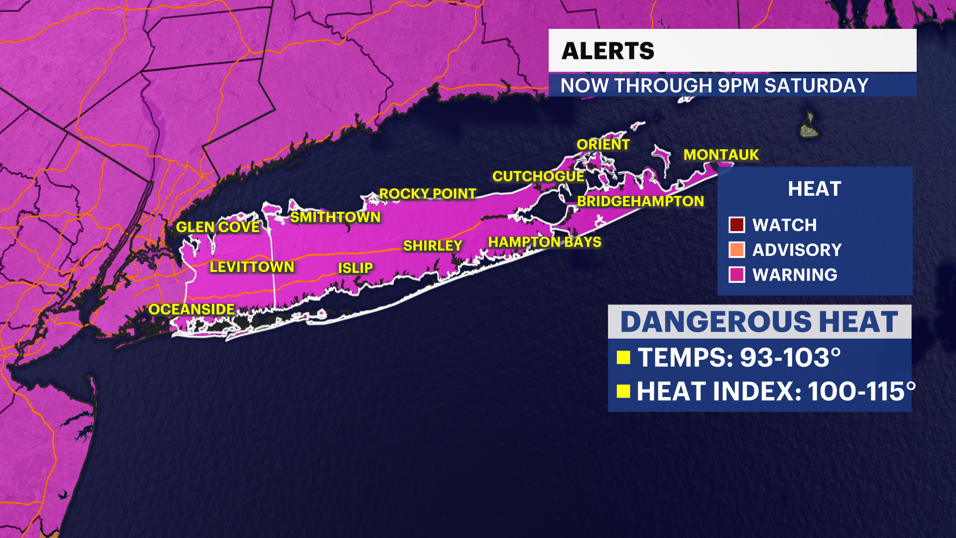
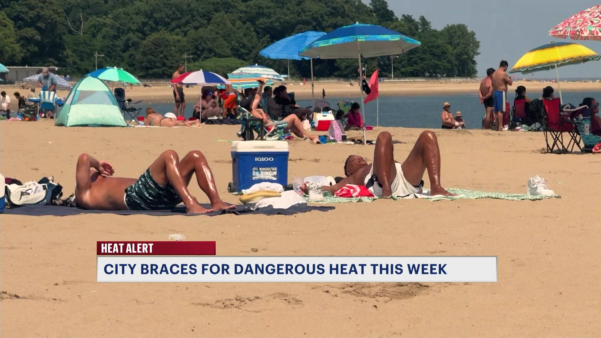
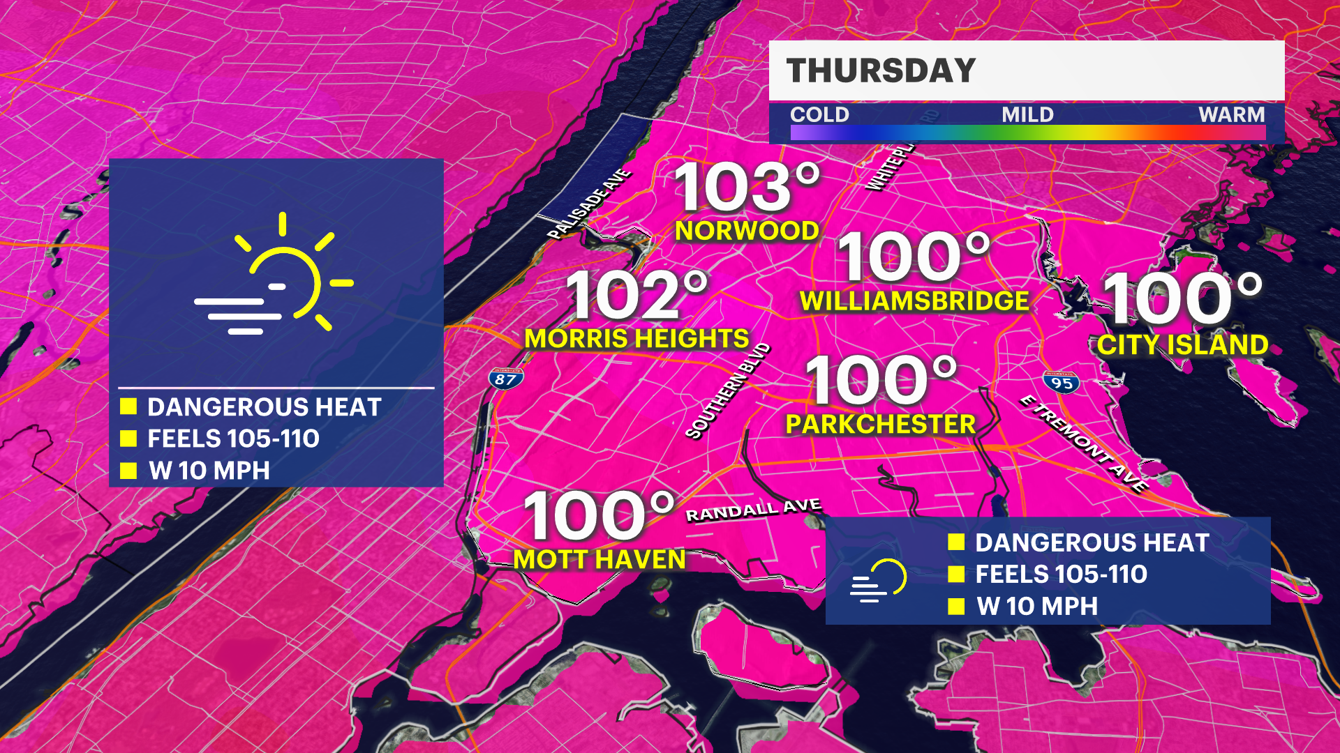
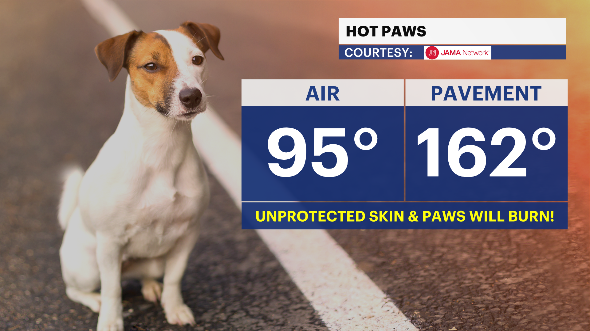
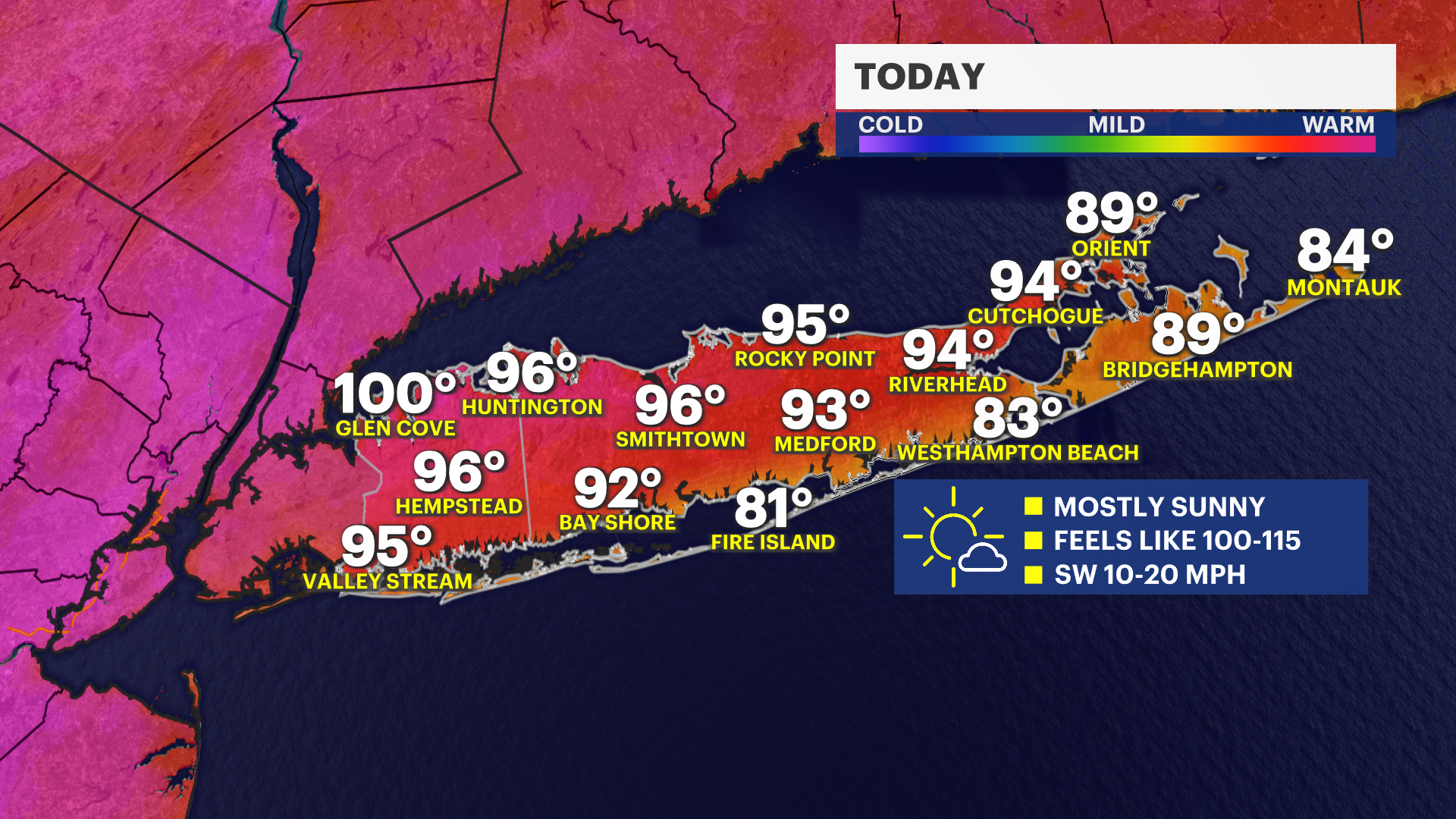
Dangerous heat continues across Long Island today, and an Extreme Heat Warning remains in effect through Saturday at 9 p.m. In addition, an Air Quality Alert is in effect for elevated ozone levels, which could make it difficult for sensitive groups to breathe. If you're heading to the beach, there's also a high risk of dangerous rip currents along the South Shore, so only swim at beaches with lifeguards on duty. For today, expect wall-to-wall sunshine and intense heat. High temperatures will climb into the 90s, but it'll feel more like the lower 100s. Limit time outdoors if possible, drink plenty of water, and take frequent breaks in the shade or air conditioning.
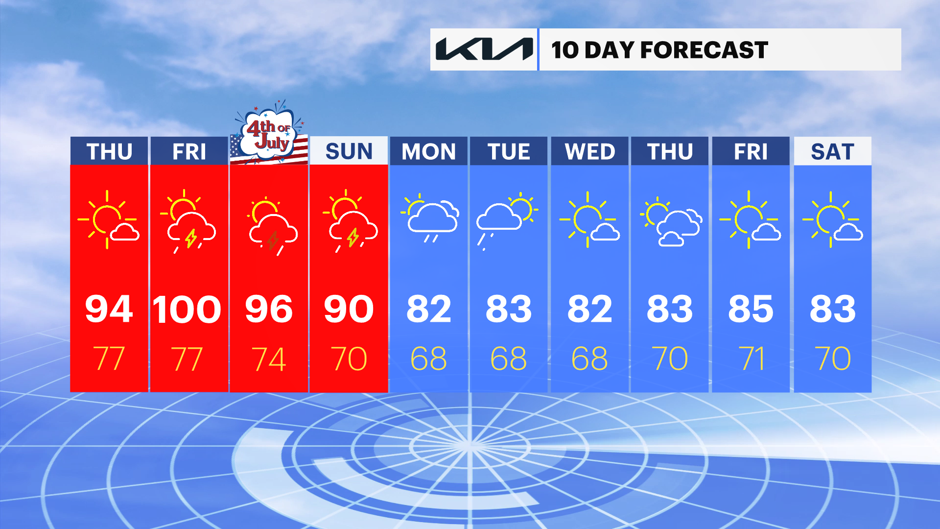
Tonight will remain partly cloudy, warm, and muggy. Overnight lows will only fall into the 70s to around 80 degrees, offering very little relief from the heat. On Friday, we'll see plenty of sunshine through much of the day before a few afternoon clouds develop. High temperatures will approach 100 degrees, with heat index values ranging from 100 to as high as 115 degrees. A few isolated late-day showers and thunderstorms are possible, and any storm could produce brief heavy rain and gusty winds. A few spotty showers or storms may linger Friday night with lows staying in the 70s.
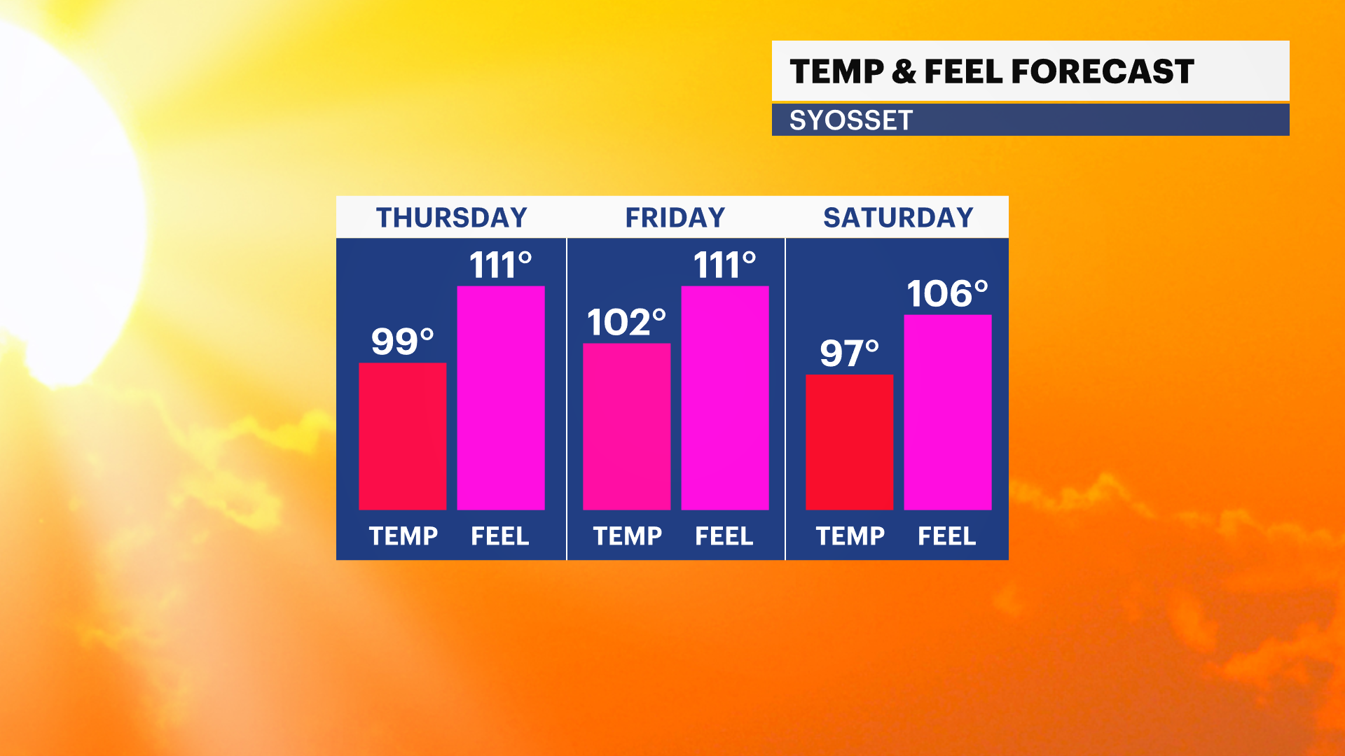
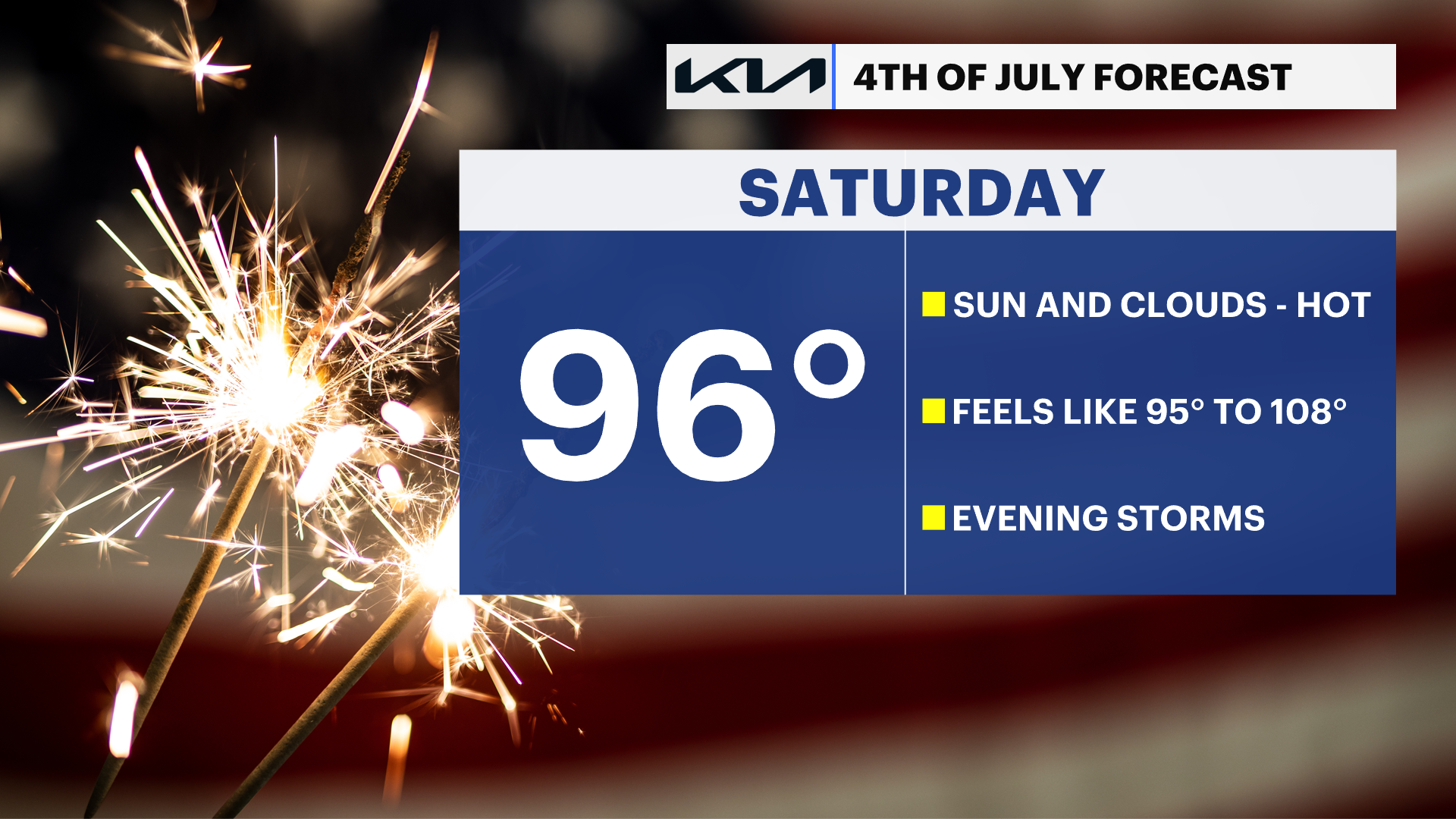
The Fourth of July will be another hot and humid day. Expect mostly sunny skies with afternoon temperatures in the 90s and feels-like temperatures once again climbing into the lower 100s. Most holiday plans will stay dry, but there is the chance of an isolated late-day shower or thunderstorm. Saturday night remains warm and muggy with lows in the 70s and a few scattered showers or storms possible.
Looking ahead to Sunday, we'll keep the hot and humid weather around with partly sunny skies, highs near 90 degrees, and heat index values between 95 and 100. Once again, a few late-day showers and thunderstorms could develop. By Monday, the pattern begins to change as temperatures ease back into the 80s, with a better chance for scattered rain showers. Stay cool, stay hydrated, and have a safe Fourth of July weekend.
100 DEGREE DAYS ON LONG ISLAND ARE RARE
Reaching an official air temperature at Islip MacArthur Airport here on Long Island of 100 degrees or hotter is extremely rare. It has actually only happened eight times since records have been kept at the airport since 1963 - one of those times was in June of last year. The forecast high on Friday is 100, which could be the ninth time in recorded history. This is not typical summer heat for Long Island. Our normal average highs this time of year are in the lower 80s.
Here are the eight times Islip has reached 100 degrees:
104°F – July 3, 1966 (Islip's record high)
102°F – July 5, 1999
101°F – July 6, 2010
101°F – July 21, 1991
101°F – June 24, 2025 (hottest June day on record)
100°F – July 22, 2011
100°F – August 2, 1975
100°F – August 9, 2001
ANY RECORD HEAT FOR LONG ISLAND?
While this week's heat can be dangerous, we are not expecting any official records to be broken at Islip MacArthur Airport at this time, but Saturday could be close!
TODAY: Forecast high: 94 | Record high: 99 (1966)
FRIDAY: Forecast high: 100 | Record high: 104 (1966)
SATURDAY: Forecast high: 96 | Record high: 97 (2010)