Another summer preview across the Hudson Valley heading into the weekend
While it is nice today - heat, humidity and rain chances will rise over the next several days.
More Stories


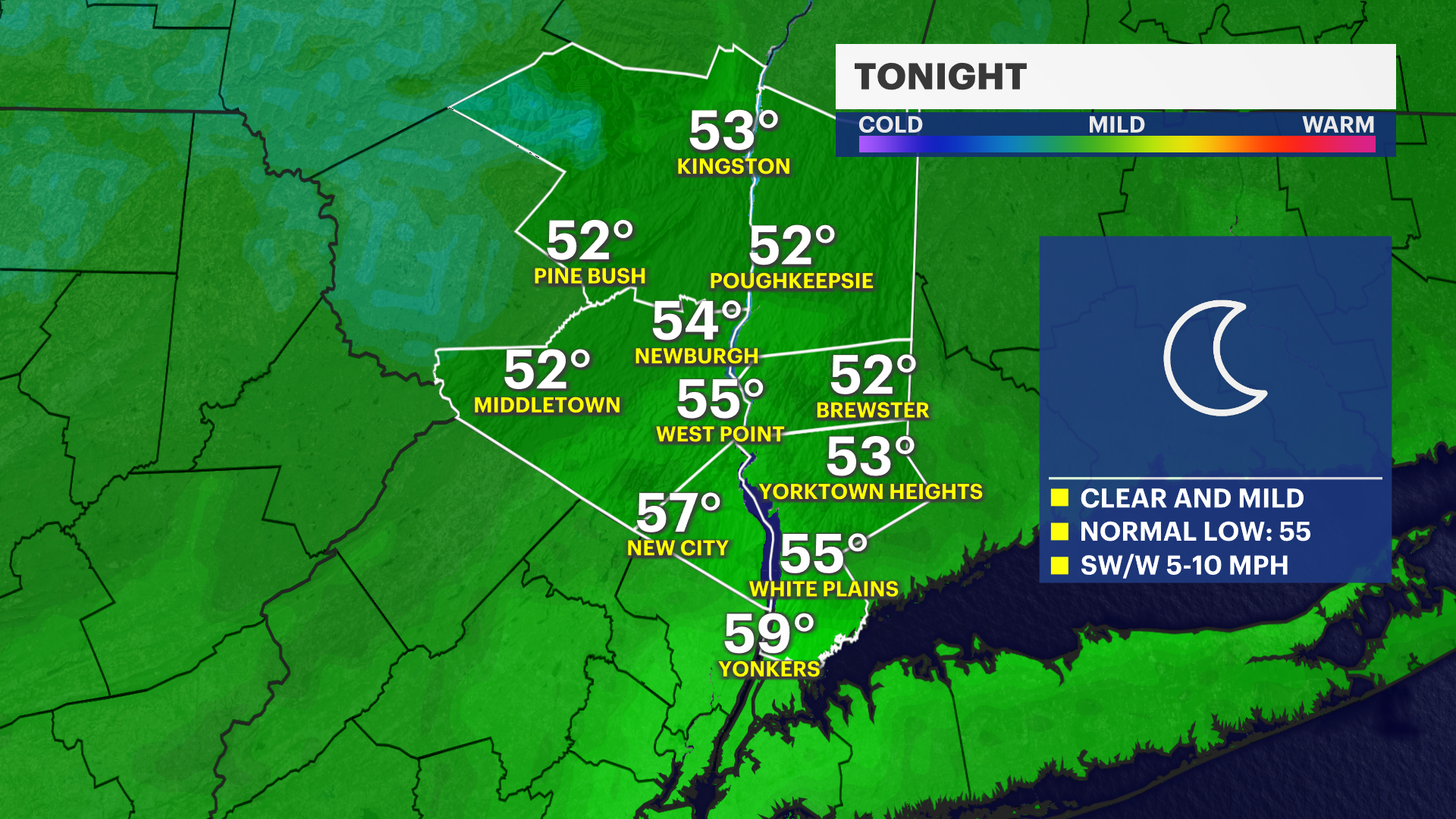
Today was an absolute beauty with plenty of sunshine, and highs in the 70s for most. There were even a few low 80s mixed in. As we push into tonight, things stay quiet, but a warm-up is brewing.
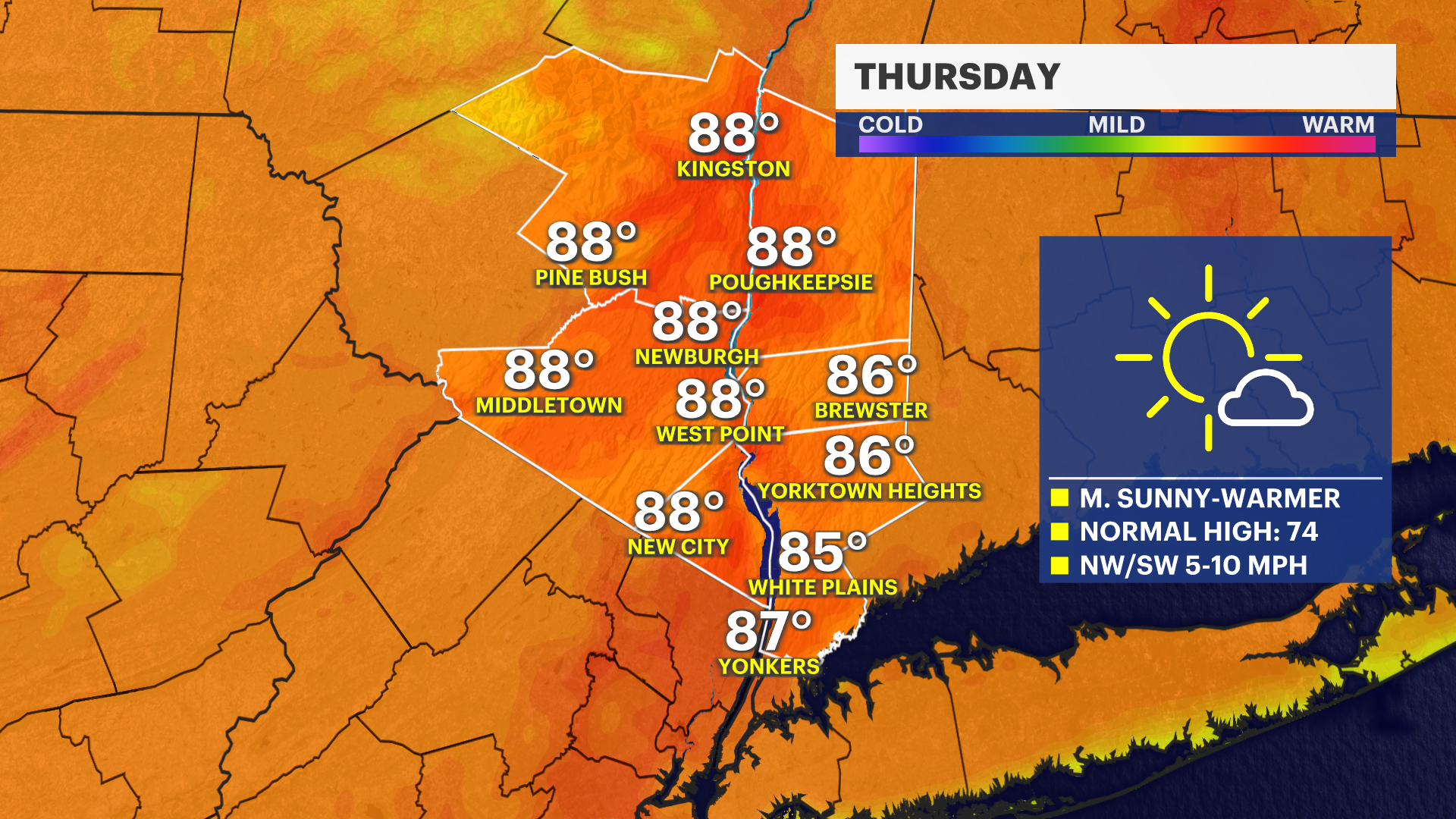
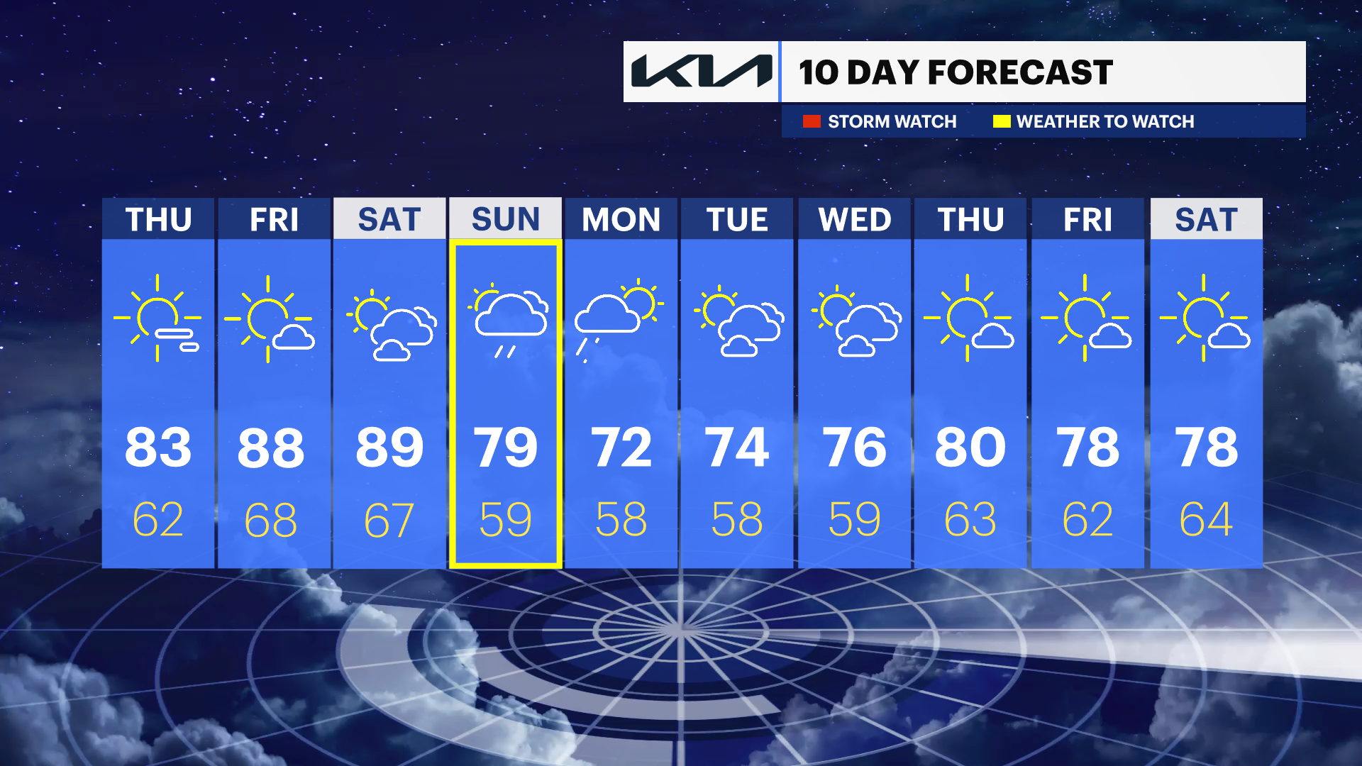
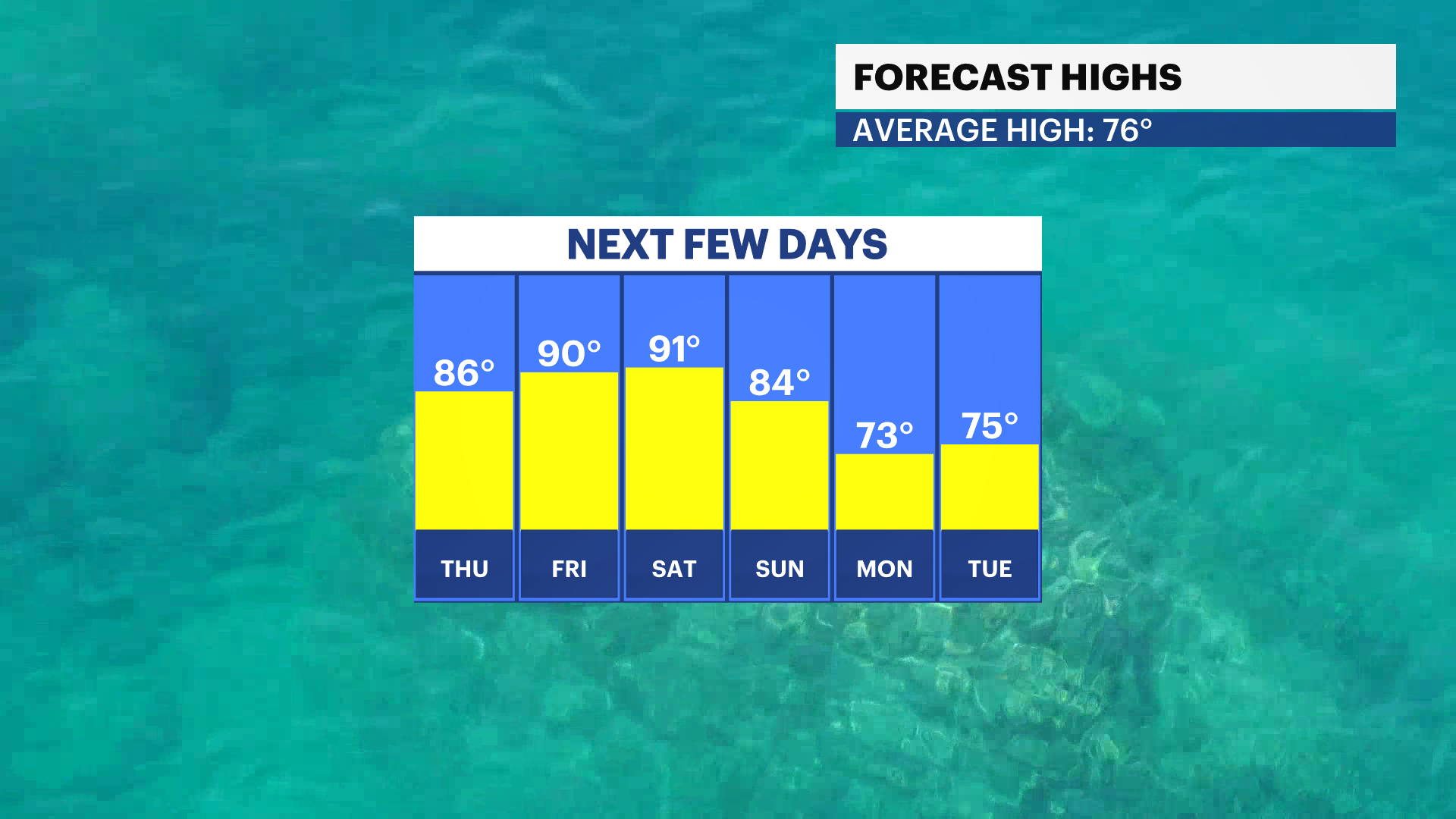
The heat gradually builds over the next several days. We aren't diving headfirst into full-blown summer weather quite yet, but a muggier setup is on the way. Temperatures head into the mid-80s tomorrow, then flirt with the low 90s Friday and Saturday. A few spots could even challenge daytime records all three days. Thursday’s humidity will still be comfortable, but those numbers trend upward by Friday. You'll definitely want the A/C running by the end of the workweek.
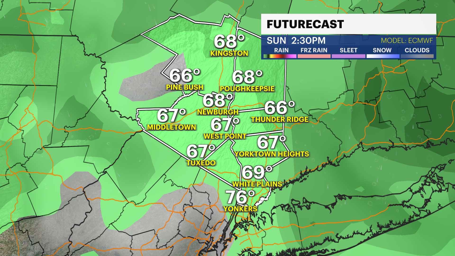
Our next storm system approaches over the weekend, ramping up the moisture. The good news? The rain holds off until Sunday, meaning your weekend is split right down the middle. Saturday is your green light for outdoor plans, while Sunday looks much wetter. Expect on-and-off rain and an isolated chance of thunderstorms, which will knock temperatures back into the 70s, though the humidity will hang around.
ALMANAC:
Average High: 74 | Average Low: 55
Record High: 87 (2010) | Record Low: 42 (1986)
Sunrise: 5:24 a.m. | Sunset: 8:22 p.m.
THE FORECAST:
TONIGHT: Clear and seasonal with a light breeze. Lows: Low to mid-50s.
THURSDAY: Mostly sunny with rising temperatures. Highs: Mid-80s. Lows: Upper 50s to low 60s.
FRIDAY: Partly cloudy, feeling hotter and more humid. Highs: Upper 80s to low 90s. Lows: Mid-60s.
SATURDAY: Partly cloudy skies with breezy winds and temps feeling hot and humid. Highs: Upper 80s to low 90s. Lows: Upper 60s.
SUNDAY: Mostly cloudy with a chance for rain and isolated thunderstorms. Highs: Upper 70s. Lows: Upper 50s.