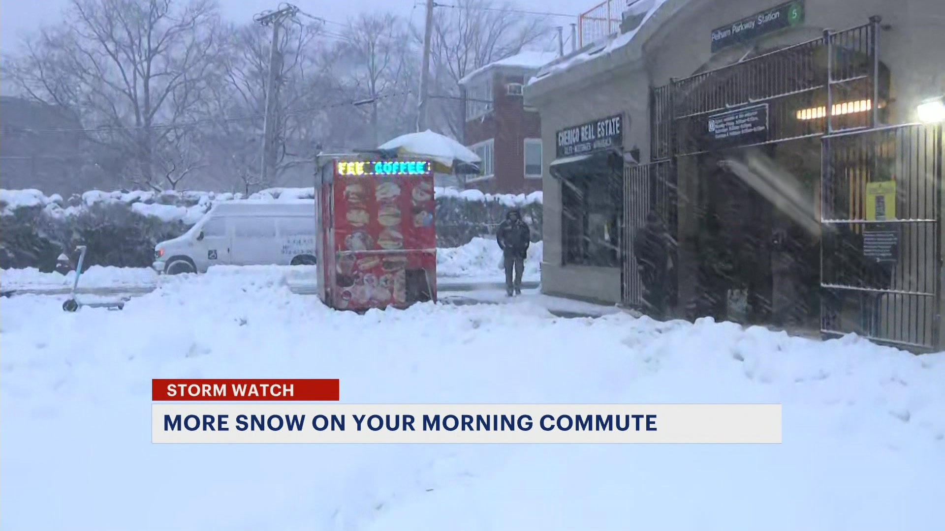
Sun and clouds, with summer-like temps on Monday for the Bronx
A taste of summer with plenty of sunshine is expected to start off the week, but the total opposite is possible for Memorial Day weekend.
More Stories


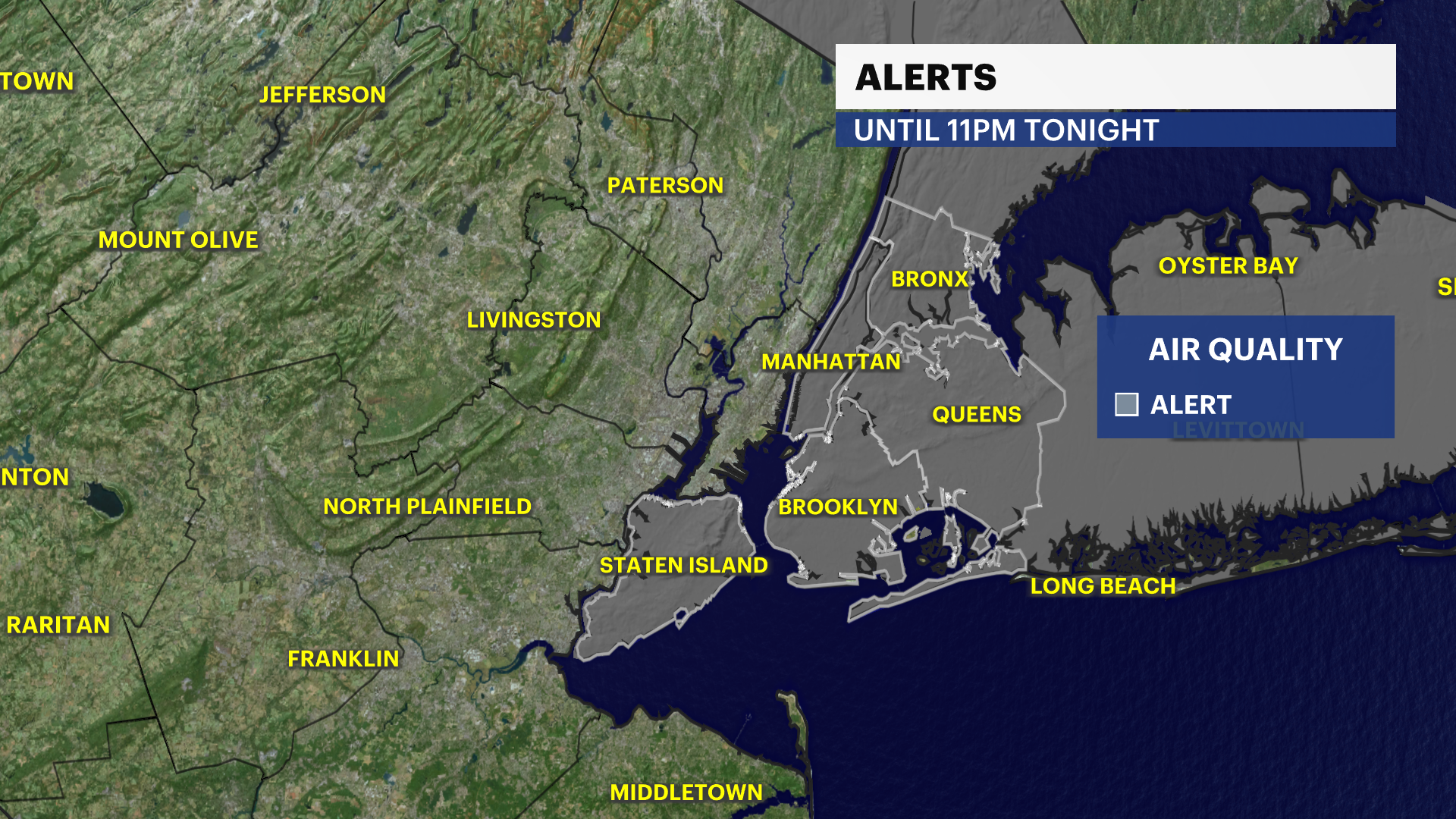
An air quality alert is in effect until 11 p.m.
FORECAST
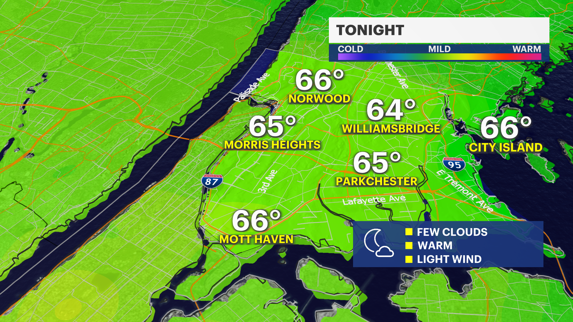
Overnight: Very mild
A few clouds move in. Temperatures are in the low to mid-60s.
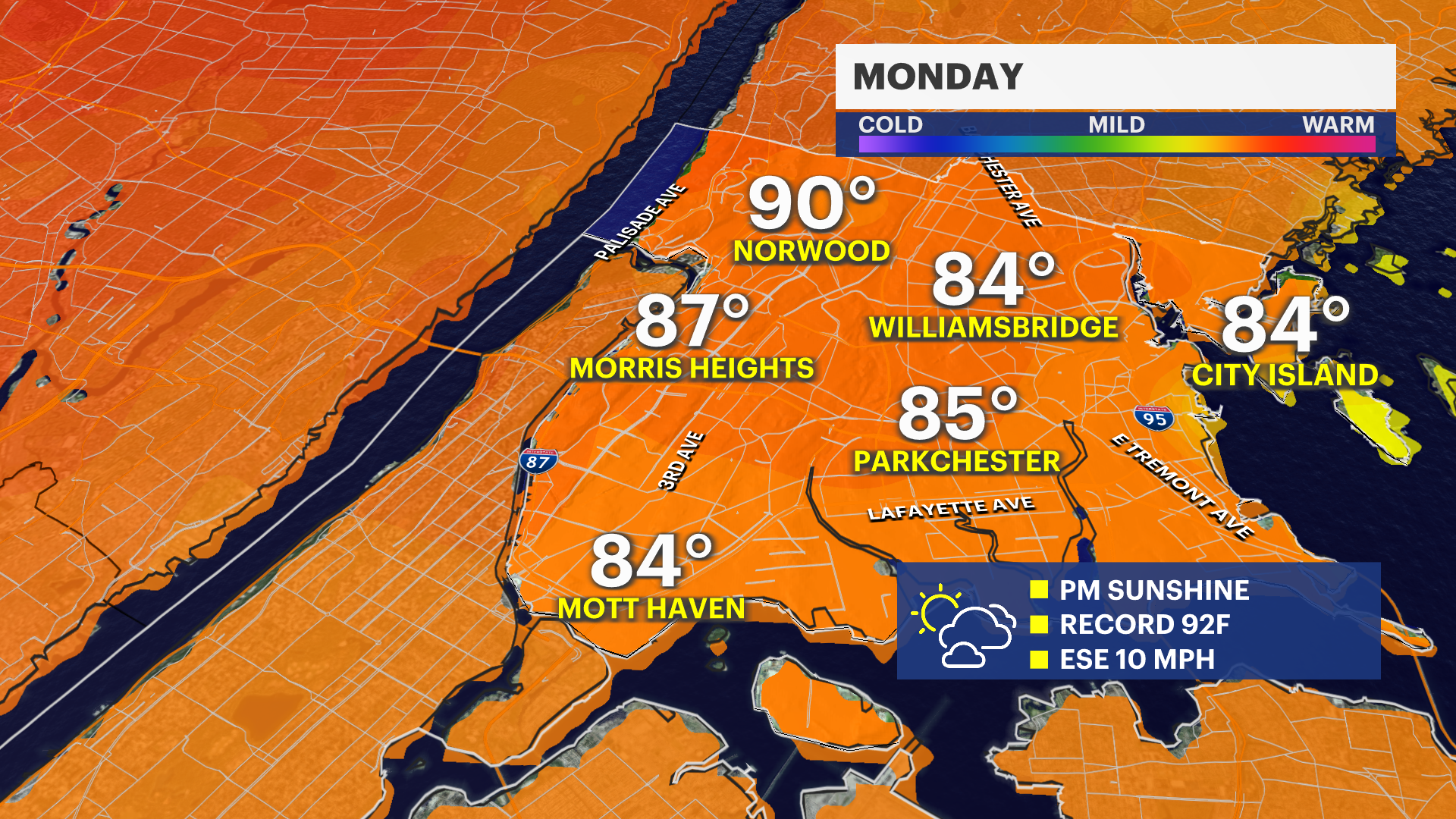
Monday: Warm, with morning clouds
A few clouds from overnight will linger for the morning. It's a mild day, with high temperatures in the 70s for coastal spots and well into the 80s inland. Winds are light early and then shift to the east-southeast at 5 to 10 mph.
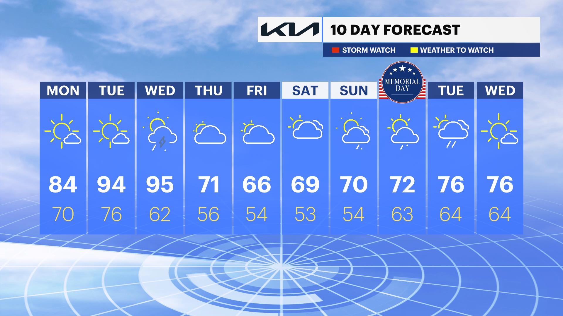
Tuesday: The hottest day
Ample sunshine is expected, with high temperatures in the upper 80s to low 90s. Record heat is possible. A stray thunderstorm is possible in the afternoon.
Wednesday: Hot, then stormy
Plenty of sunshine will once again bring temperatures into the upper 80s and low 90s. Record heat is possible. Pop-up thunderstorms are expected in the evening.
Cloudy and cool through Memorial Day
The pattern will flip for the end of the week. Cold maritime air will keep temperatures generally in the 60s under mostly cloudy skies through Memorial Day weekend. The News 12 Storm Watch Team is monitoring for a shower chance Saturday through Monday. The best chance for showers will be Friday night into Saturday and next Sunday night into Memorial Day as of Sunday evening's weather forecast.