Blustery Friday kicks off cooler weekend in The Bronx
Gusty winds ease by Saturday with sunshine returning, but rain looms late Sunday into early next week.
More Stories


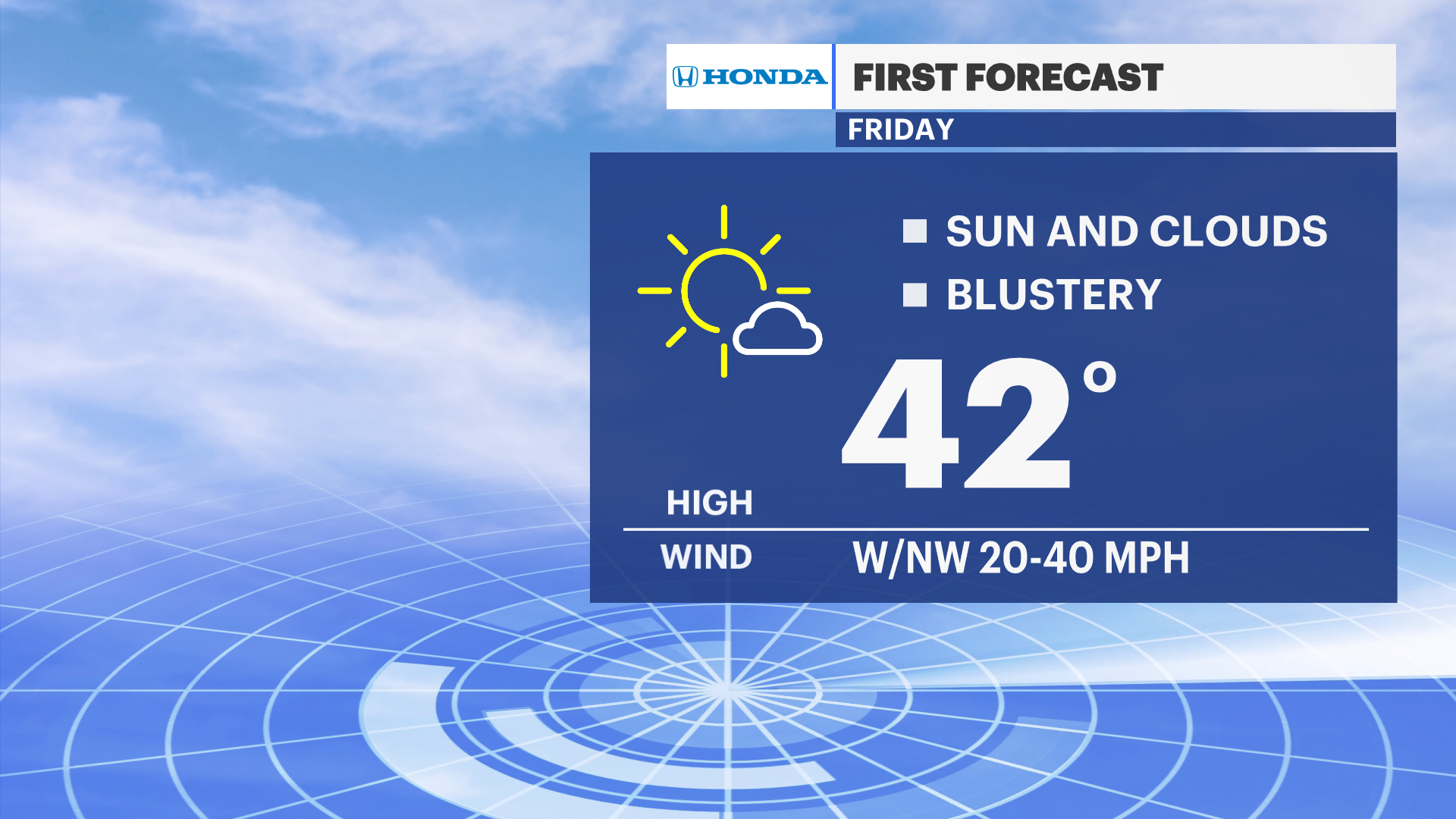
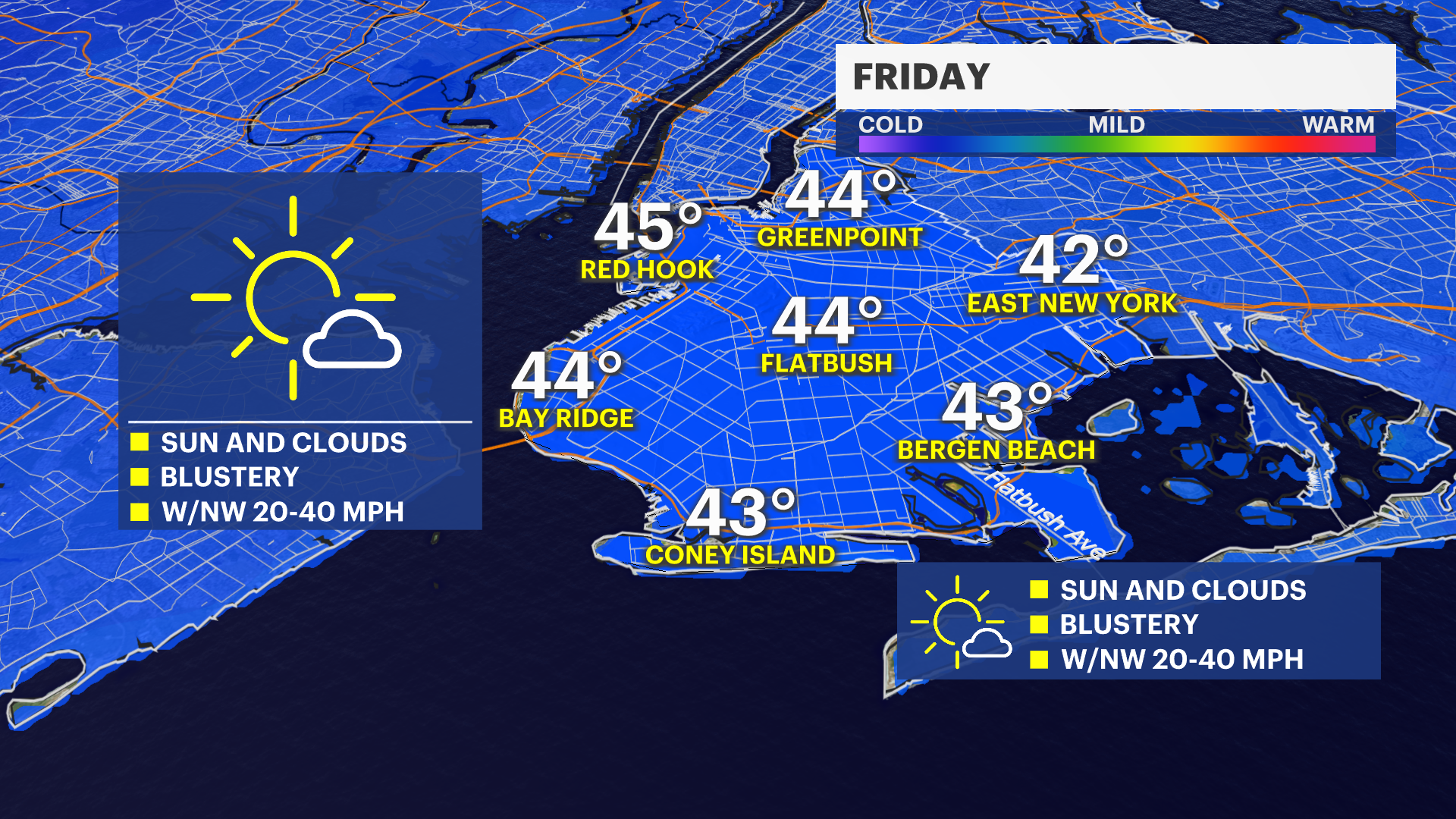
A breezy and chilly stretch continues as we head into Friday, with strong west winds keeping wind chills in the 20s and 30s early on.
Conditions calm down a bit through Saturday with sunshine returning, but clouds quickly build ahead of the next system. Rain moves in on Sunday afternoon, bringing a damp and gray finish to the weekend.
Early next week stays cool with a mix of clouds and occasional rain, and even a brief rain and snow mix possible on Tuesday before temps rise enough for plain rain. Mid-week trends drier and brighter again.
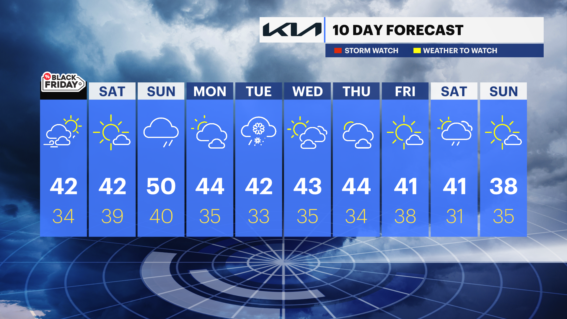
FORECAST:
FRIDAY: Mostly sunny and breezy with temperatures in the mid-40s to upper 40s.
SATURDAY: Sunny and seasonable, highs in the low 40s to mid-40s.
SUNDAY: Rain likely in the afternoon, highs in the upper 40s to near 50.
MONDAY: Partly sunny and cooler, highs in the low 40s.
TUESDAY: Chance of a rain and snow mix early, then rain likely; highs in the upper 30s to low 40s.
WEDNESDAY: Mostly sunny and colder, highs near 40.
THURSDAY: Partly sunny, highs in the low 40s.