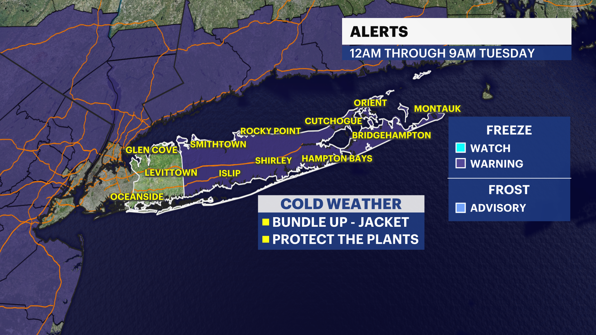
STORM WATCH: Chilly morning temperatures with light scattered showers Thursday
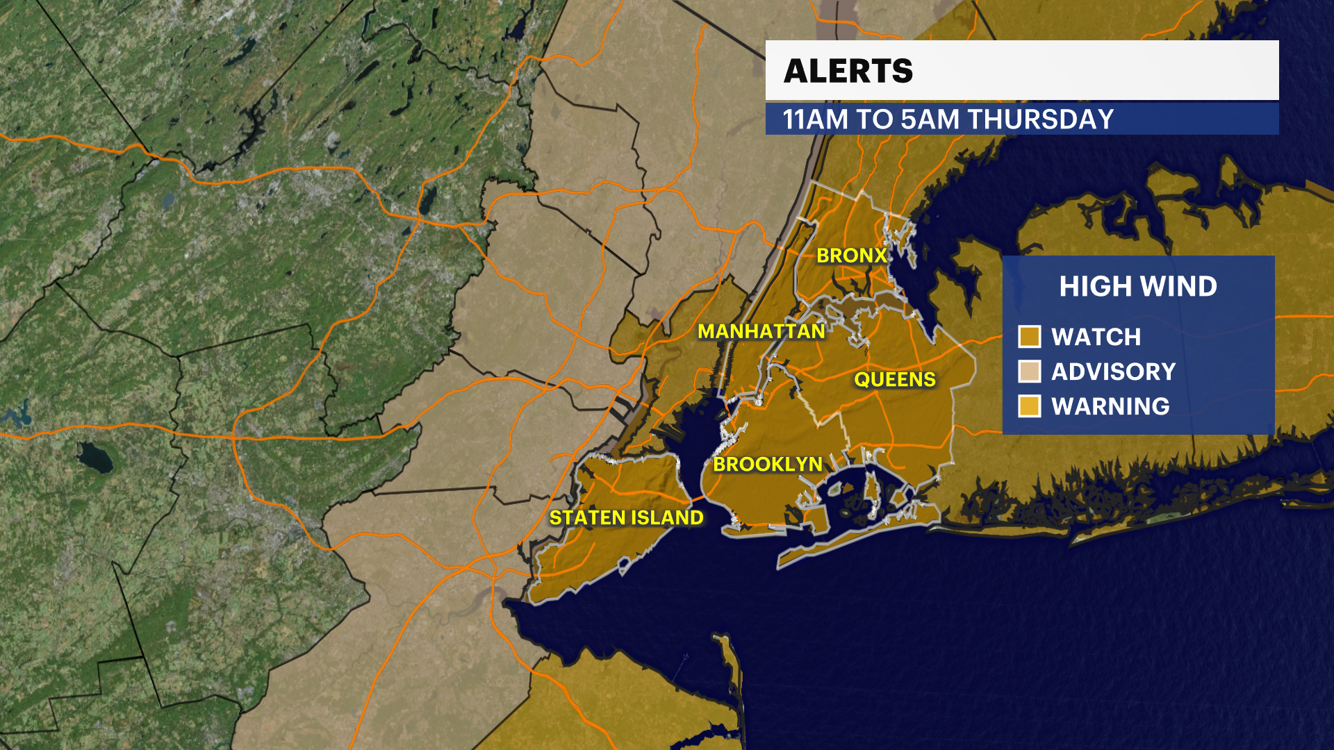
The National Weather Service has issued a flood watch from 4 p.m. to 1 a.m. A high wind warning is in effect from 11 a.m. to 6 a.m. Thursday.
More Stories


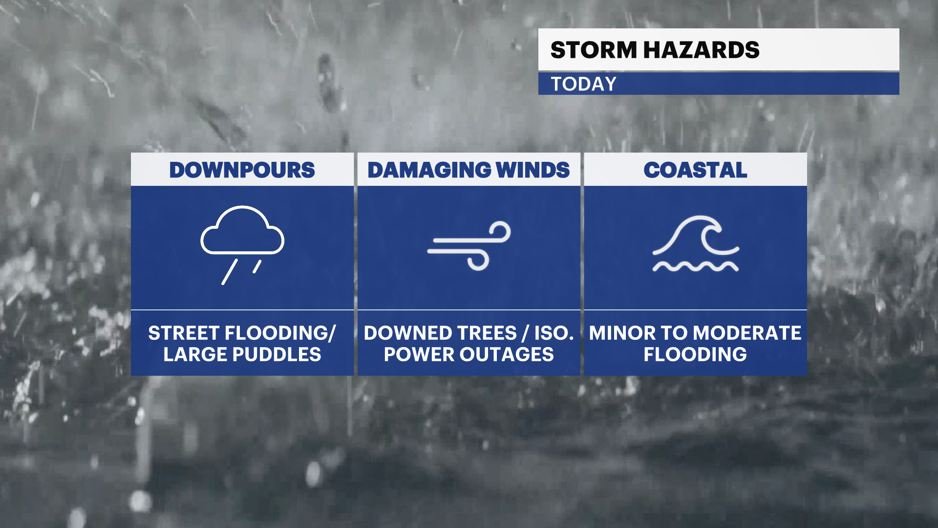
Storm Watch Team Meteorologist Allan Nosoff says more heavy rain and gusts of wind up to 40 mph will batter New Yorkers tonight.
Catch the Brooklyn forecast below:
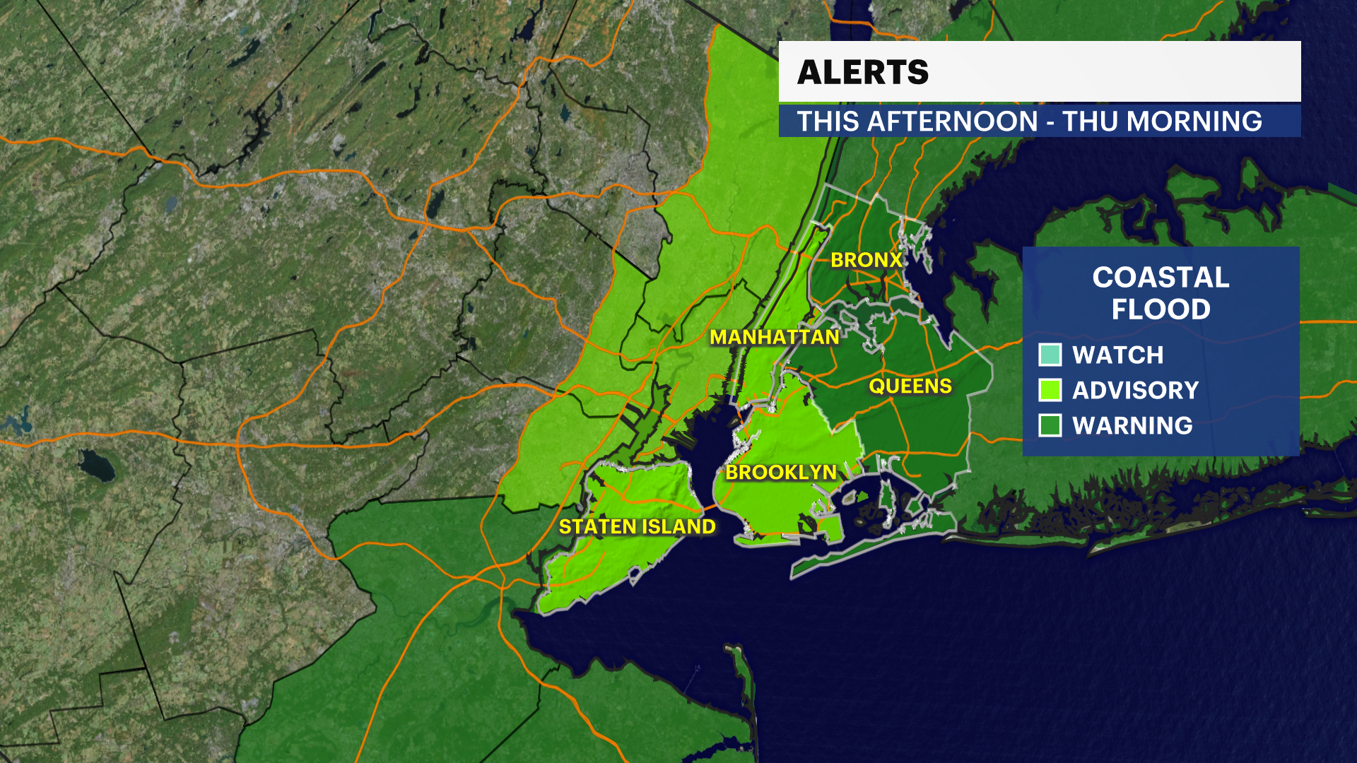
The National Weather Service has issued a high wind warning is in effect from 11 a.m. to 6 a.m. Thursday. A coastal flood warning is in effect from 4 p.m. to 10 a.m. Thursday. A coastal flood advisory is in effect from 2 p.m. to 7 a.m. Thursday.
A coastal storm will continue to impact the tri-state through Thursday morning. Rounds of heavy rain and high winds will likely create unfavorable or hazardous conditions during daytime hours, along with flooding concerns across the region. Storm Watch Team Meteorologist Julian Seawright gives a quick breakdown on the latest storm.
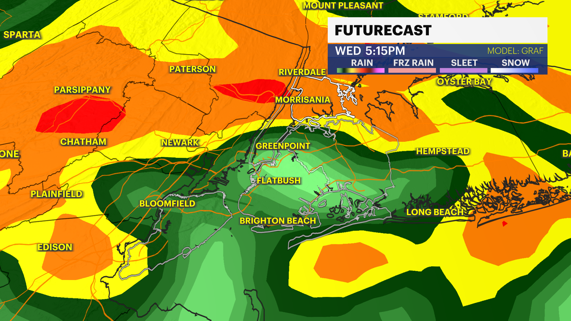
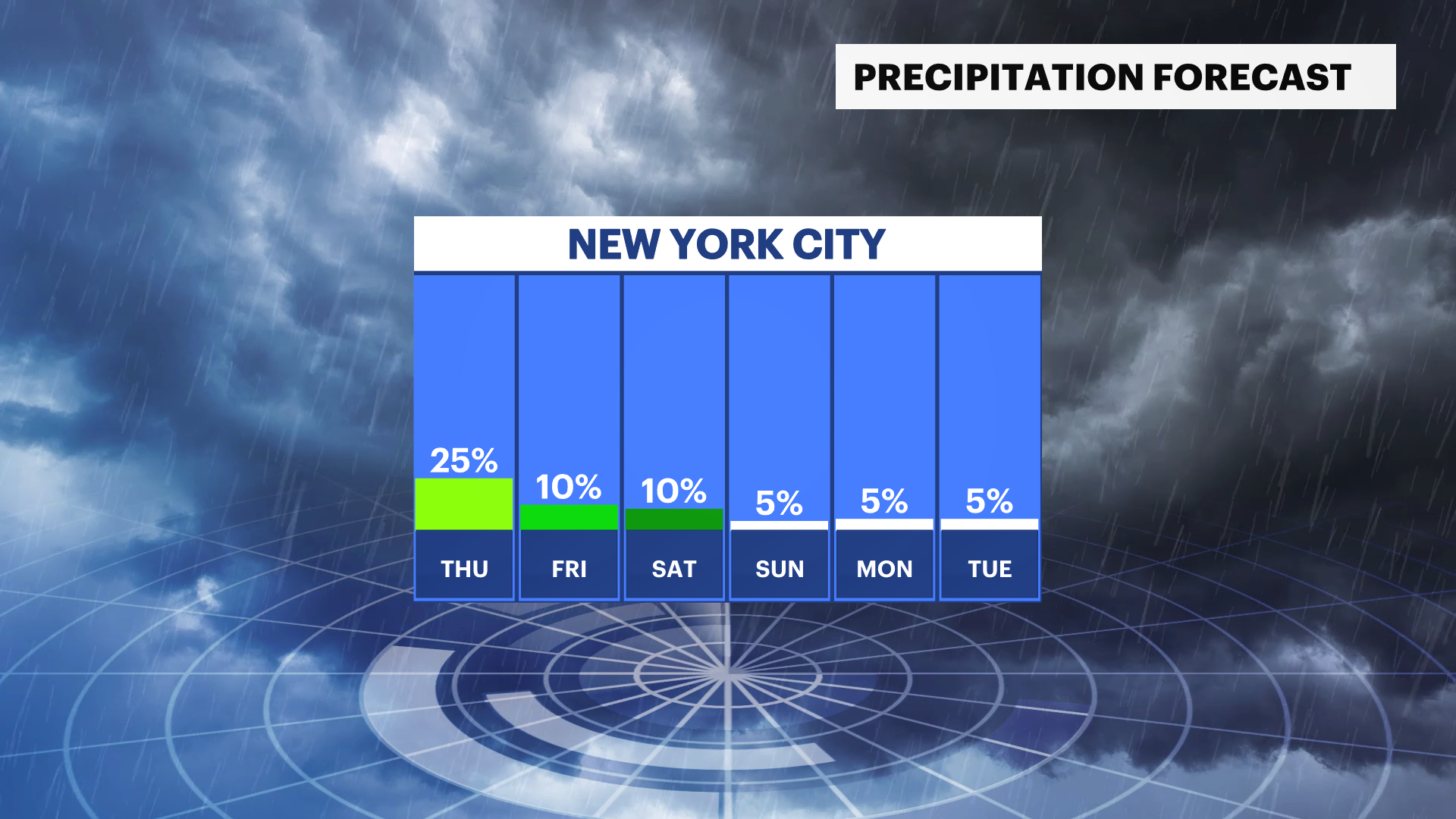
WEDNESDAY: Rain tapers to light showers or just cloudy conditions after midnight. Cold and windy. Lows down to 40, feeling like the 30s.
THURSDAY: Dreary and cold. Not much rain, maybe a few spotty showers in the PM. Some mist and drizzle sprinkled in. Not as windy, only 15-25 mph gusts. Highs near 48. Lows down to 37. Feeling like freezing by the morning!
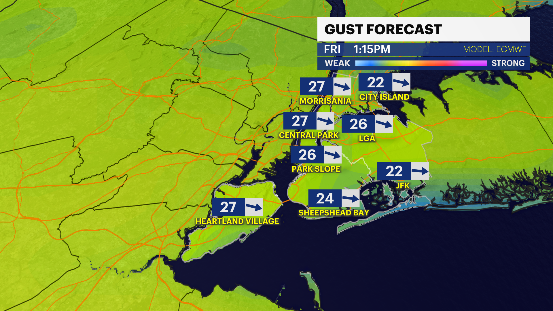
FRIDAY - YANKEES' OPENING DAY: Low pressure is still close enough to spark a few isolated showers or mist. Yanks will play on with no issues, even if there's a drizzle at times. It will be breezy. NW gusts of 30 mph will help the ball carry to right and hinder any ball hit to left. Highs near 50. Lows around 41.
WEEKEND: Improving! Leftover clouds Saturday and still a bit chilly, much warmer and sunny Sunday. Near 52 Saturday, 63 Sunday.
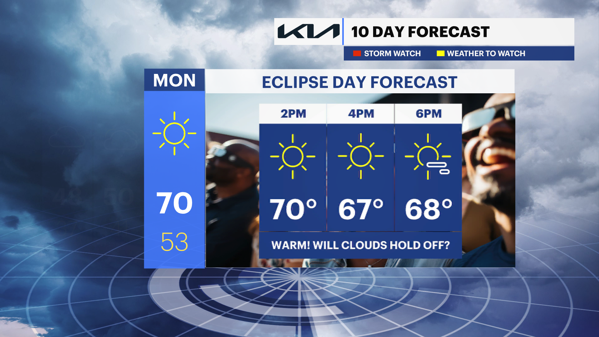
MONDAY - SOLAR ECLIPSE: So far so good...BUT a few clouds from the west may try to speed up, otherwise good viewing conditions! Highs surge to near-70.