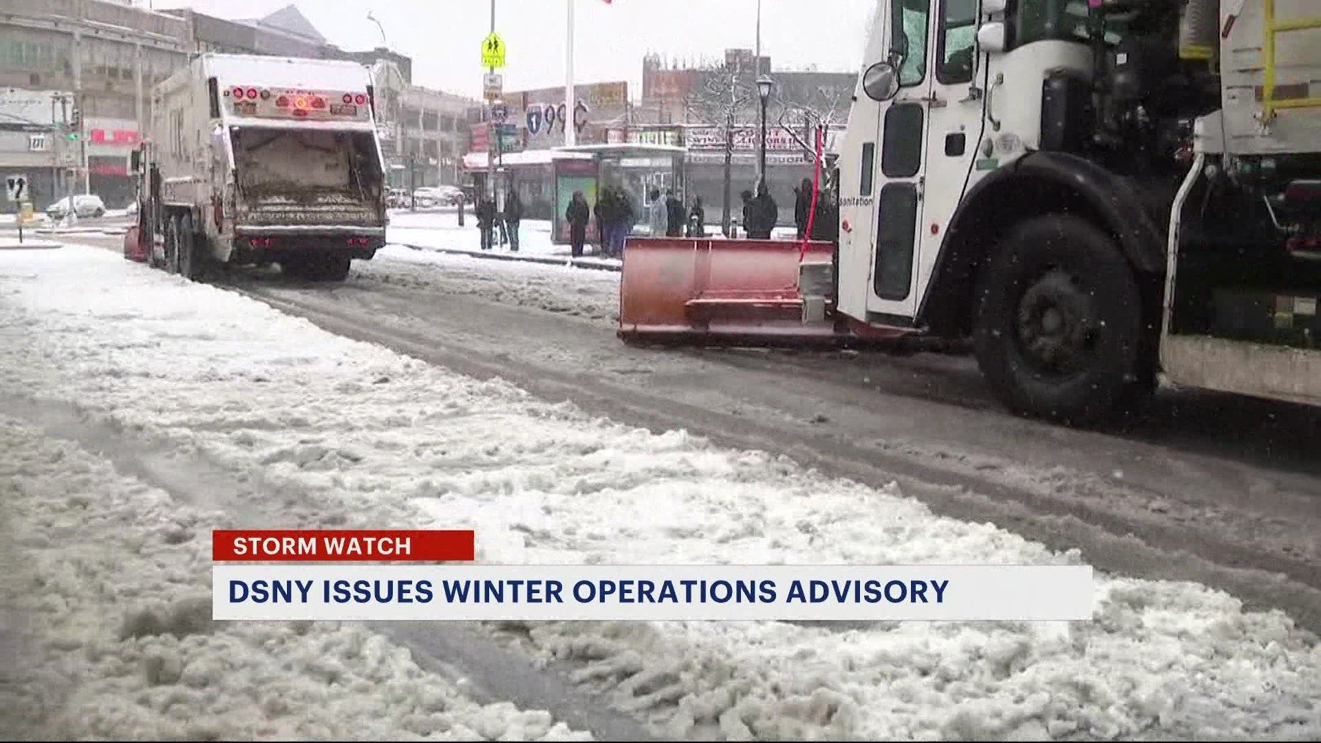
STORM WATCH: Tracking steamy conditions, thunderstorms for Friday in the Bronx
News 12 Storm Watch Team Meteorologist Allan Nosoff says heat, humidity, and poor air quality will precede strong to severe storms on Friday.
More Stories
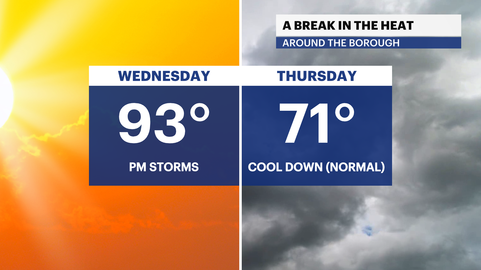


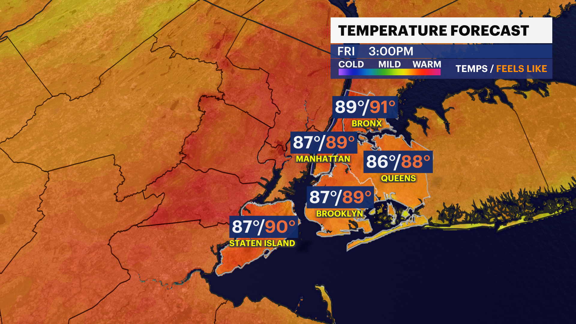
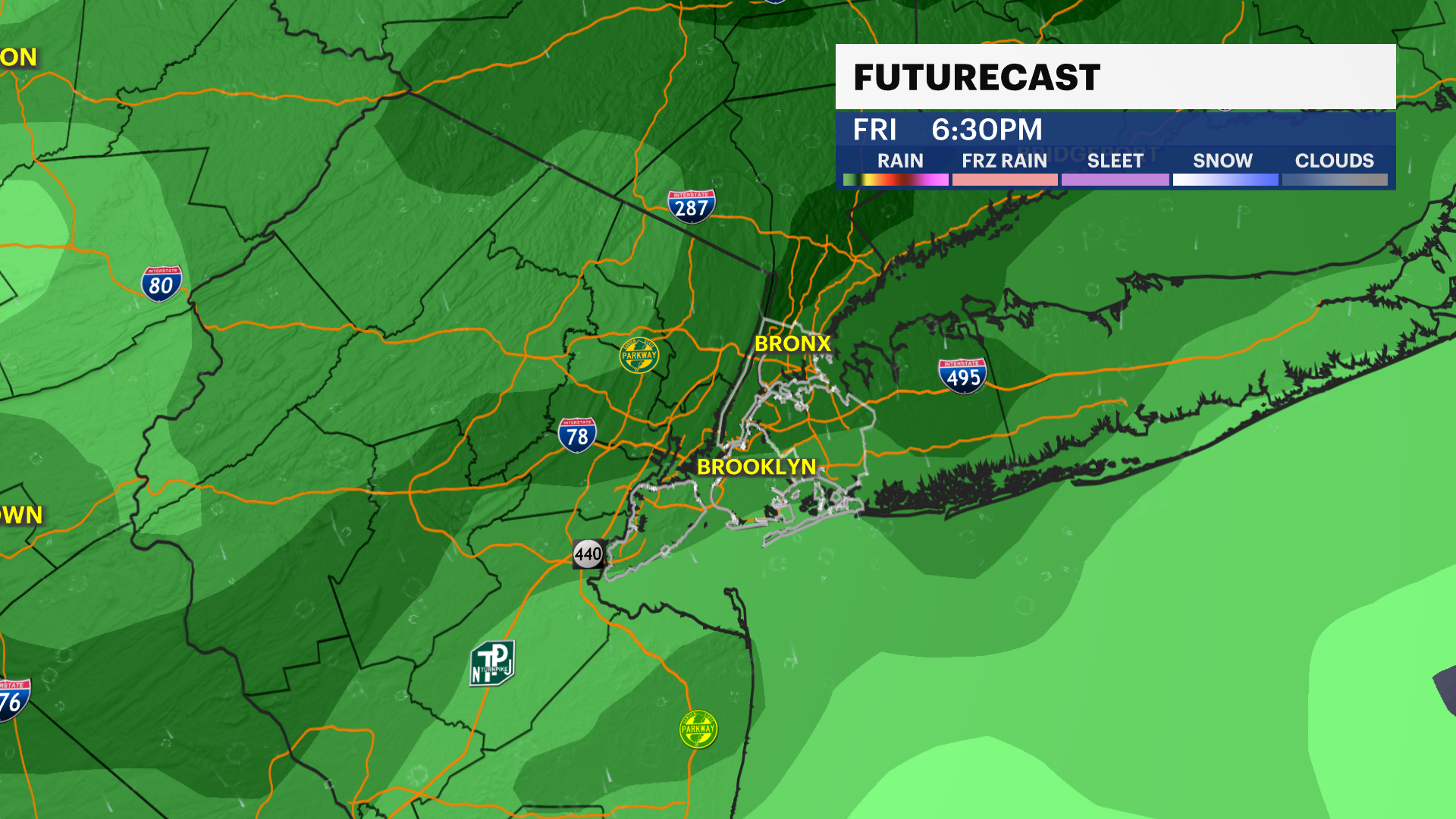
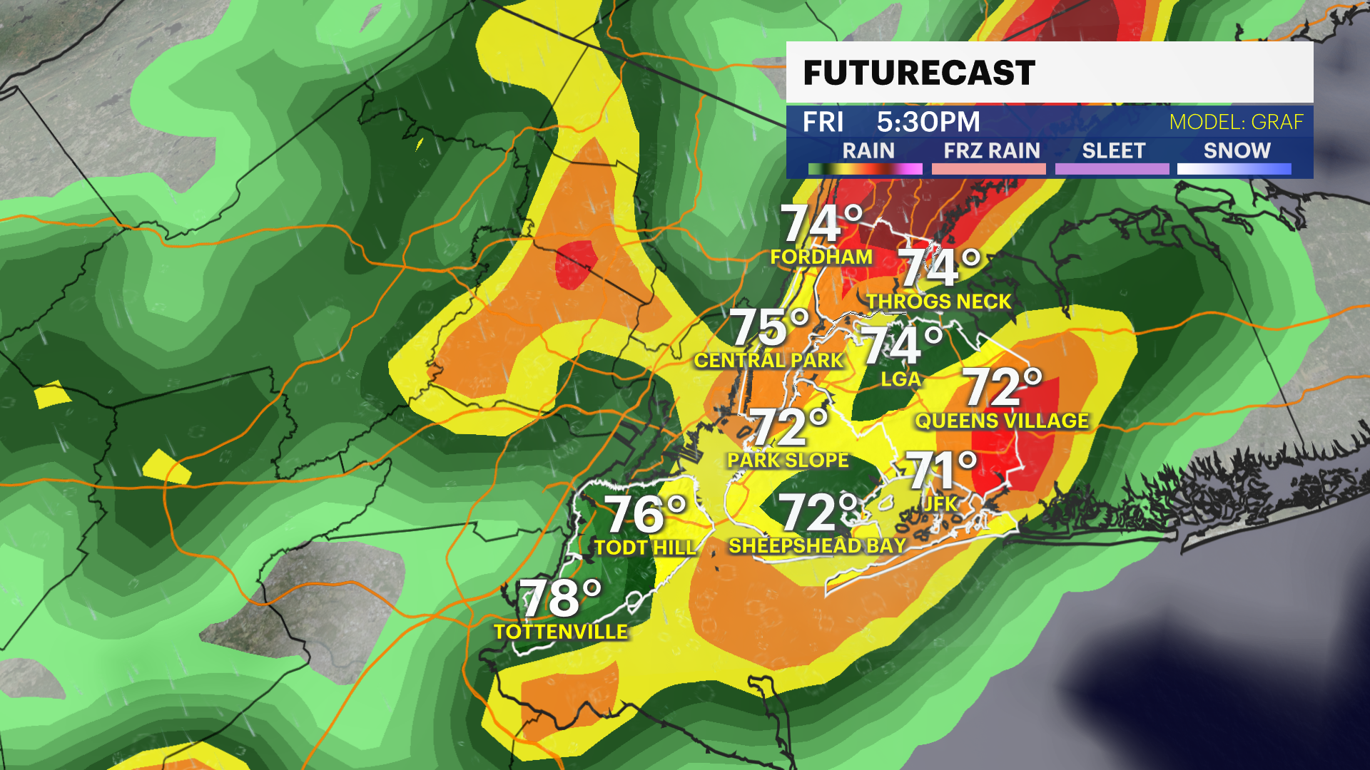
NEXT: It will feel steamy on Friday with hot temperatures in the upper-80s. Feel-like temps will be in the low-90s. A cold front will bring strong to severe thunderstorms Friday evening. Soaking rain, damaging winds and hail is expected. Timing is likely after 5 p.m. - 12 a.m. Hazardous travel is expected.
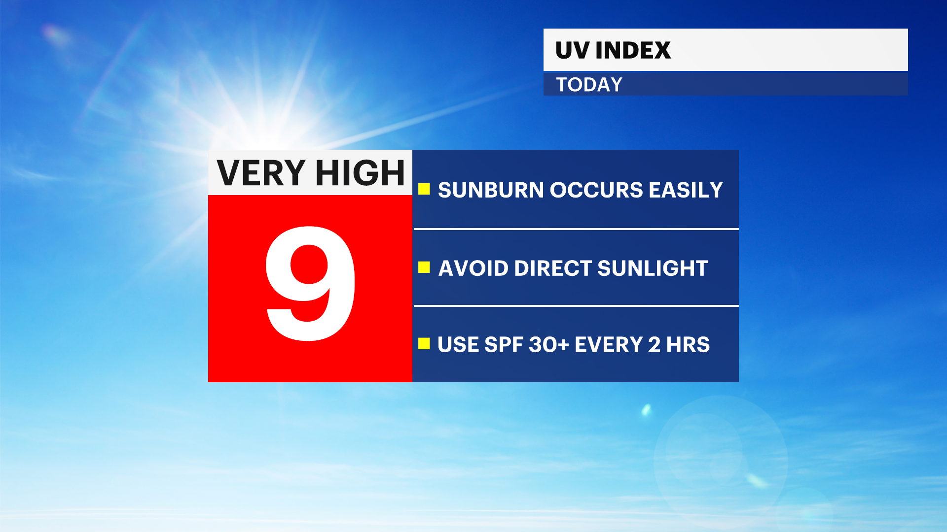
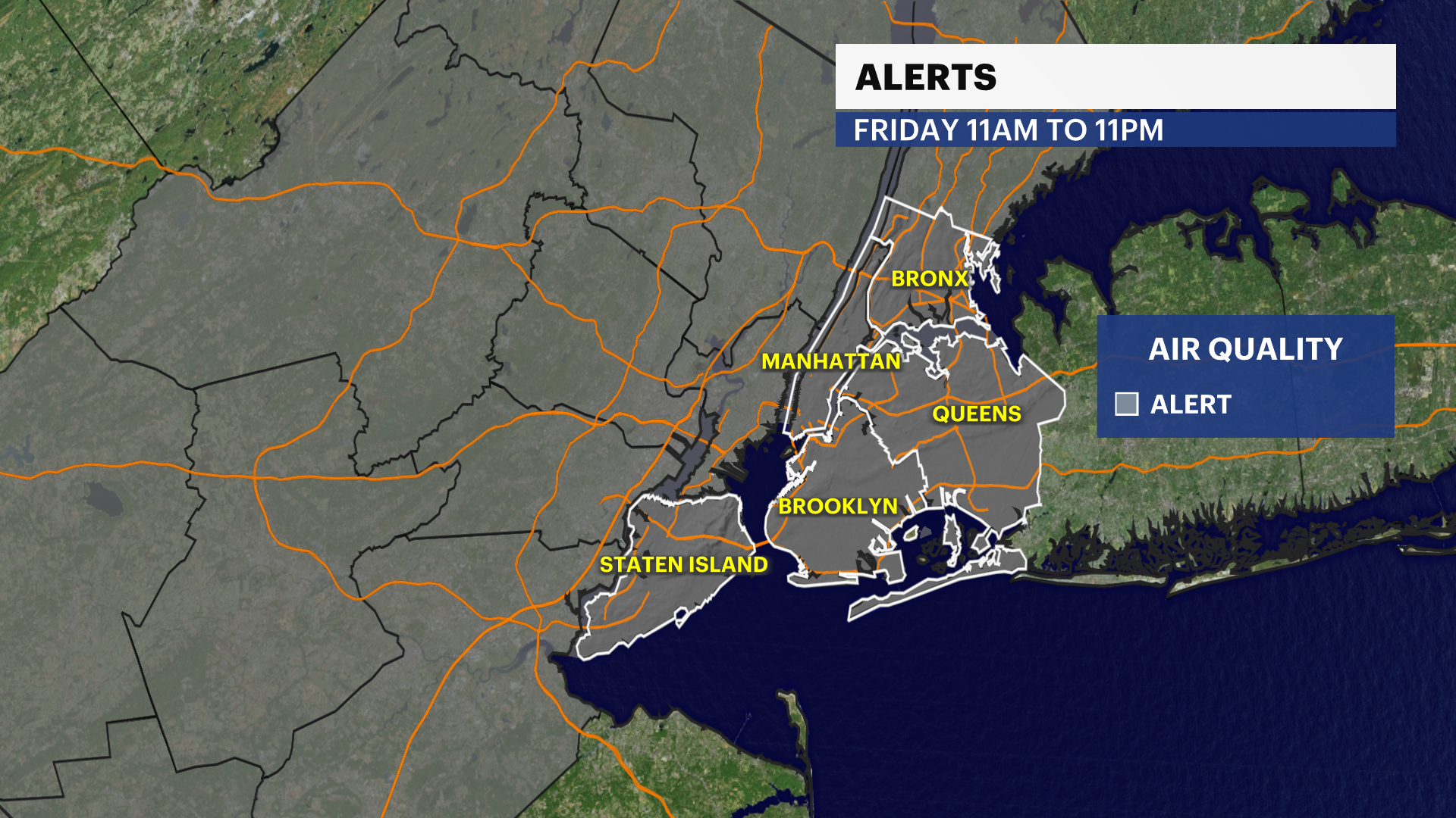
The National Weather Society has issued an air quality alert from 11 a.m. to 11 p.m. on Friday.
TONIGHT: A few clouds. Warmer and much more humid. Lows near 71. Turn on the A/C's.
TOMORROW: Hazy, hot and humid. Poor air quality. Highs up to 88. Strong-to-severe storms are likely to arrive around 5PM, with drenching downpours, gusty winds, and small hail. Storms taper to showers by sunset, and end around midnight. Lows down to 67.
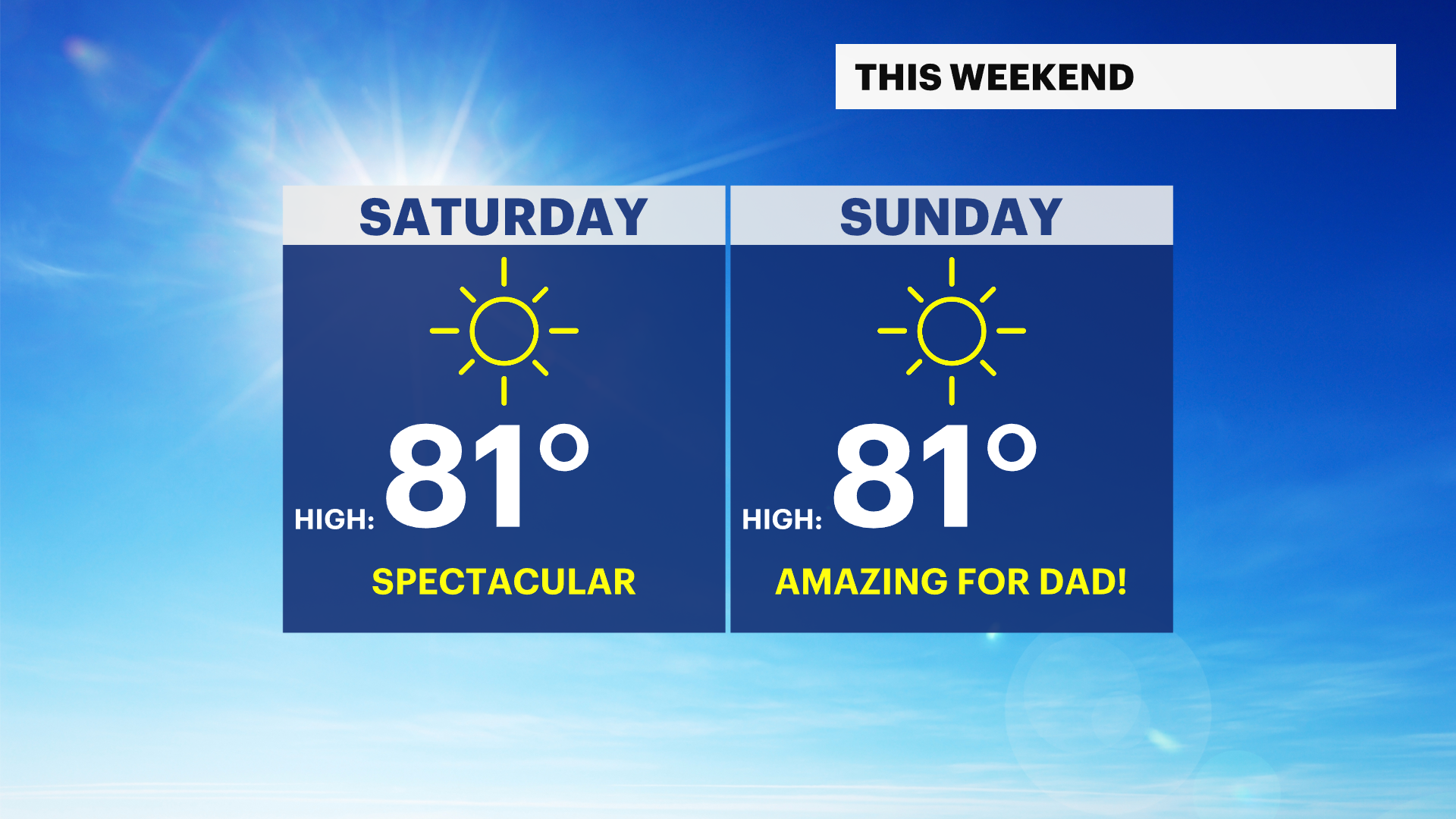
FATHER'S DAY WEEKEND: Perfection. Sunny, warm, and comfortable. Highs around 80, lows around 65.
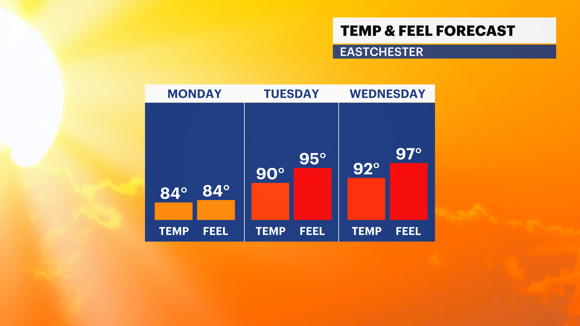
MONDAY: More of the same, sunny but beginning to heat up. Highs back to 85. Lows near 73.
NEXT TUESDAY THROUGH SATURDAY: A heat dome is expected to develop, with our first heat wave likely (3+ days of 90+ degree highs). See above for the link to my article and explainer video. Highs could even approach 100 away from the water, but details on strength and position of the heat dome are still TBD.
WHAT IS A HEAT DOME? Click here for Allan Nosoff's breakdown.