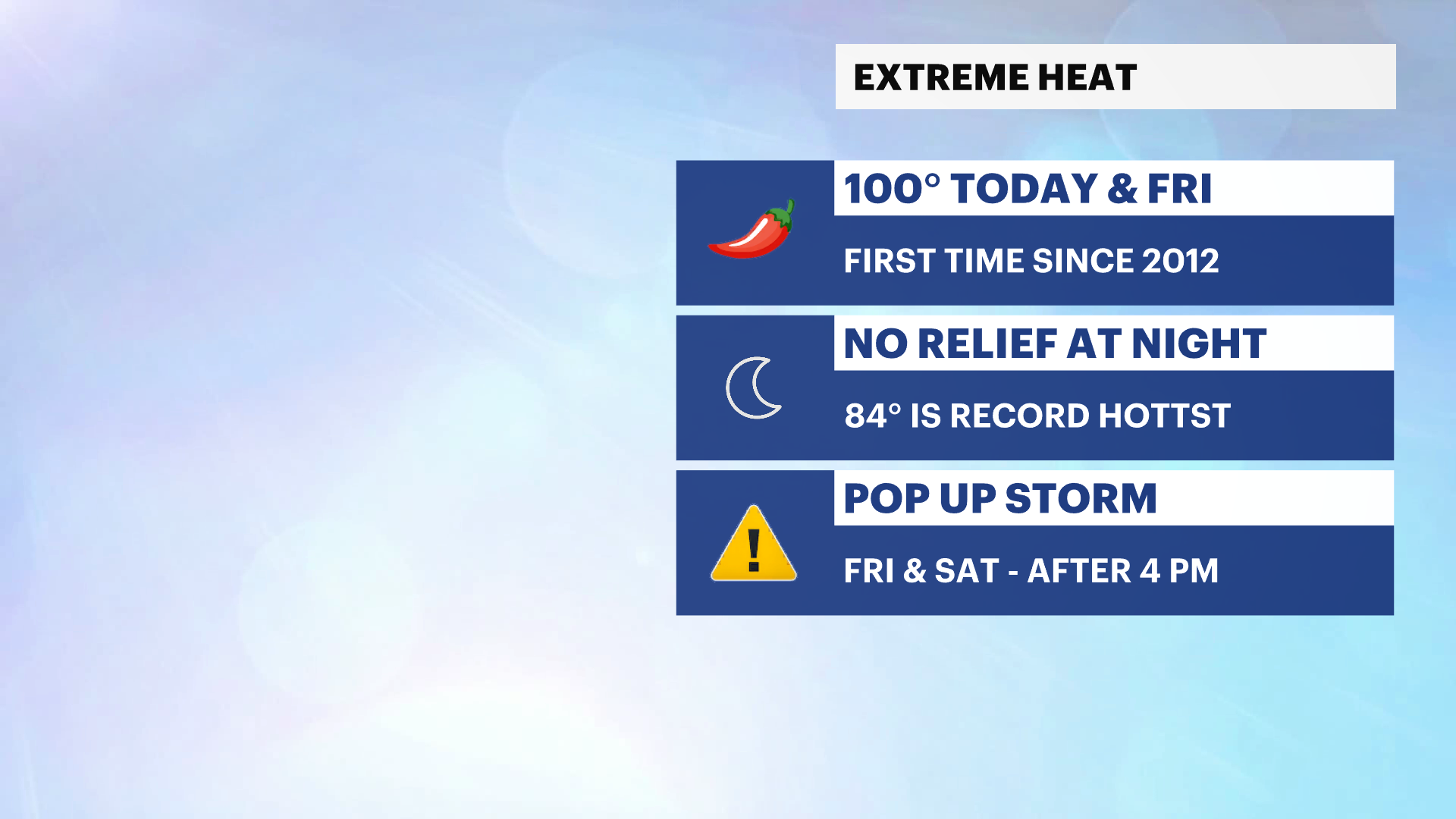
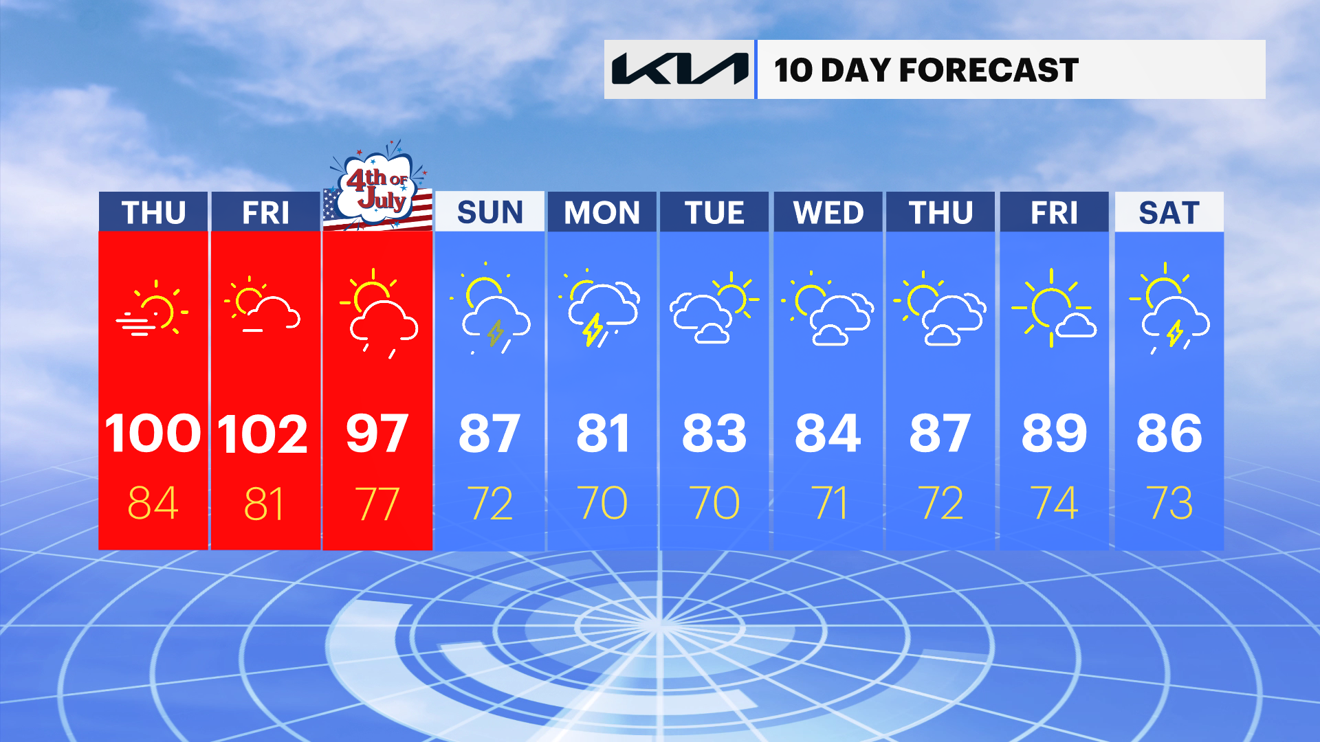
EXTREME HEAT: 100 degree temperatures expected today and Friday
Temperatures will feel like 110-degrees today & tomorrow and overnight temperatures could be the hottest on record for the city tonight.
More Stories
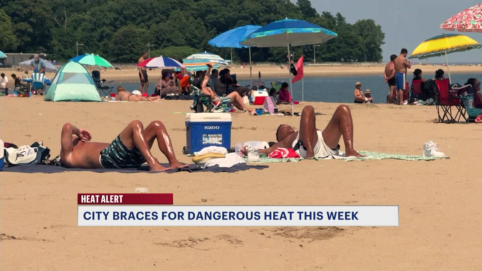


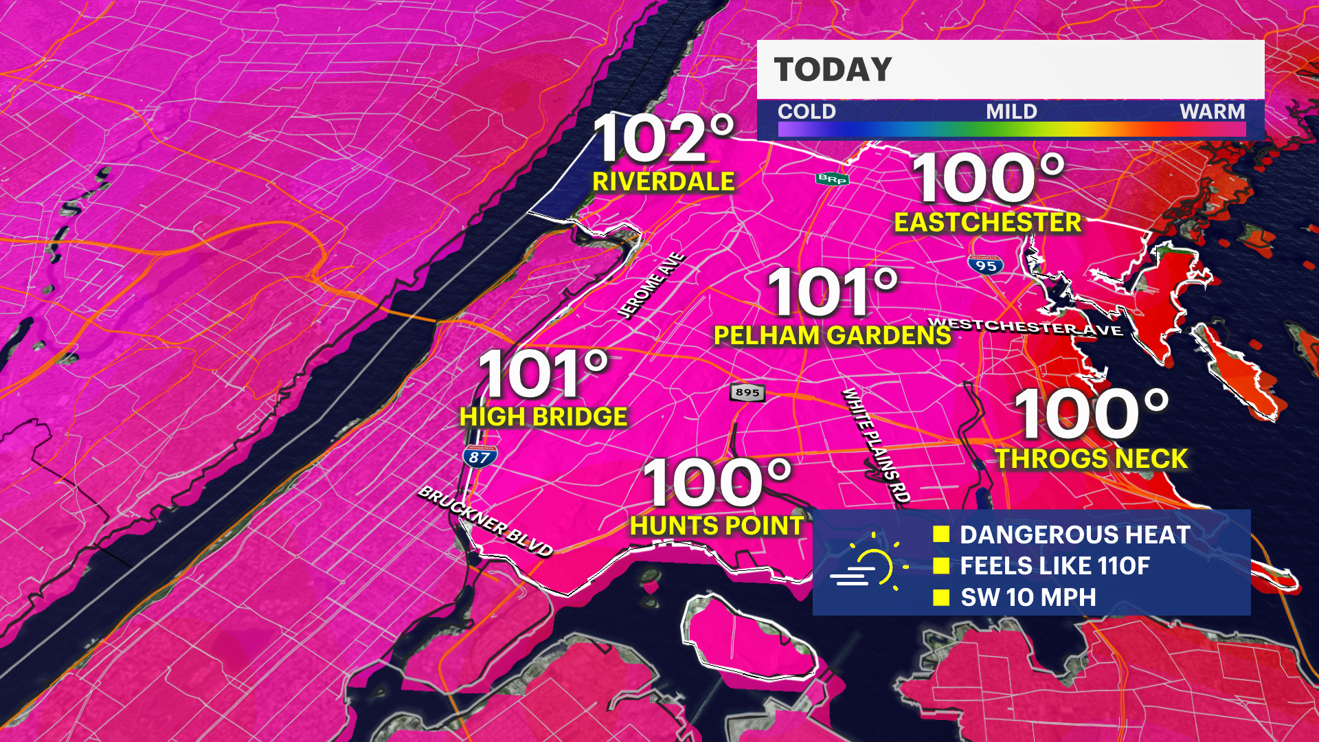
It's a very hot and humid start to the day today. Temperatures will be significantly hotter than yesterday's high of 93-degrees. We expect 100F heat for your Thursday and Friday afternoon with heat index temperatures to soar to 110F. This will be one of the hottest feeling summer days of all-time in the city.
Today is hot and sunny with a stray afternoon thunderstorm possible, but more likely west or north of the city. Overnight tonight, temperatures will remain in the 80s and it will be one of the hottest nights on record for the city.
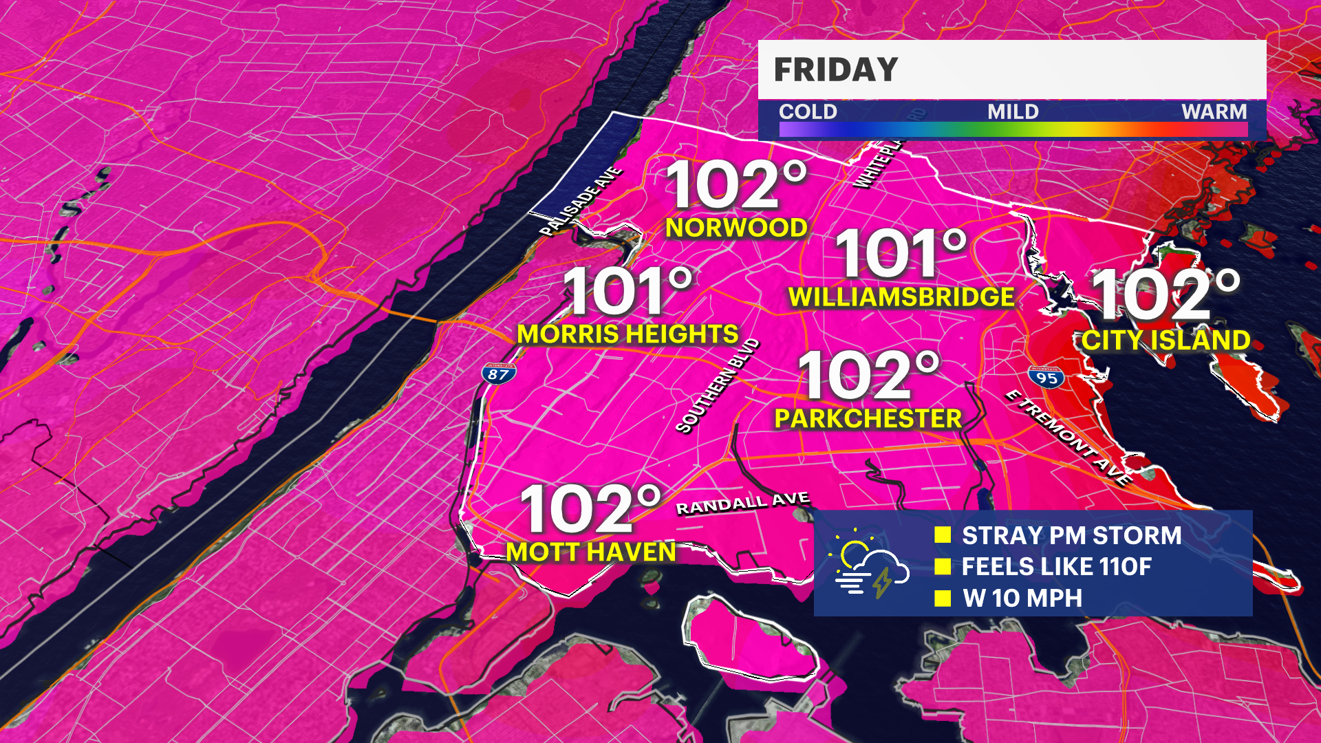
Friday will be similar and just as brutal. Friday afternoon and evening could see showers and storms.
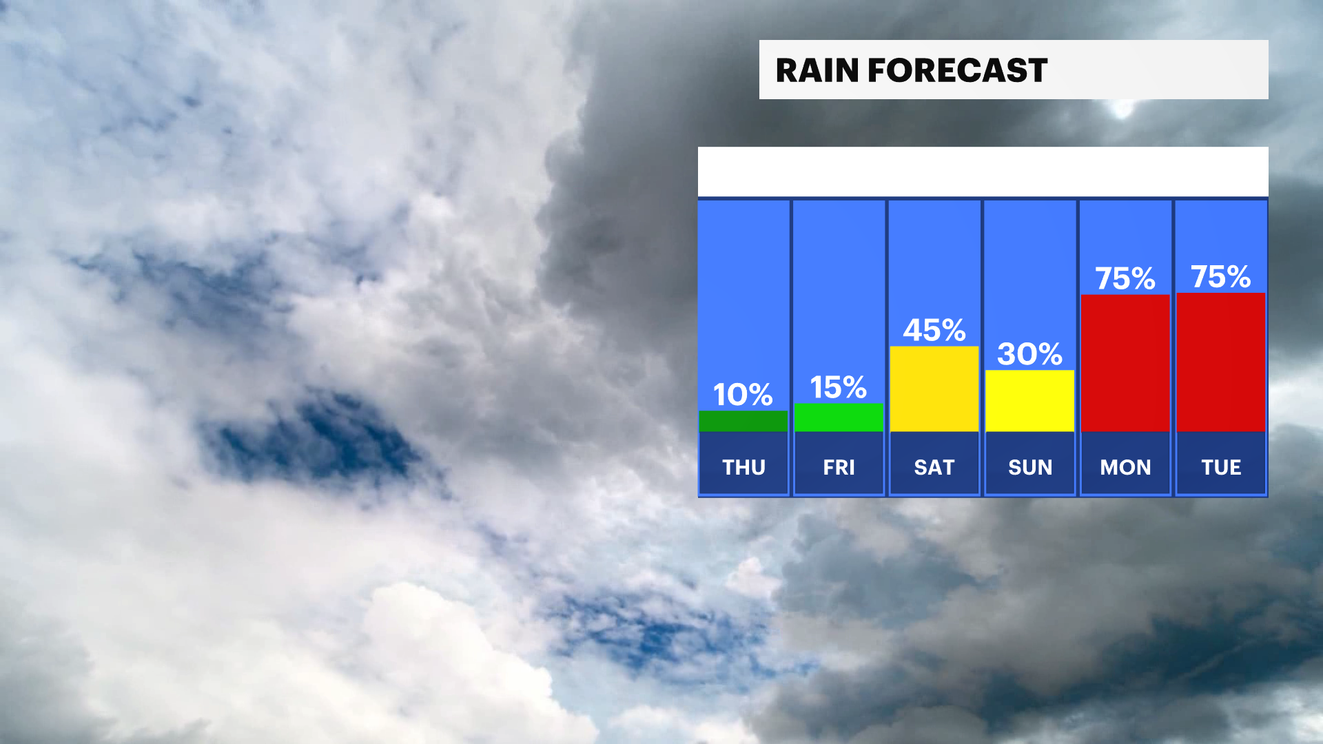
The 4th of July is on Saturday! The extreme heat will be sticking with us for the holiday, with highs in the high 90s that feel into the low 100s. There is the chance to see strong storms in later parts of the day-- so keep an eye on the forecast as you prepare to celebrate outside and head to fireworks displays.
The problem with this level of heat and humidity is that it can make even the smallest shower or storm strengthen and become strong to severe.
The extreme heat warning has been extended to include Saturday. Temperatures on Indendepence Day will feel like the low 100s and will be in the upper 90s. Seasonable weather will return on Sunday.