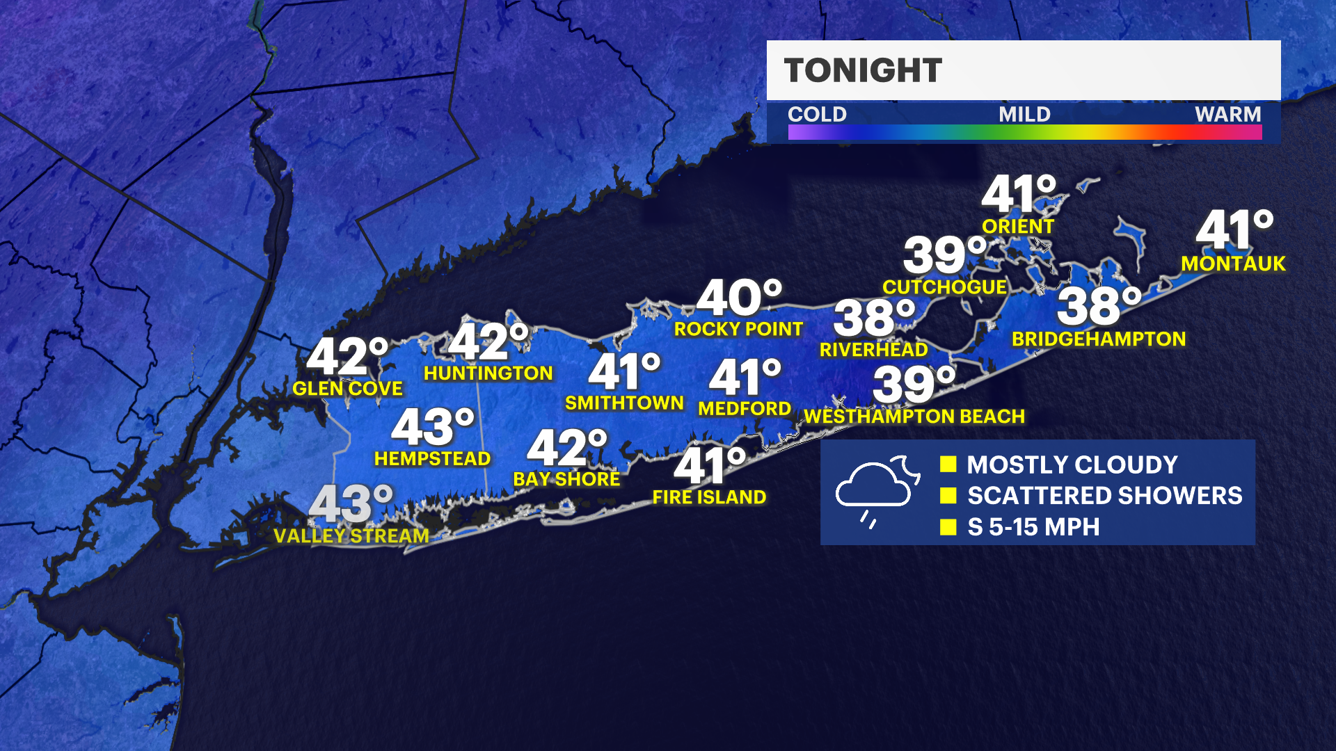
Not as cold with scattered showers arriving tonight; briefly warmer weather coming
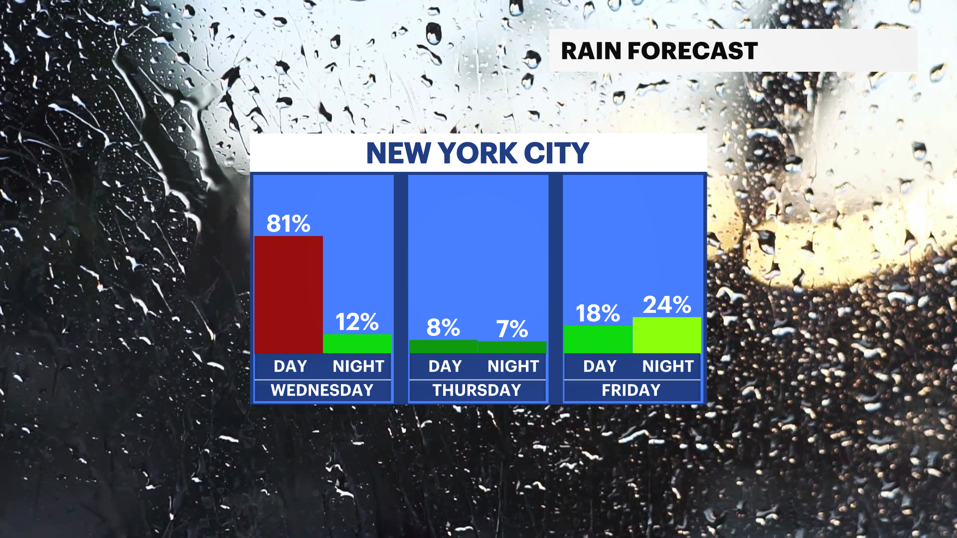
The evening will be dry, but have an umbrella and rain jacket with you after 11 p.m. and through Wednesday morning with scattered rain showers moving through Long Island.
More Stories

As we head through tonight, clouds will thicken up, and we’ll see showers begin to develop overnight. It won’t be as cold, with lows settling into the 40s. Roads could turn a bit damp late, so just keep that in mind if you’re out and about.
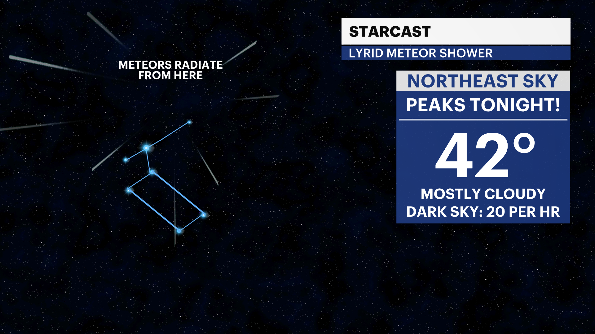
LYRID METEOR SHOWER TONIGHT
Unfortunately, the weather locally will not be good for viewing, but this meteor shower peaks tonight into tomorrow morning. I wish the weather would be better. The forecast calls for mostly cloudy skies with showers developing towards morning. If anything, maybe before 10 p.m. you might be able to see a few between the clouds, but you need to give your eyes around 45 minutes to adjust to the night sky. I would temper expectations locally for this one, but look northeast this evening to give it a try.
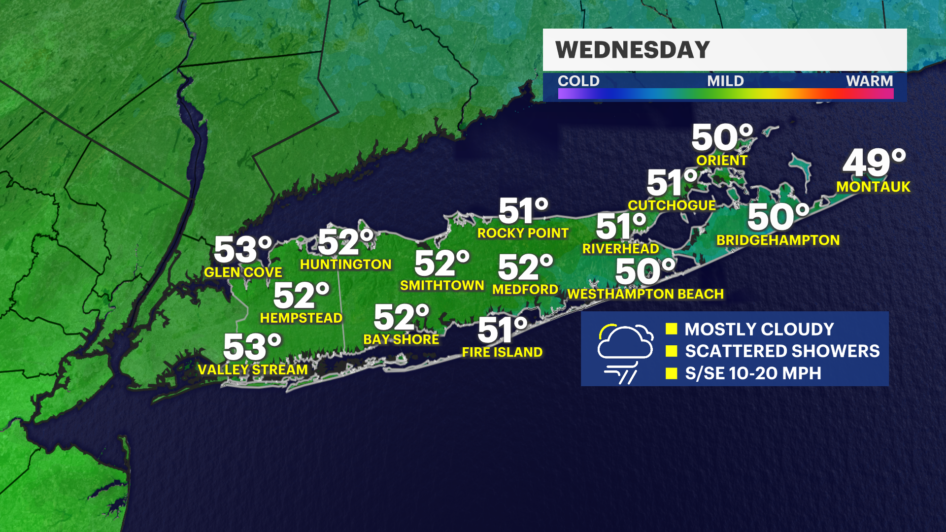
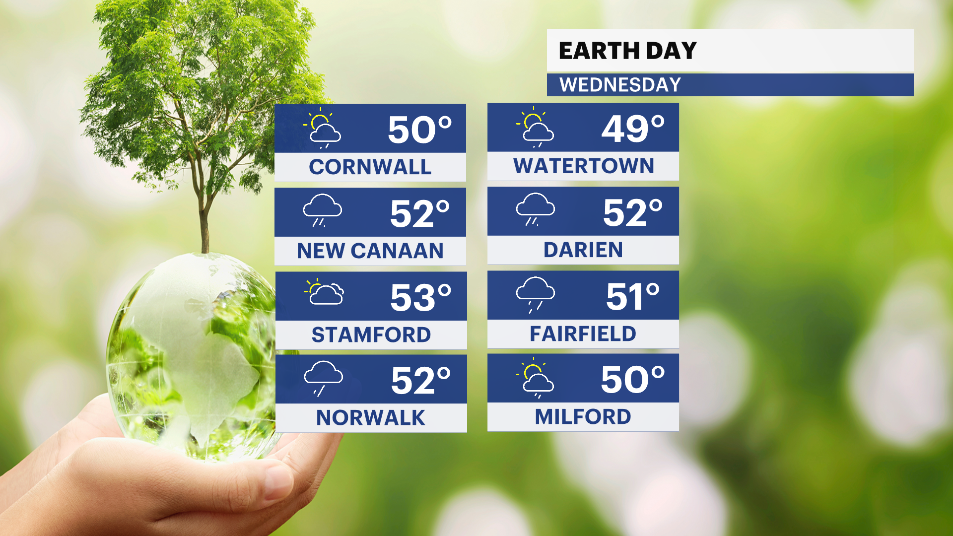
For Wednesday, keep the umbrella handy. It’s looking like a grey and unsettled day with on-and-off rain showers throughout. Temperatures will climb into the 50s despite the clouds and rain.
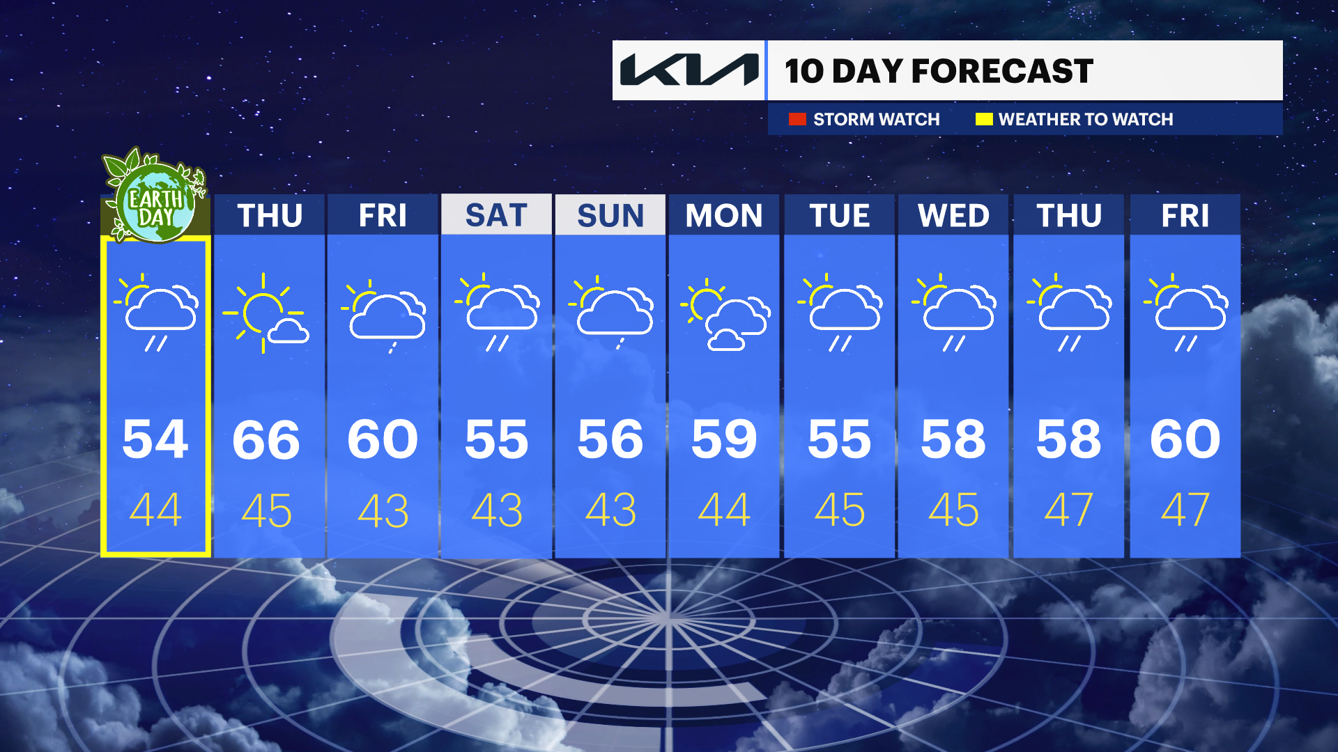
Looking ahead, we do have some nicer weather on the way. Thursday and Friday both bring a return to sunshine with highs warming into the 60s — a welcome change. As we head into the weekend, we’ll be tracking the chance for more wet weather, with temperatures easing back into the 50s.
Tonight: Showers likely, mainly after 2am. Mostly Cloudy, with a low around 39. South wind 5 to 10mph.
Wednesday: Cloudy skies with on and off showers. High near 54. South wind 10 to 15mph.
Wednesday Night: Mostly cloudy, with a low around 44. East wind around 5 to10 mph.
Thursday: Mostly sunny, with a high near 66.
Thursday Night: Mostly cloudy, with a low around 45.
Friday: Mostly sunny, with a high near 62.
Friday Night: Mostly cloudy with a few showers towards morning. Low around 43.
Saturday: A few showers. Mostly cloudy, with a high near 54.
Saturday Night: Scattered showers. Mostly cloudy, with a low around 42.
Sunday: A few spotty showers. Partly sunny, with a high near 56.