Tracking Debby: Hudson Valley
News 12 Storm Watch Team Meteorologist Addison Green provides an update on what Debby will bring locally to the Hudson Valley.
More Stories


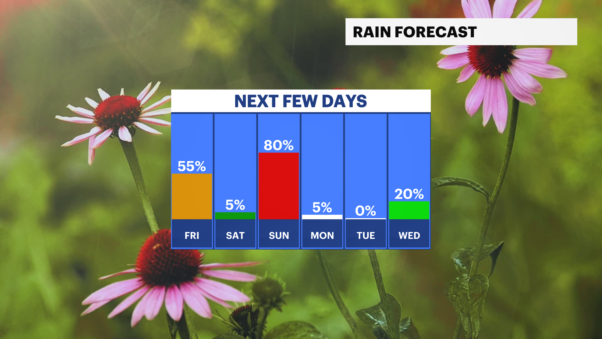
Tropical Storm Debby weakened Thursday afternoon to a tropical depression, but it still poses a threat to the Hudson Valley for Friday afternoon and evening.
This system will continue to weaken as it moves northward toward the Northeast
Looking at the timing of the event, the region can expect to see showers move in throughout the day, with moderate to heavy rain around 4 p.m. - 5 p.m., and lasting - on and off - until 10 p.m. - 11 p.m.
On top of the rain, there will also be a concern for flooding and even flash flooding.
The ground is still soggy from the recent heavy rains back on Tuesday and so it will not take much rainfall to lead to more flood conditions.
Flood alerts will be issued as the moisture packed storms rain themselves out across the Hudson Valley. Winds will gust between 30-50 mph, and some areas could be placed under a wind advisory.
The potential for rotation within thunderstorms could lead to tornado warnings to be placed on numerous spots across the Hudson Valley, especially for Orange and Rockland counties.
The remnants of Debby will leave the region overnight Friday, heading into very early Saturday.
Breezy to gusty winds will linger for Saturday but coming out of the Northwest and drawing down drier air. We'll also see the winds back down through the day as well.