Sunny and warm Sunday before another heat wave returns next week in Connecticut
Sunshine and Lower Humidity Return for a Beautiful Sunday Across Western Connecticut
Share:
More Stories


Forecast
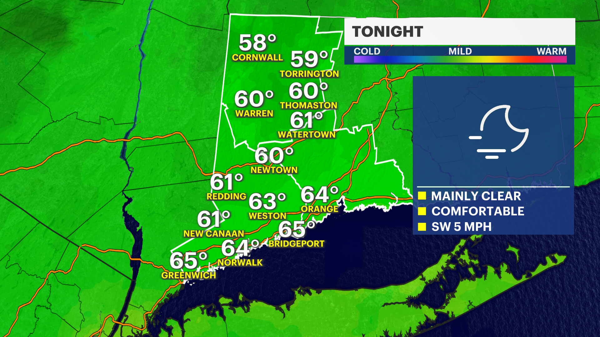
Some relief from the humidity is on the way moving into the second half of the weekend.
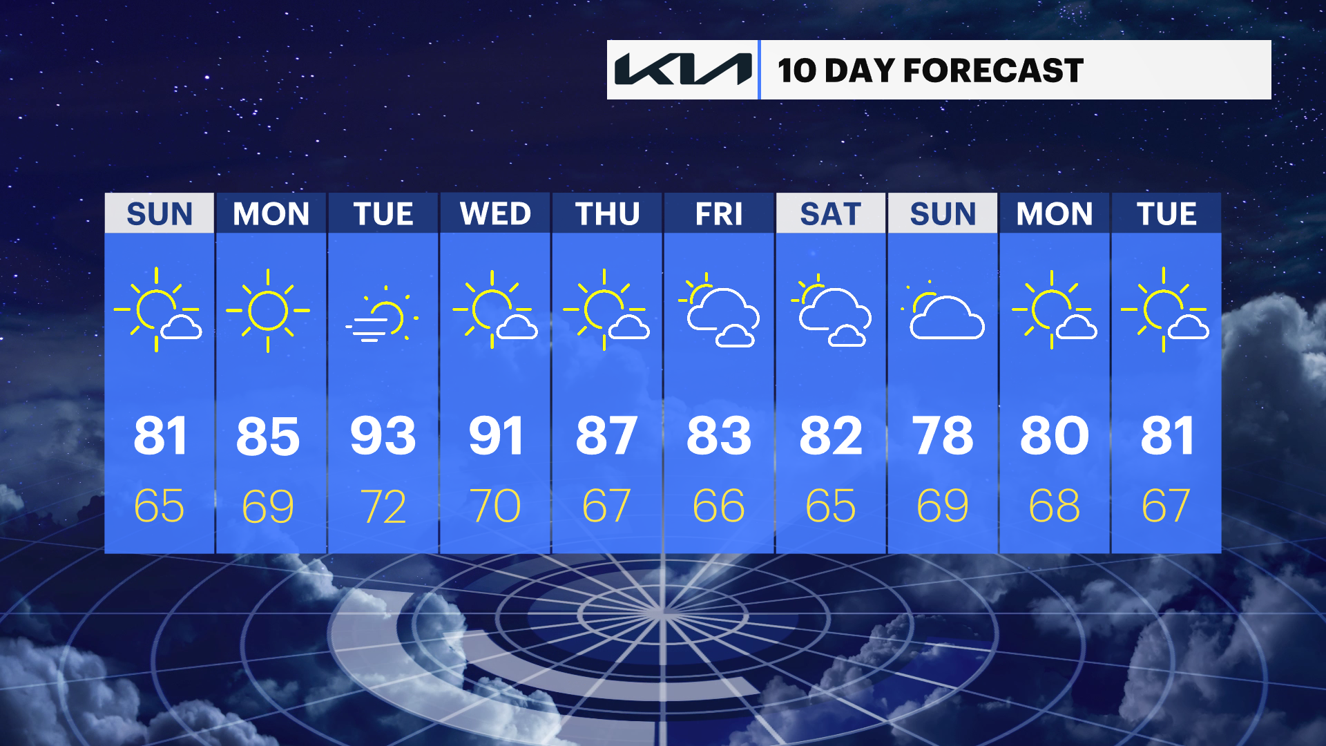
Sunday is shaping up to be a beautiful day across western Connecticut. Expect plenty of sunshine, warm temperatures and noticeably lower humidity to make for a comfortable finish to the weekend. That pleasant stretch will carry into the start of next week before another surge of heat begins to build by midweek. As temperatures climb, so will the humidity, sending "feels-like" readings back into the mid- to upper 90s by the middle of the workweek.