Spring sizzle with highs in the 80s today, possible isolated thunderstorm late today
Summer-like isolated thunder shower possible into the evening.
Share:
More Stories


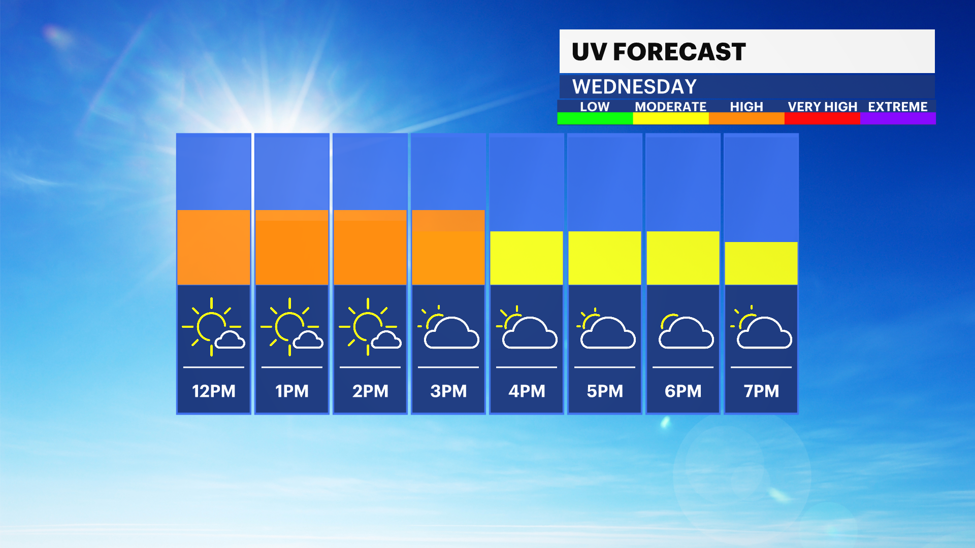
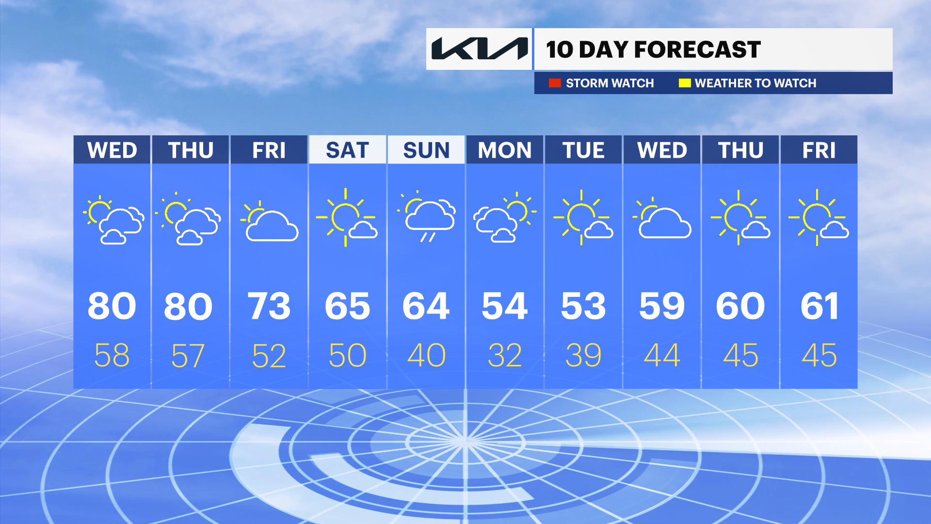
Another afternoon featuring 80s for many communities. Grab the sunscreen as the UV index is high between 12 p.m. and 3 p.m. especially. It will stay a bit cooler along the Long Island Sound beaches, though still in the low 70s
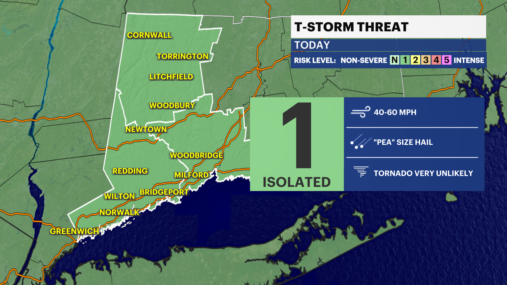
A chance of an isolated thunderstorm late today and tonight, especially for areas along and north of I-84.It's in and out but wouldn't hurt to keep the rain jacket around just in case.
The chance of showers has lowered for Friday but still can't rule out a passing shower. Next rain chance is Sunday with highs in the 60s. Heads up gardeners, early next week a frost and/or freeze is possible Monday night into Tuesday morning.