More Stories
NOW: Dry Wednesday with warmer temperatures and lower humidity.
NEXT: Temperatures continue to drop leading up to a major cool down Friday into the weekend.
Storm Watch Team Meteorologist Darryl Green says a high rip current risk has been issued for Brooklyn and Queens beaches today.
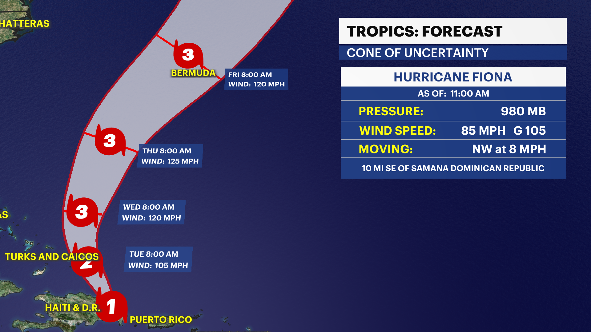
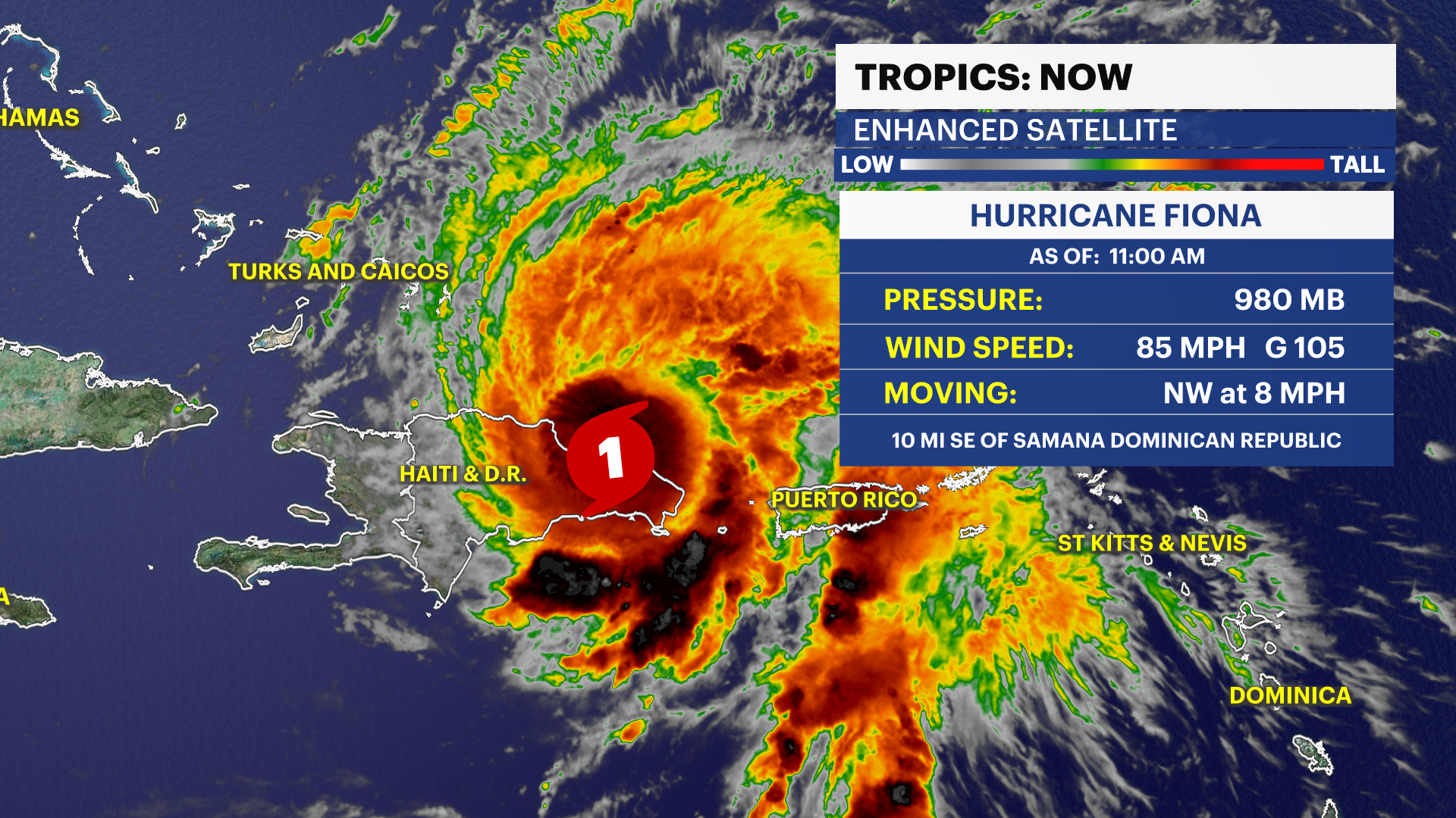
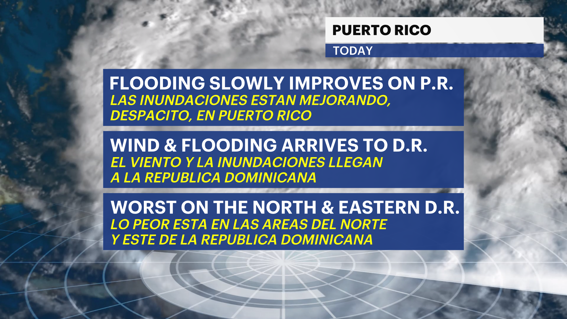
Hurricane Fiona is still bringing heavy rain to Puerto Rico. This will move toward the Dominican Republic with strong winds through tonight. Tropical Storm Fiona is expected to intensify to a Category 2 as it makes it northwestern turn toward the Turks and Caicos tomorrow. Heavy rain and destructive winds will impact parts of the Turks as the system moves away from Puerto Rico and Dominican Republic tomorrow.
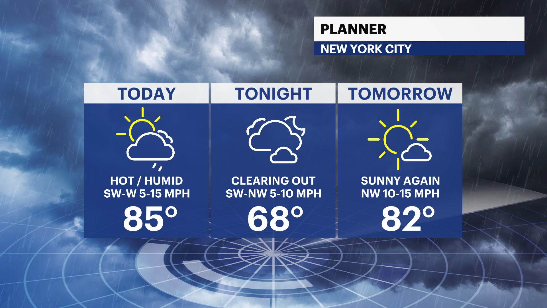
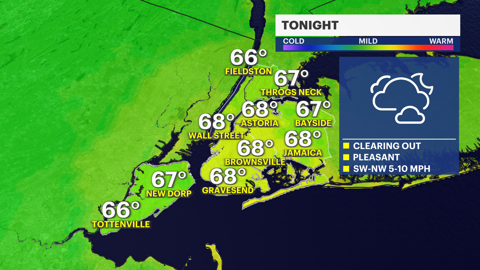
Overnight: Gradual clearing sky, mild and less humid. Lows near 67.
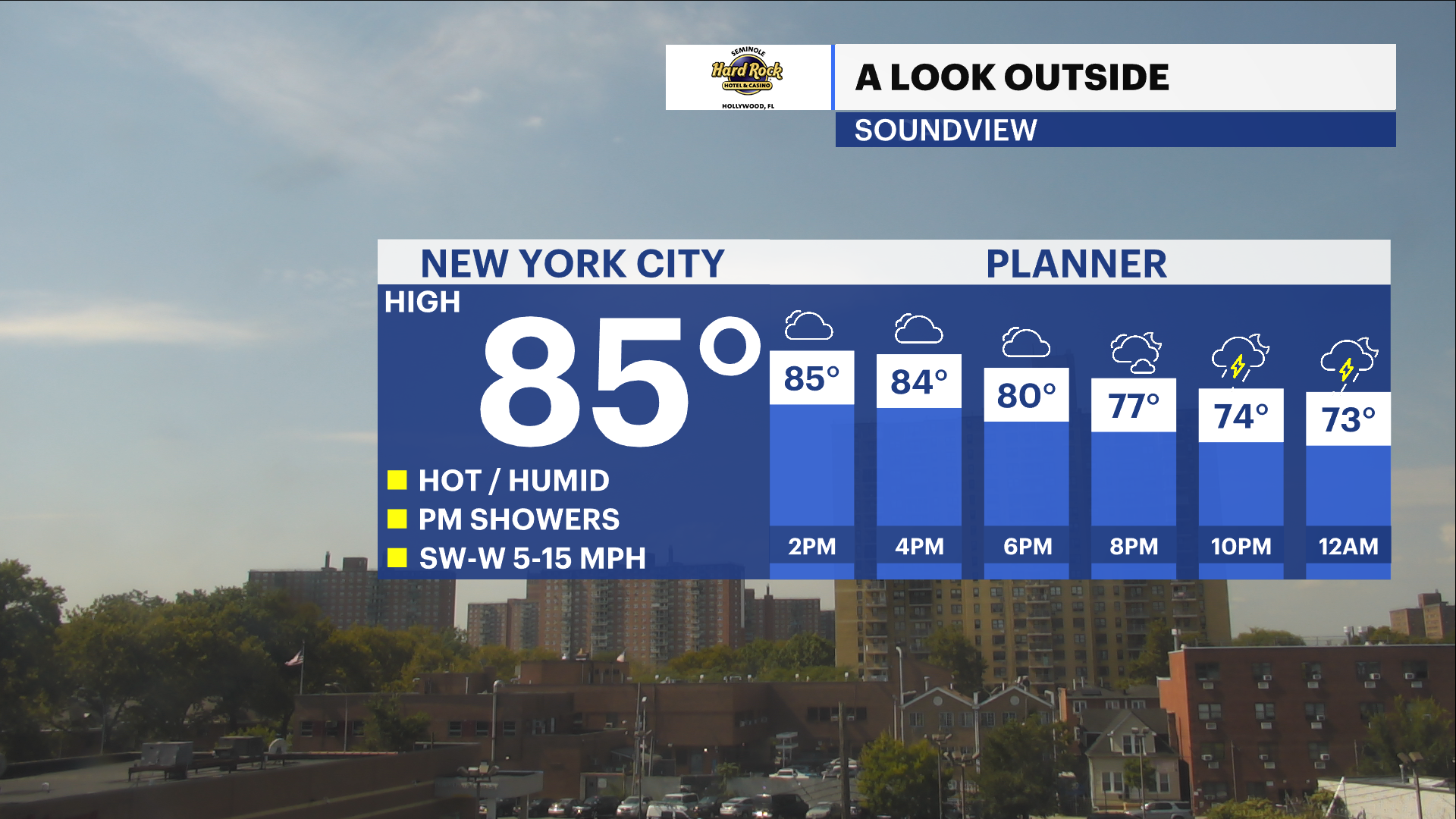
Tuesday: Warm, sun with a few clouds, nice. Highs near 82. Lows near 66.
Wednesday: Bright and warm. Increasing clouds late. Highs near 81. Lows near 64.
Thursday (FIRST DAY OF FALL): Chance of morning thundershowers. More clouds than sun, not as warm. Highs near 76. Lows near 57.
Friday: Mostly sunny, cooler and comfy. Fall chill. Highs near 66. Lows near 53.
Saturday: Sun and clouds, mild and nice. Highs near 69. Lows near 59.
Sunday: Mostly sunny, seasonable. Highs near 74. Lows near 60.
More from News 12

35-year-old man fatally stabbed in Norwood
1:27

Less chill today, warm weather returns this week in The Bronx
1:37

Truck stuck under subway underpass causes major delays in Kingsbridge
0:28

MTA employee punched, robbed of $150 in Van Nest
1:49

Third pothole blitz weekend underway in New York City
0:24
