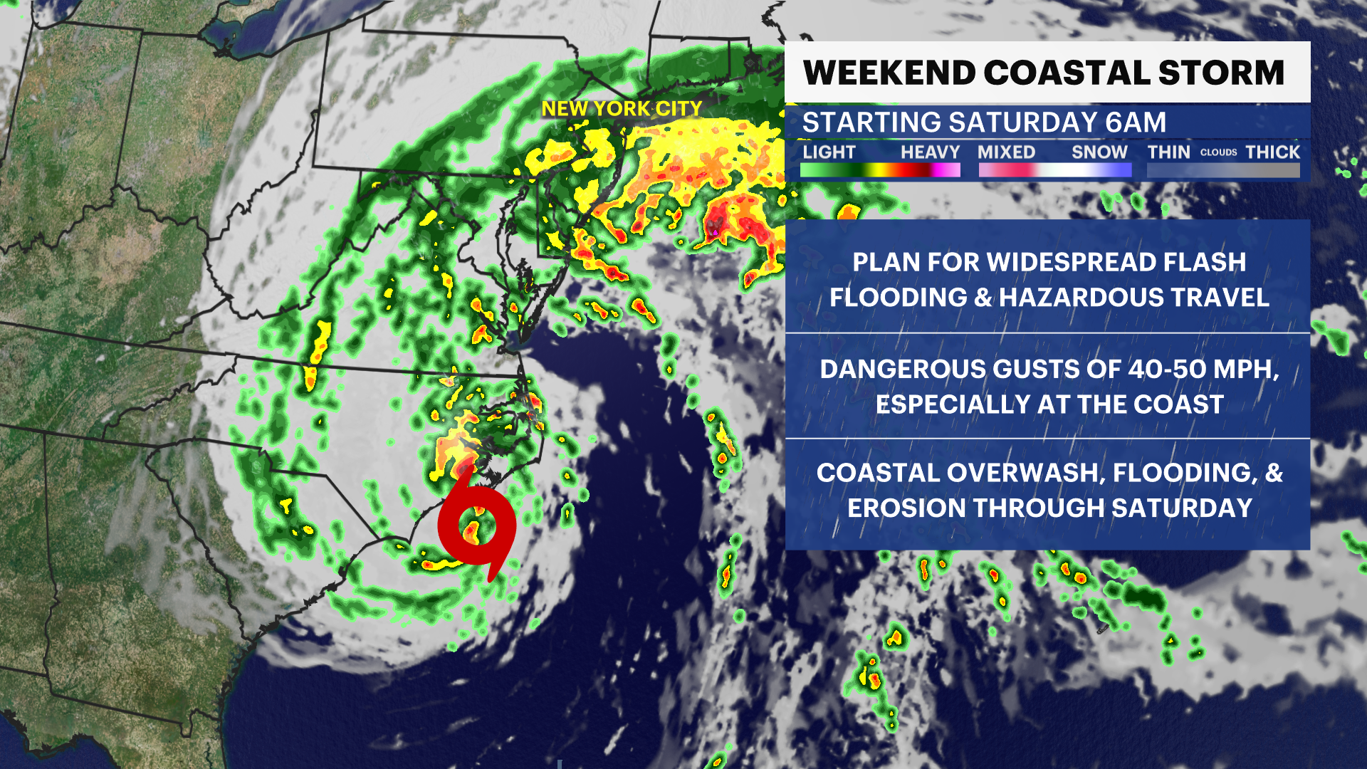
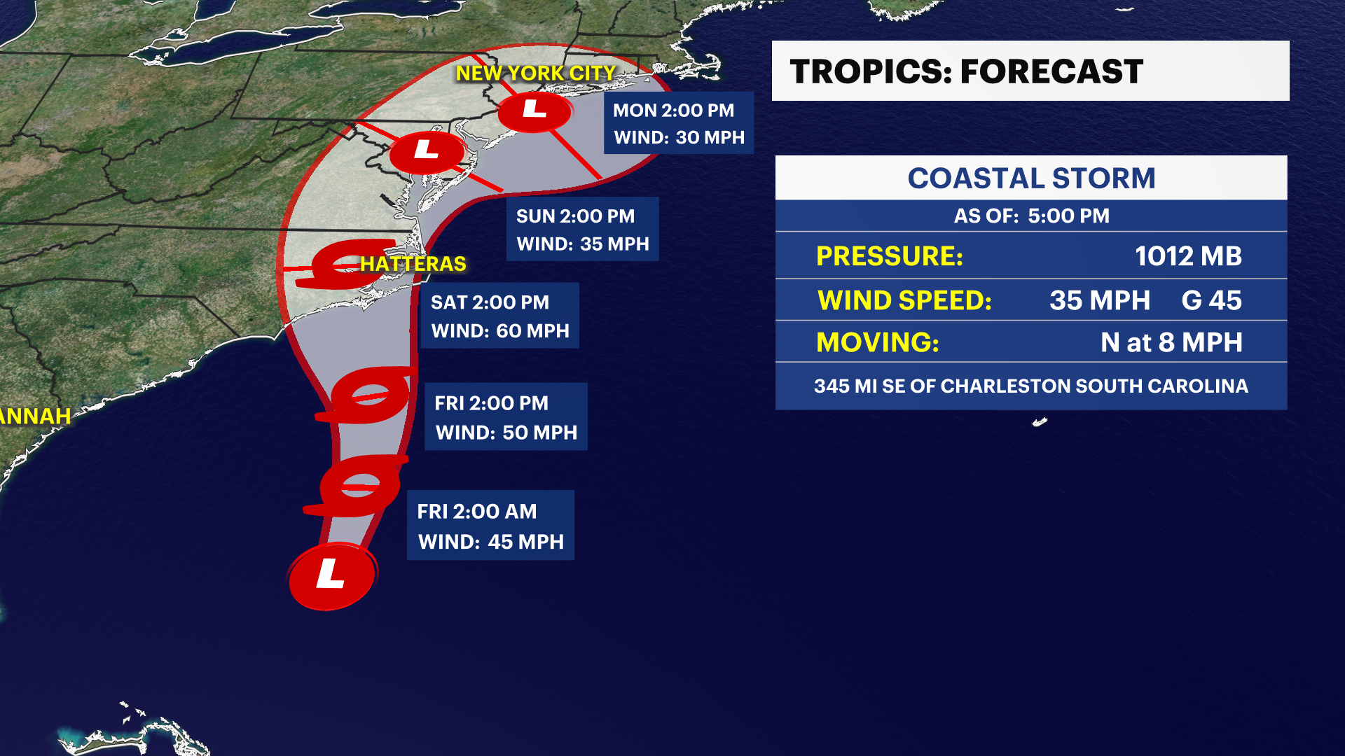
TRACKING OPHELIA: Heavy wind gusts and downpours for Saturday
News 12 Storm Watch Team Meteorologist Allan Nosoff says rain is expected to arrive after midnight.
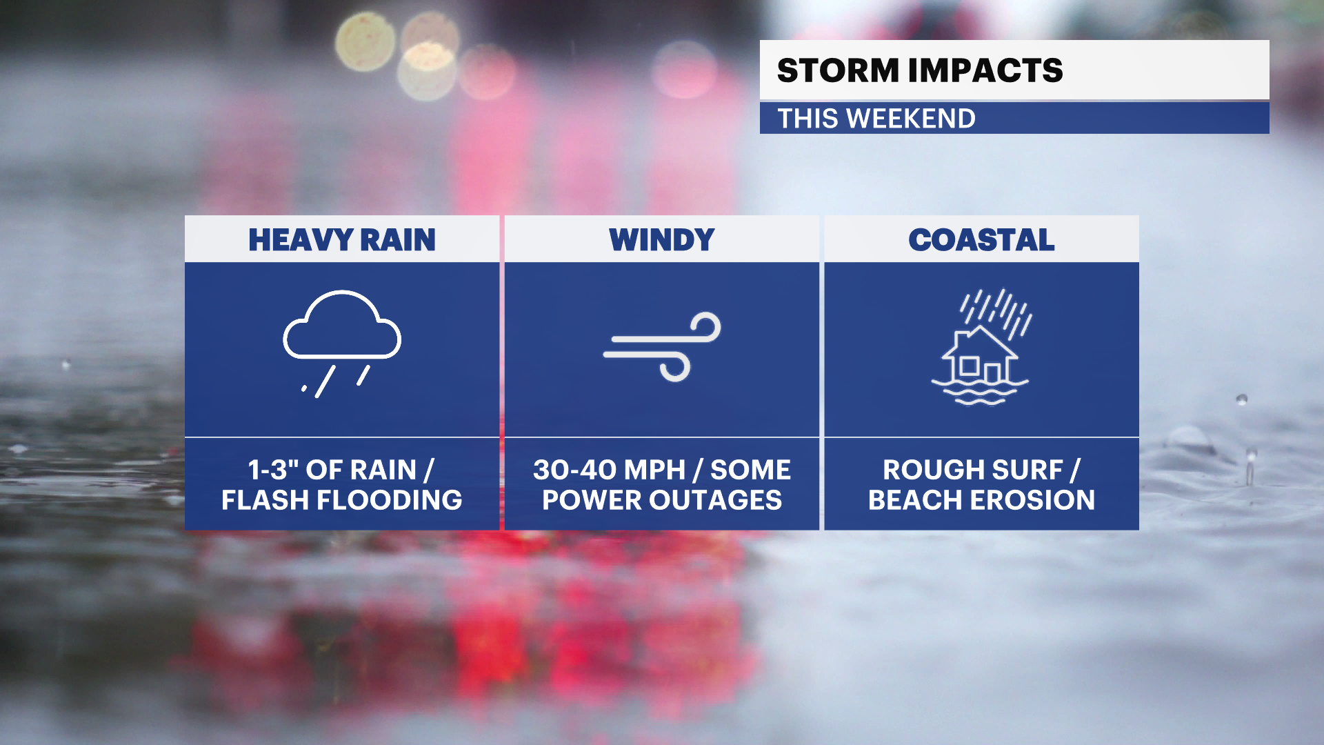
News 12 Storm Watch Team Meteorologist Allan Nosoff says this weekend will be wet and windy.
There is a rip current statement and a high surf advisory in effect for Saturday's coastal storm.
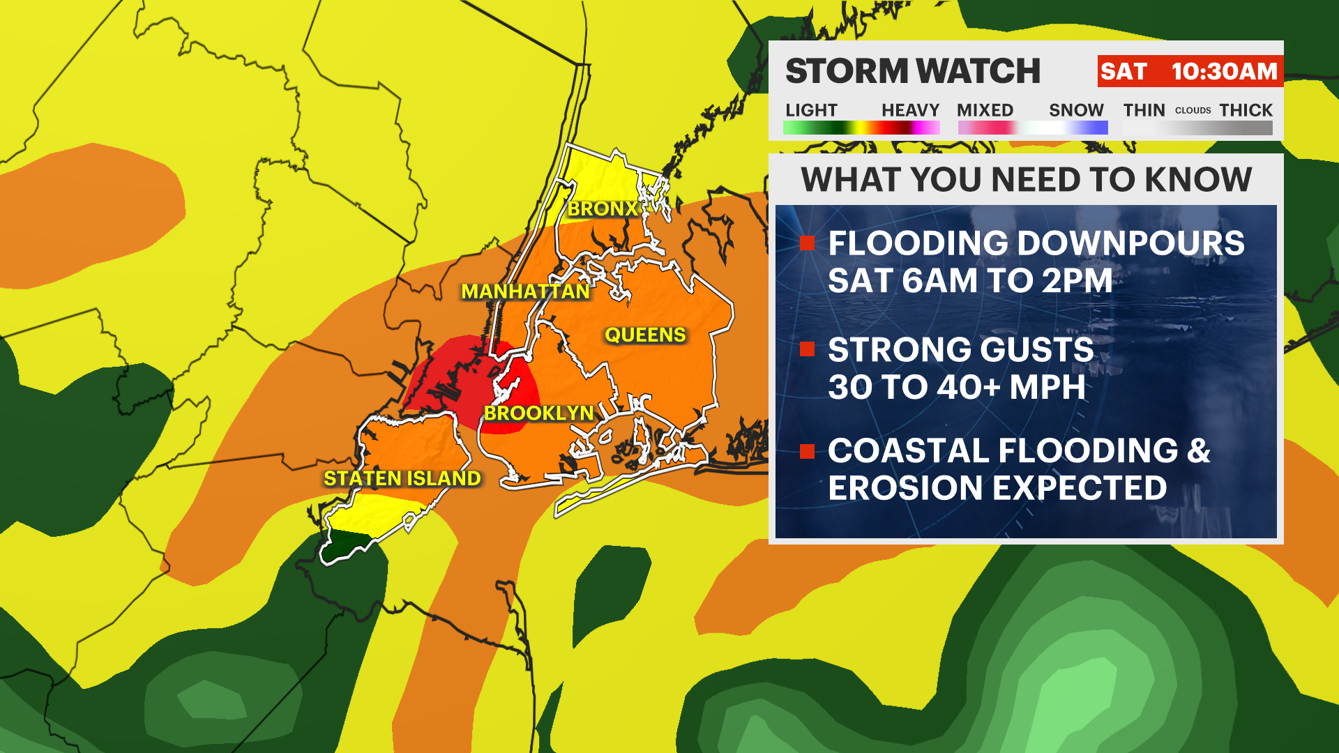
TROPICAL STORM OPHELIA:" The brunt of the windswept rain still being 6AM to 2PM, and the storm is expected to feature widespread flash flooding, dangerous wind gusts of 30-50 mph, and coastal flooding/erosion/over wash.
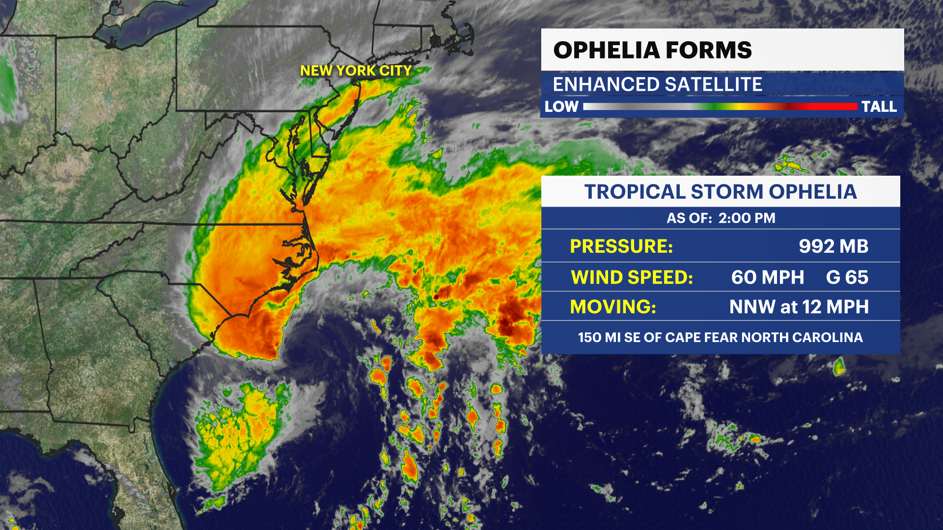
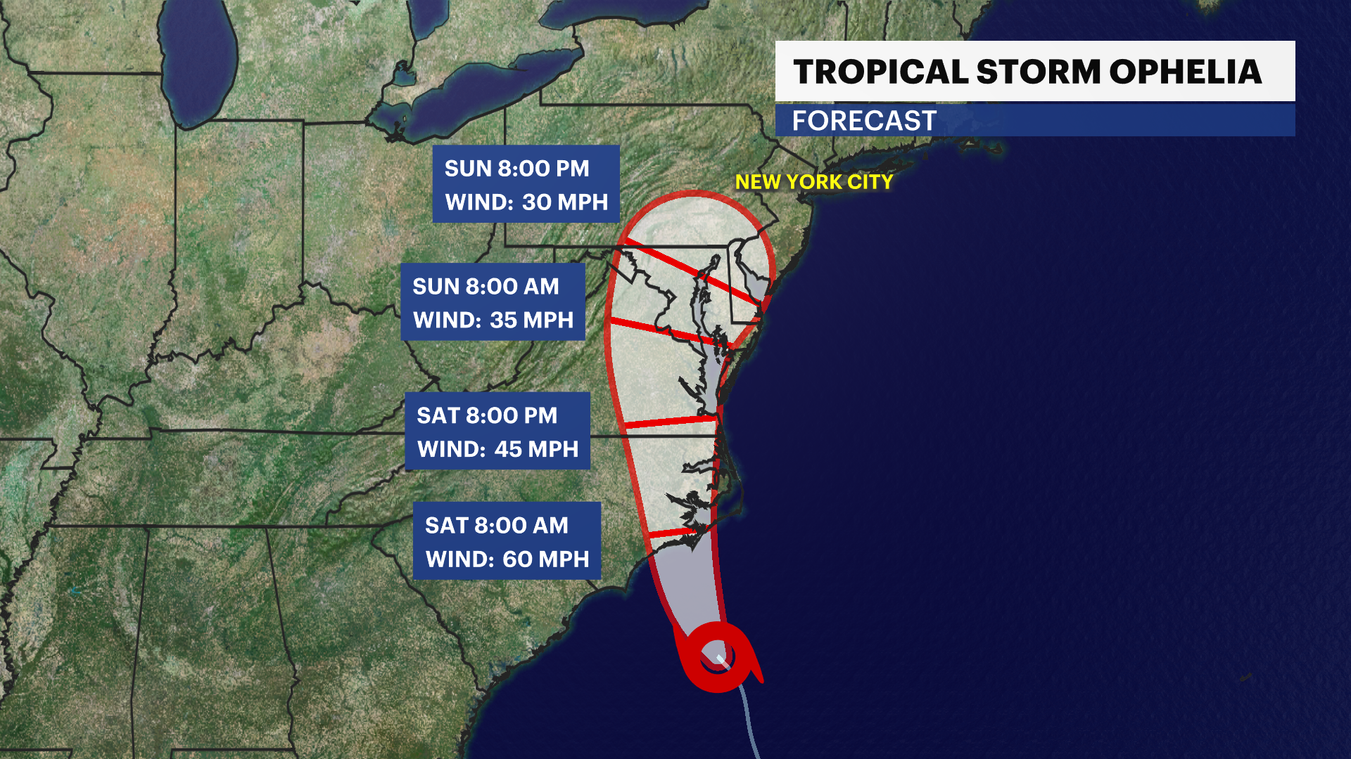
This nor'easter-like storm will last throughout Saturday and half of Sunday. It is important to make preparations for power outages, wind damage, interrupted travel and coastal waterfront flooding during high tide.
Guide: Flooding safety tips to follow
Watch below for your hyper local forecast in the Brooklyn area from Storm Watch Team Meteorologist Mike Rizzo:
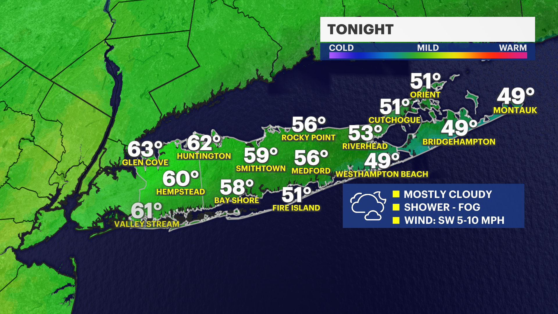
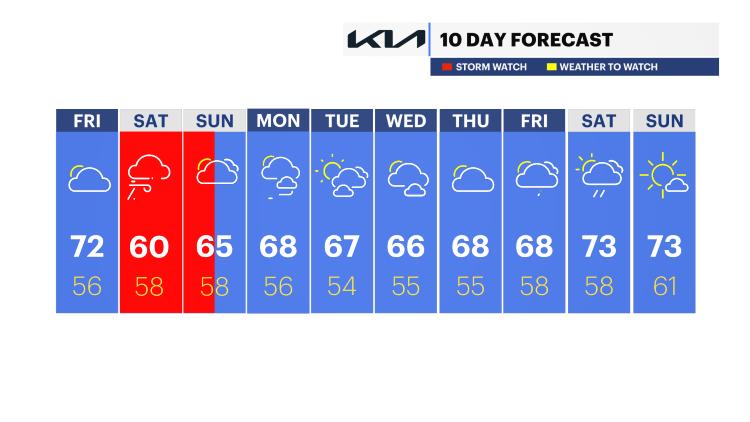
TONIGHT - STORM WATCH: Showers becoming heavy in a hurry. Lows down to 57.
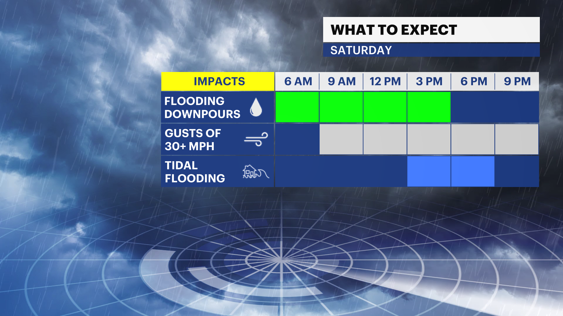
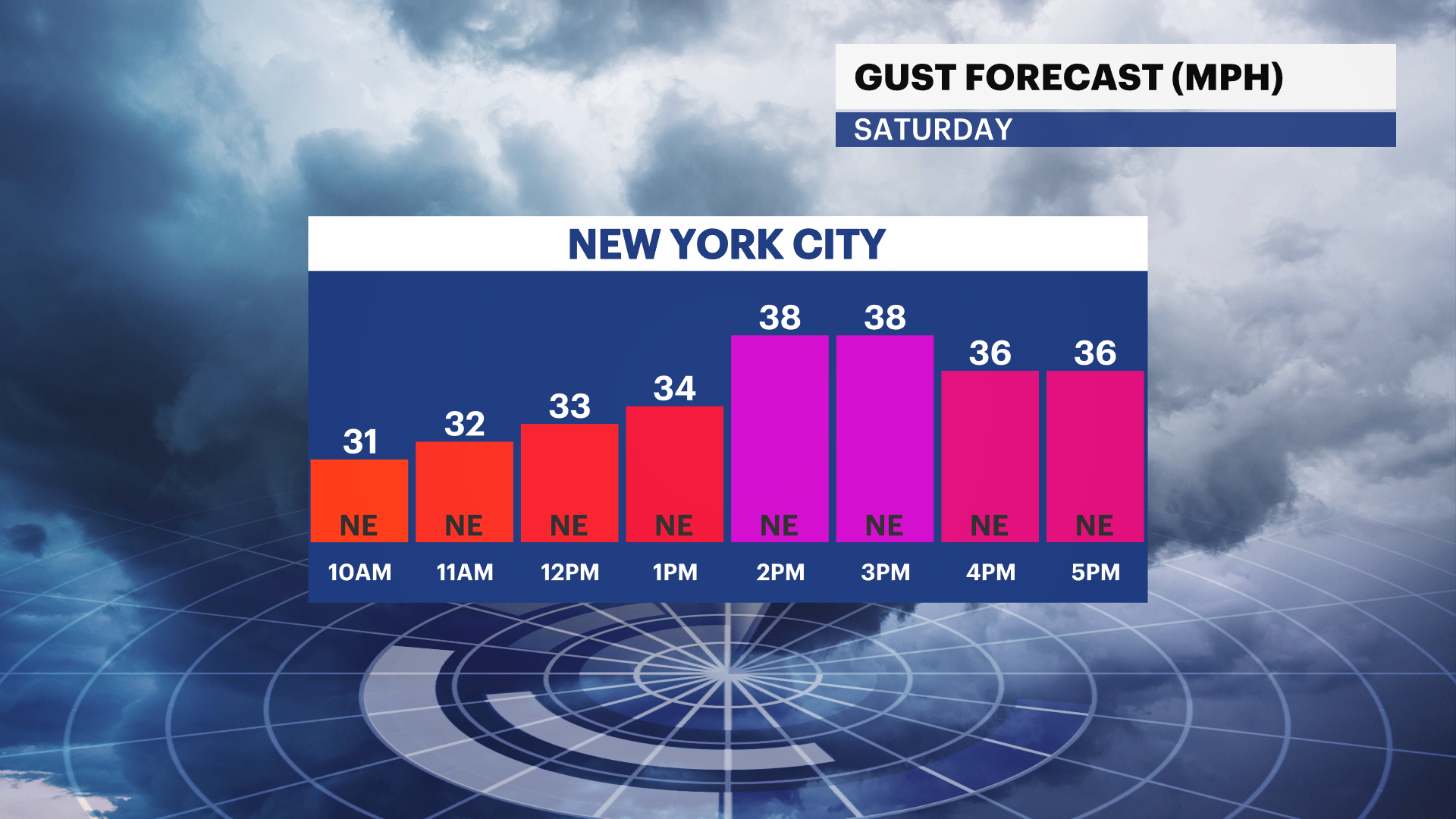
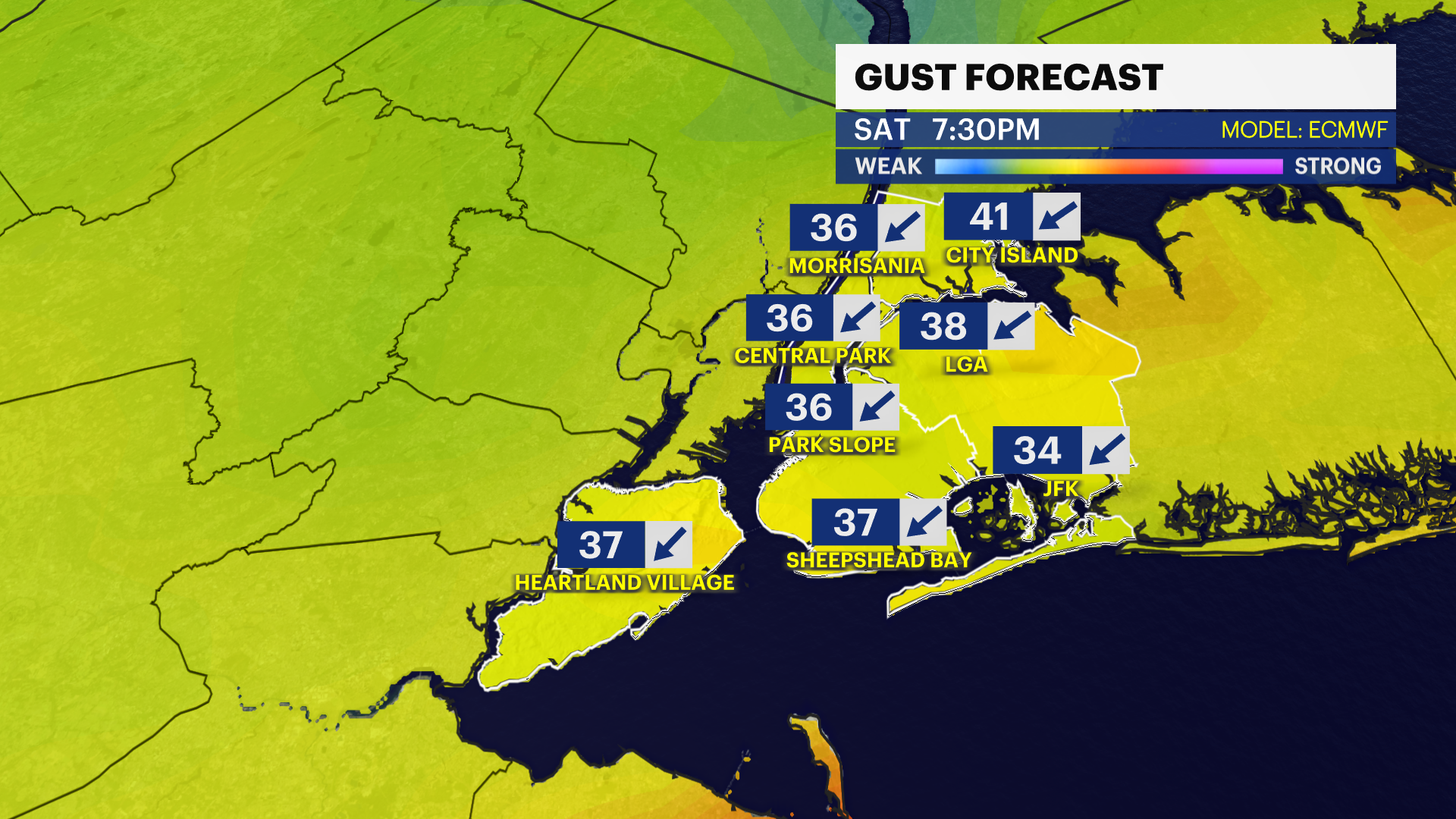
SATURDAY - STORM WATCH: Rain. Heaviest, windswept rain expected between 6 a.m. and 2 p.m. Then scattered showers and downpours through the early evening. Increasingly windy through the day with gusts between 20-40 mph, 40+ mph along the coast. Highs struggle to budge past 60. The best chance at a break will be during the evening through the wee-hours of Sunday morning. Lows hover around the 60-degree mark.
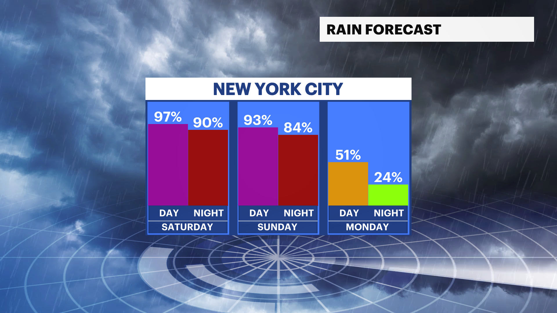
SUNDAY - STORM WATCH: Scattered showers likely. A round of heavier rain is possible at some point during the second half. Highs up to 65. Lows near 58.
MONDAY: The center of Ophelia will finally move off the coast, a little slower than before. Showers are possible for the morning before clearing skies late. Highs near 68. Lows down to 56.
TUESDAY - THURSDAY: Not too bad. Partly cloudy and cooler. Highs in the upper 60s. Lows in the mid 50s. Showers possible late Wednesday or Thursday, on the lighter side.