More Stories
NEW: Absolutely gorgeous Holy Week ending this weekend with dry conditions and temps above averages. All outdoor plans are green lighted!
NOW: Currently temps are significantly cooler compared to yesterday at this time, approximately 23 degrees colder in Central Park and Fordham! Grey, gloomy afternoon with increasingly cloudy skies overnight.
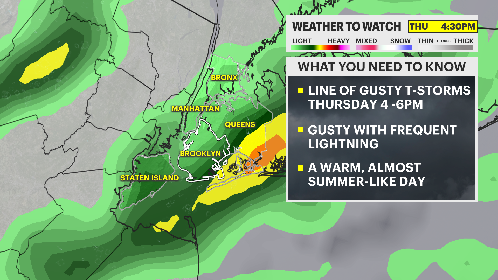
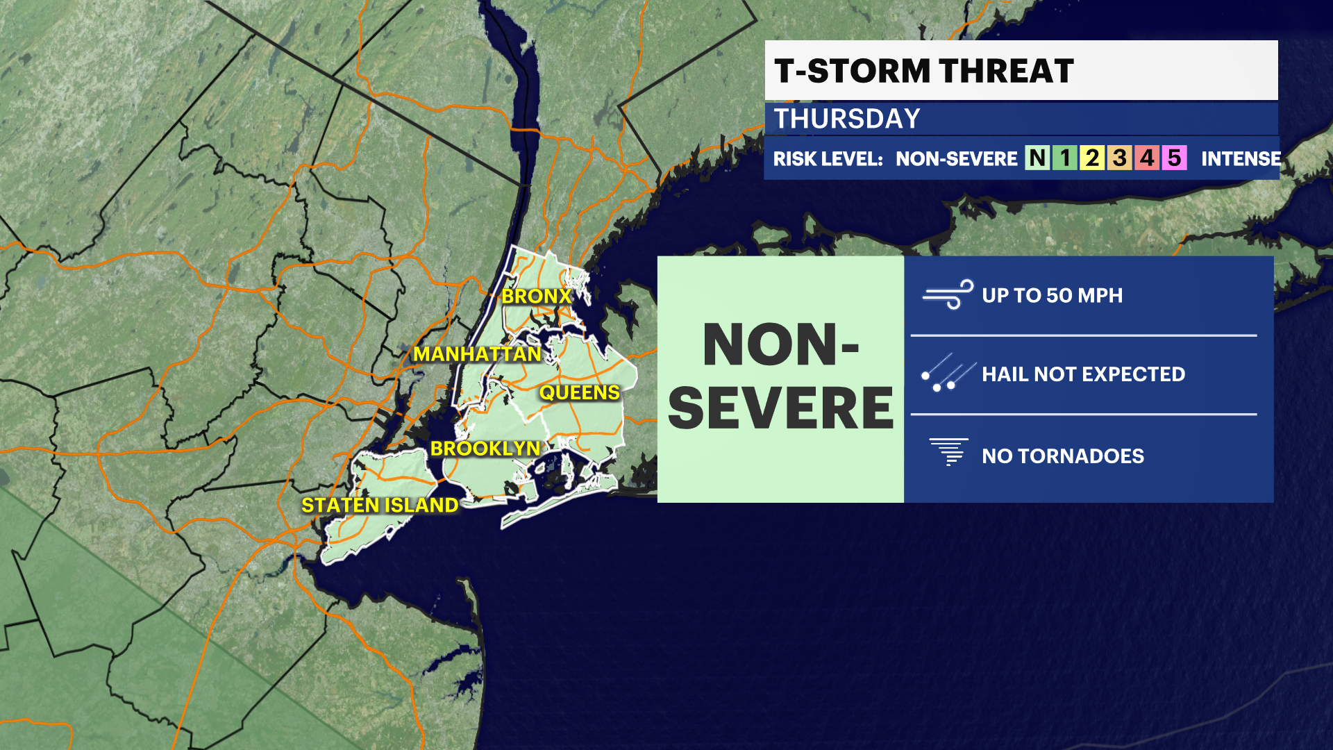
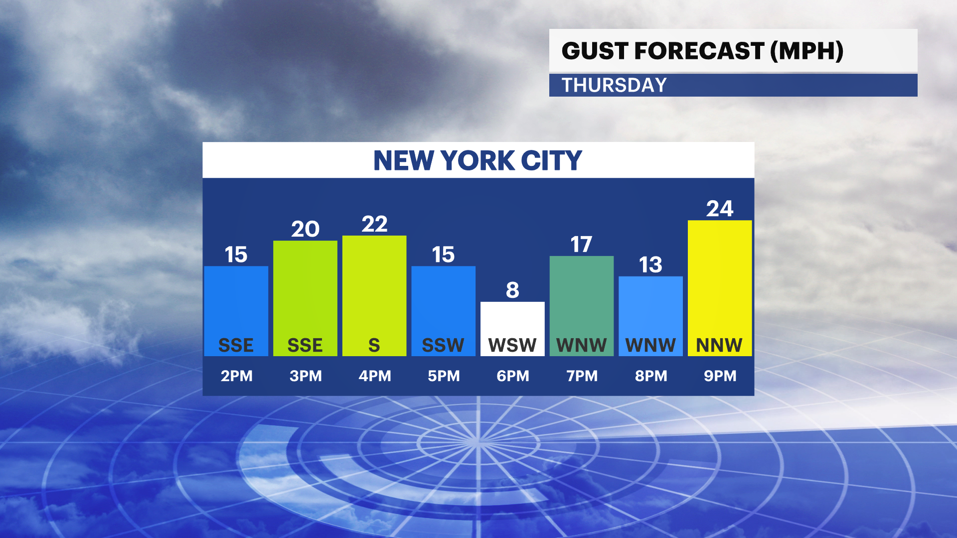
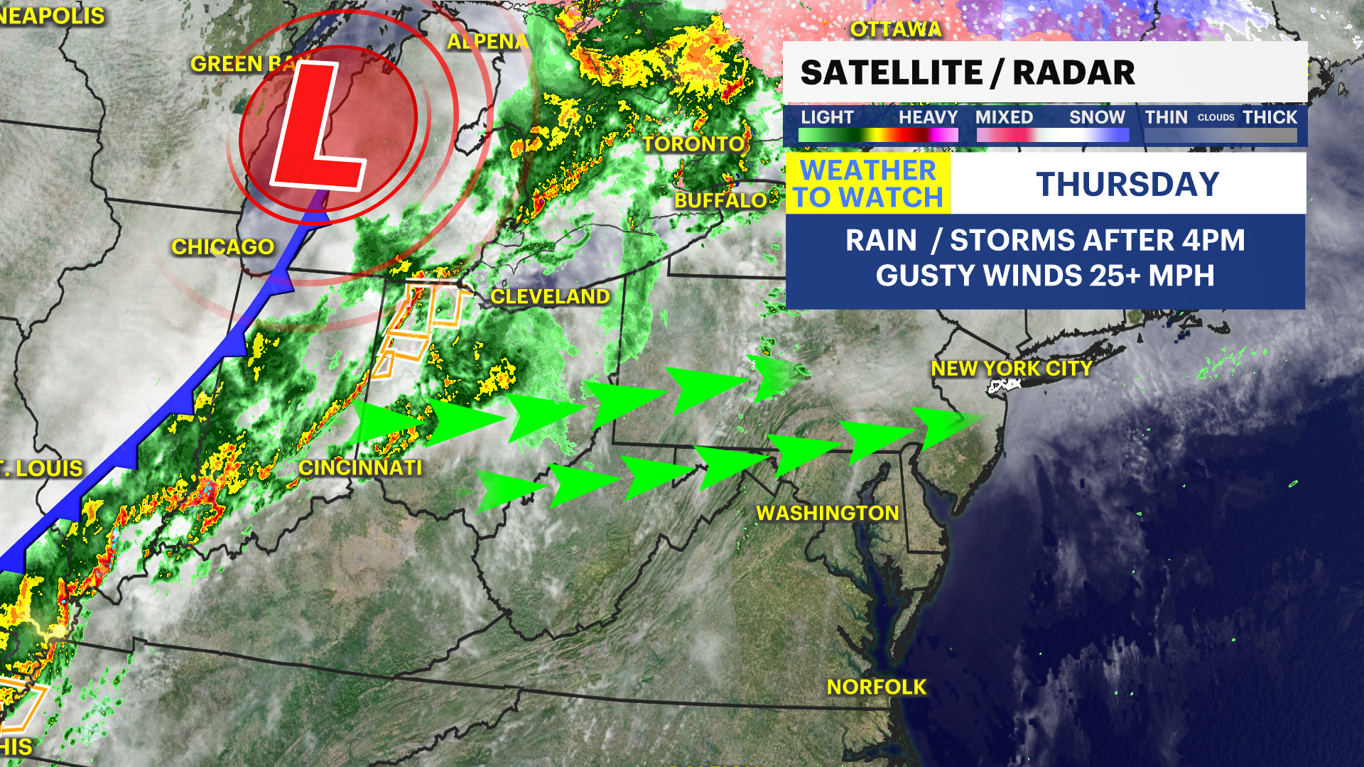
NEXT: Weather To Watch - Rain showers and pop-up, isolated thunderstorm cells in the afternoon/evening tomorrow with a cold front. It'll be interesting to see how warm the temps soar tomorrow ahead of frontal passage! This could add to more instability and produce stronger storms.
News 12 Storm Watch Team Meteorologist Hilda Estevez says cool and cloudy conditions persist tonight and there's a chance for a thunderstorm tomorrow. The weather will turn dry and seasonable by Friday and Saturday, making for pleasant weather for Easter!
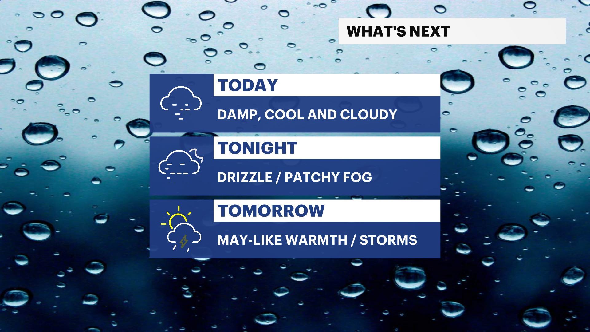
Tonight: Cloudy skies close to 55 overnight.
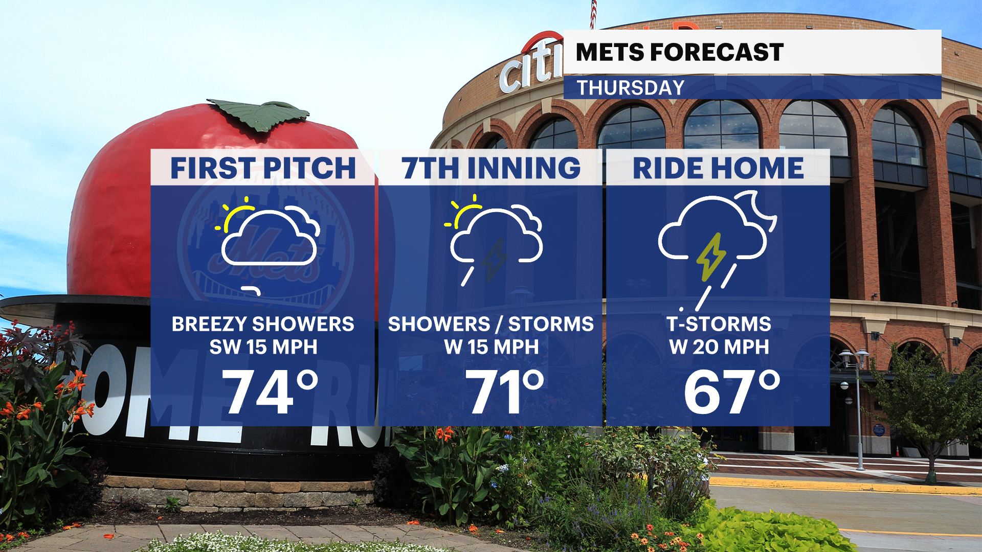
Thursday: Cloudy day. Showers and rumble of thunder likely after 3:30/4PM into 6PM. After frontal passage, cooler overnight conditions are left behind. Highs near 79! Lows stay very mild overnight near 49.
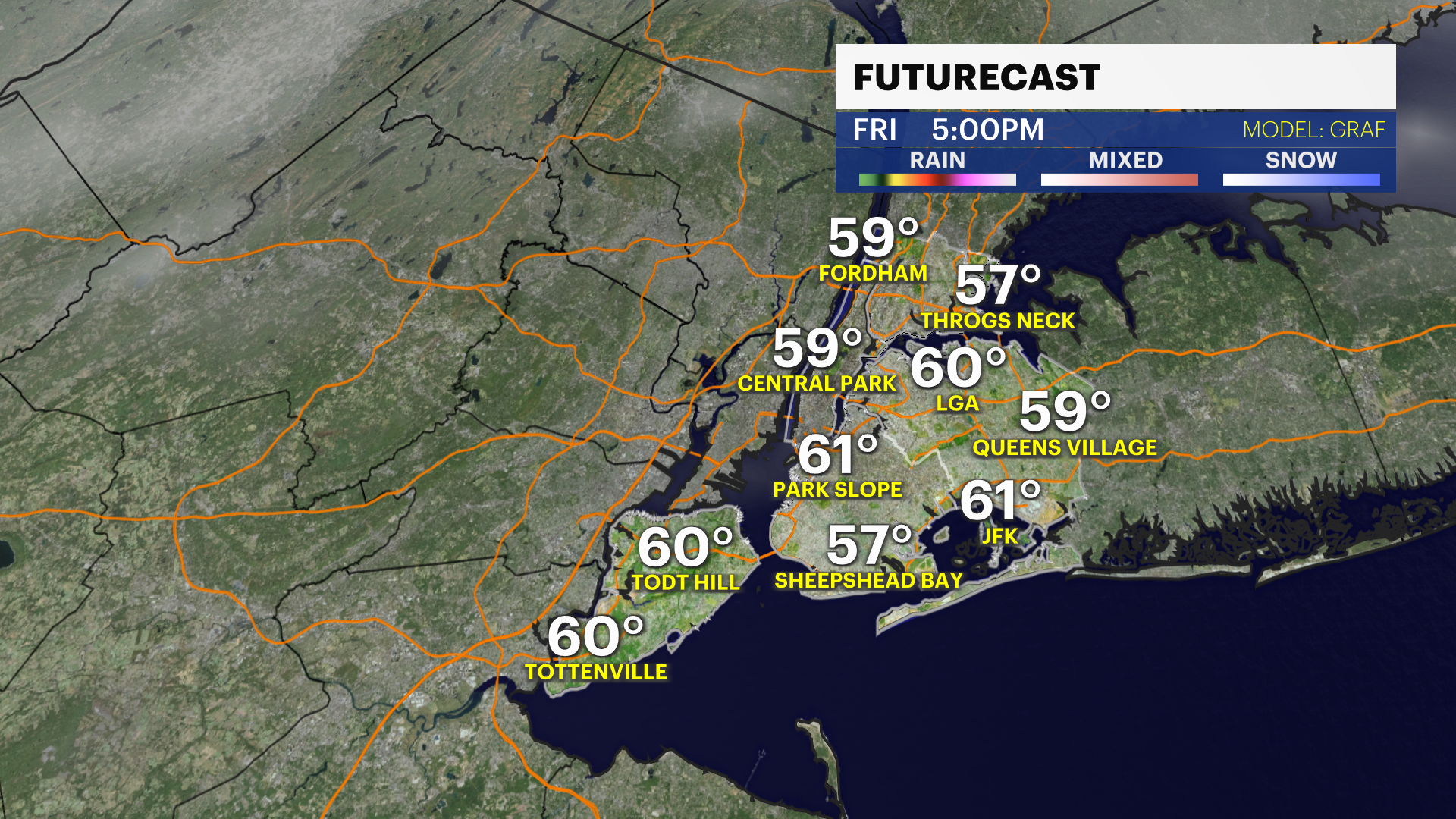
Friday/Good Friday: Partly sunny and seasonal, breezy. Highs near 61. Lows near 40.
Saturday:
The first rain-free Saturday in 3 weeks! Mostly sunny skies with highs near 57. Lows near 43.
Sunday/ Easter: A beautiful day for any and all outdoor activities and Easter egg hunts. Sunny with highs near 63. Lows stay mild near 50.
Early Next Week: Mostly sunny, mild and pleasant. Afternoon clouds. Highs near 65 for Monday and Tuesday, with lows near 50.
More from News 12
2:35

BLIZZARD WARNING: Snow and howling wind ramp up across The Bronx

LIVE RADAR: Track the snowstorm

LIVE UPDATES: Major snowstorm to blanket The Bronx; travel ban begins at 9 p.m.

Why this potential blizzard could produce thundersnow
1:34

Residents say they are fed up with dog owners refusing to scoop up poop on sidewalks
2:23
