More Stories
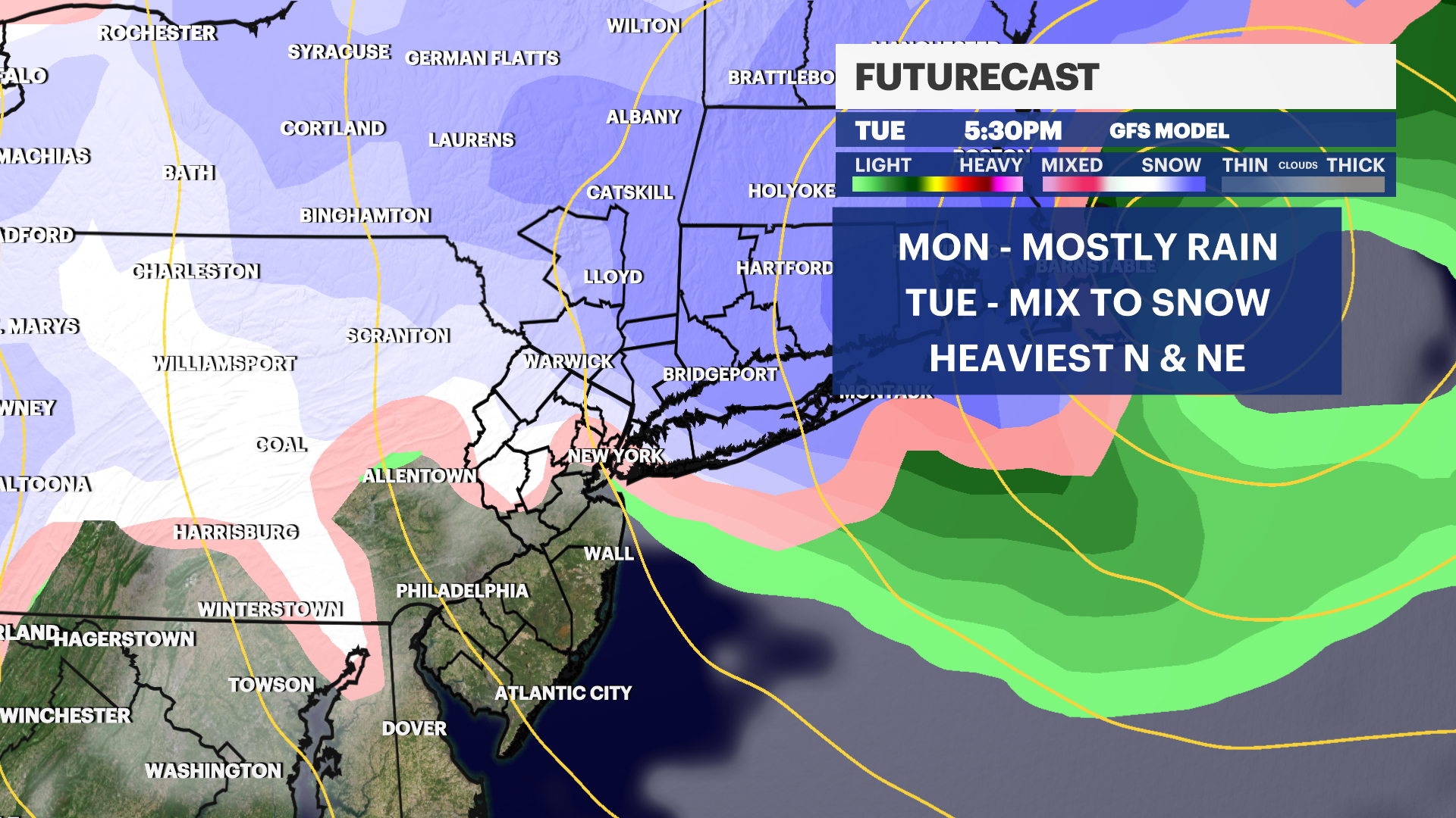
News 12 Storm Watch Team Meteorologist Allan Nosoff says all eyes will be on a long-duration coastal storm slated to arrive on Monday.
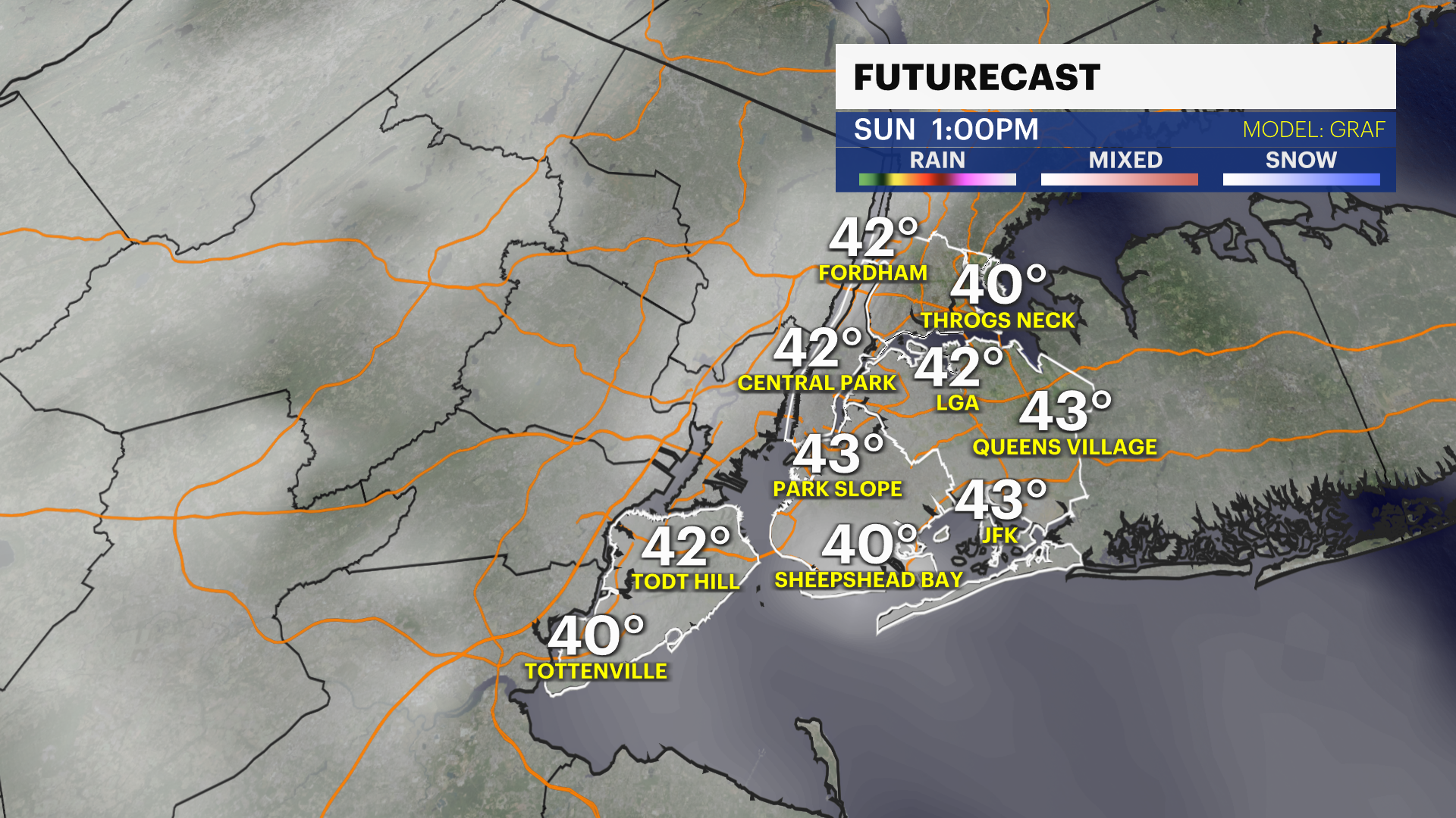
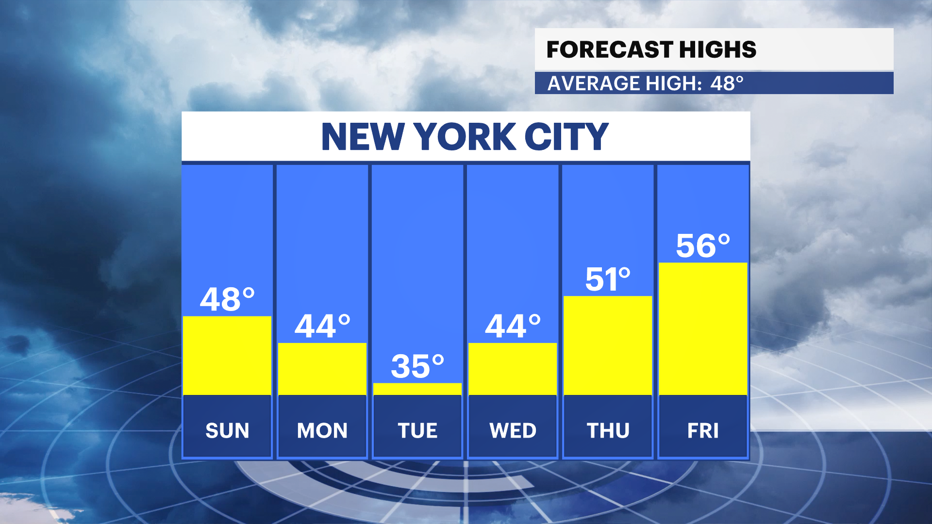
SUNDAY: Mostly sunny with a few clouds late. Highs up to 47.
Lows down to 36 with scattered showers arriving by daybreak.
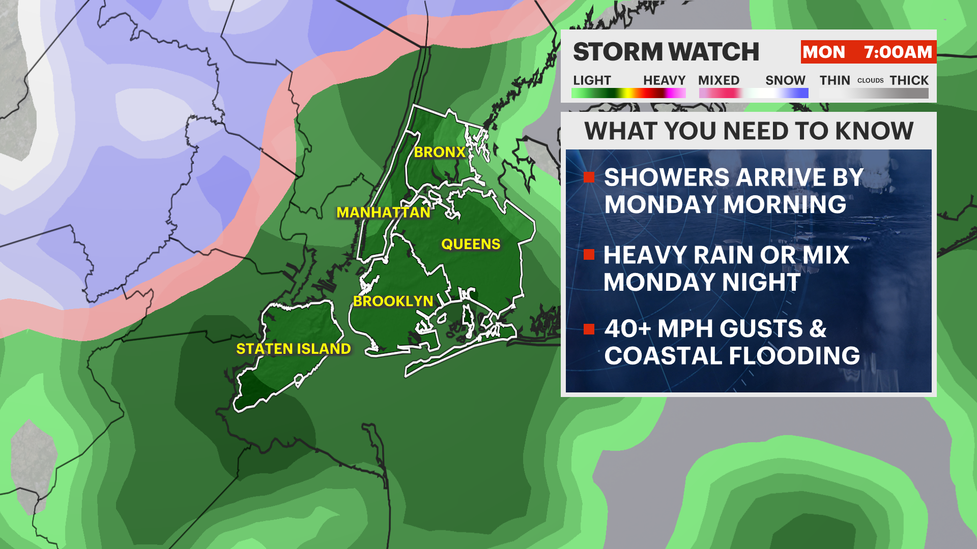
MONDAY - STORM WATCH: Scattered rain showers
throughout the day. Not expected to be heavy, but enough to inconvenience travel.
Highs near 40. A bit breezy during the day with 15-25 mph gusts.
MONDAY NIGHT - STORM WATCH: The wildcard. How
strong and close to NYC is the storm? Heavy rain or mix as temps fall to the
low- to-mid-30s. Isolated flash flooding and minor-to-moderate coastal flooding
likely. Wind gusts pick up to 30-40 mph.
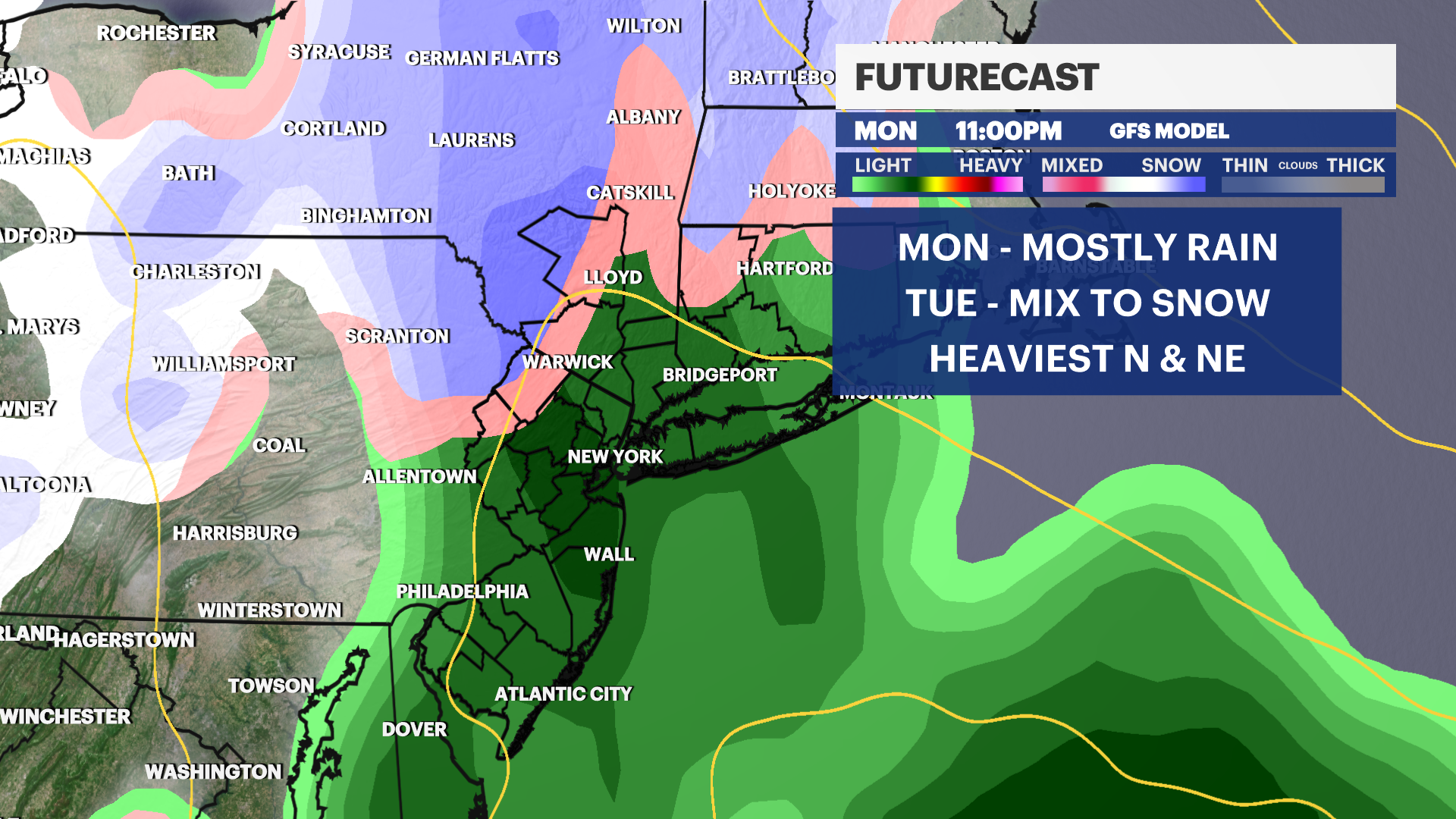
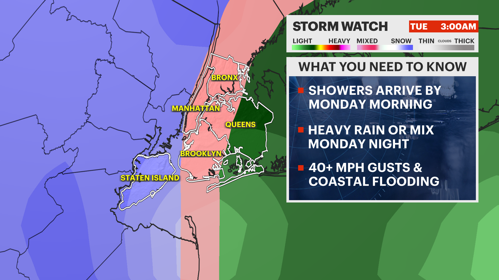
TUESDAY - STORM WATCH: Rain, mix, or snow, heavy
during the early morning and tapering off by the evening. Temps hover in the
low- to-mid-30s. Some snow accumulation is possible. Windy with 40-50 mph gusts
likely. Precipitation is done by Tuesday evening, but still windy at night with 30-40
mph gusts. Lows down to 29.
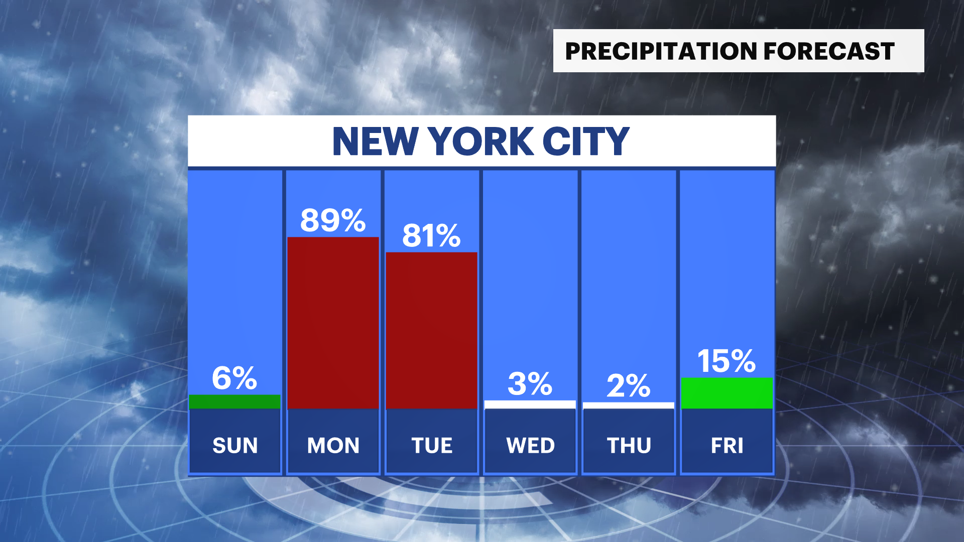
WEDNESDAY: Mostly sunny and blustery. Highs near
44. Wind gusts 30-40 mph. Lows down to 35.
THURSDAY - FRIDAY: Sunny and nice! Winds subside
and temps rise. Highs into the 50s. Lows in the low 40s.
More from News 12
1:45

Mayor Mamdani shares Easter dinner with formerly homeless veterans
1:42

Cooler temperatures to open up the week in the Bronx
1:25

Cars engulfed in flames cause road closures and delays in Longwood
1:33

Man arrested and charged after the rape of 16-year-old girl in Kingsbridge
2:11

Second fire in 6 months engulfs Wakefield apartment building known for disrepair
