Cooler, cloudy and breezy with some areas of drizzle for Brooklyn
For tonight, expect decreasing clouds with a cool breeze and lows near 60 degrees.
Share:
More Stories
1:34

Cooler, cloudy and breezy with some areas of drizzle for The Bronx
3h ago
News 12 weather blog
4ds ago1:44

Another earthquake in New Jersey rattles NYC
35ds ago
Mayor Adams declares state of emergency due to flash flooding, heavy rain
40ds ago
Gov. Kathy Hochul to declare state of emergency ahead of heavy rainfall
41ds ago
Expert explains why your appetite seems to drop in the summer
54ds ago1:34
Cooler, cloudy and breezy with some areas of drizzle for The Bronx
3h agoNews 12 weather blog
4ds ago1:44
Another earthquake in New Jersey rattles NYC
35ds agoMayor Adams declares state of emergency due to flash flooding, heavy rain
40ds agoGov. Kathy Hochul to declare state of emergency ahead of heavy rainfall
41ds agoExpert explains why your appetite seems to drop in the summer
54ds agoHere’s what you need to know:
- A HIGH RIP CURRENT RISK is in effect for Brooklyn and Queens through this evening. Life-threatening rip currents are likely.
- It's a cool, damp and breezy this morning. Temperatures are in the low to mid 60s.
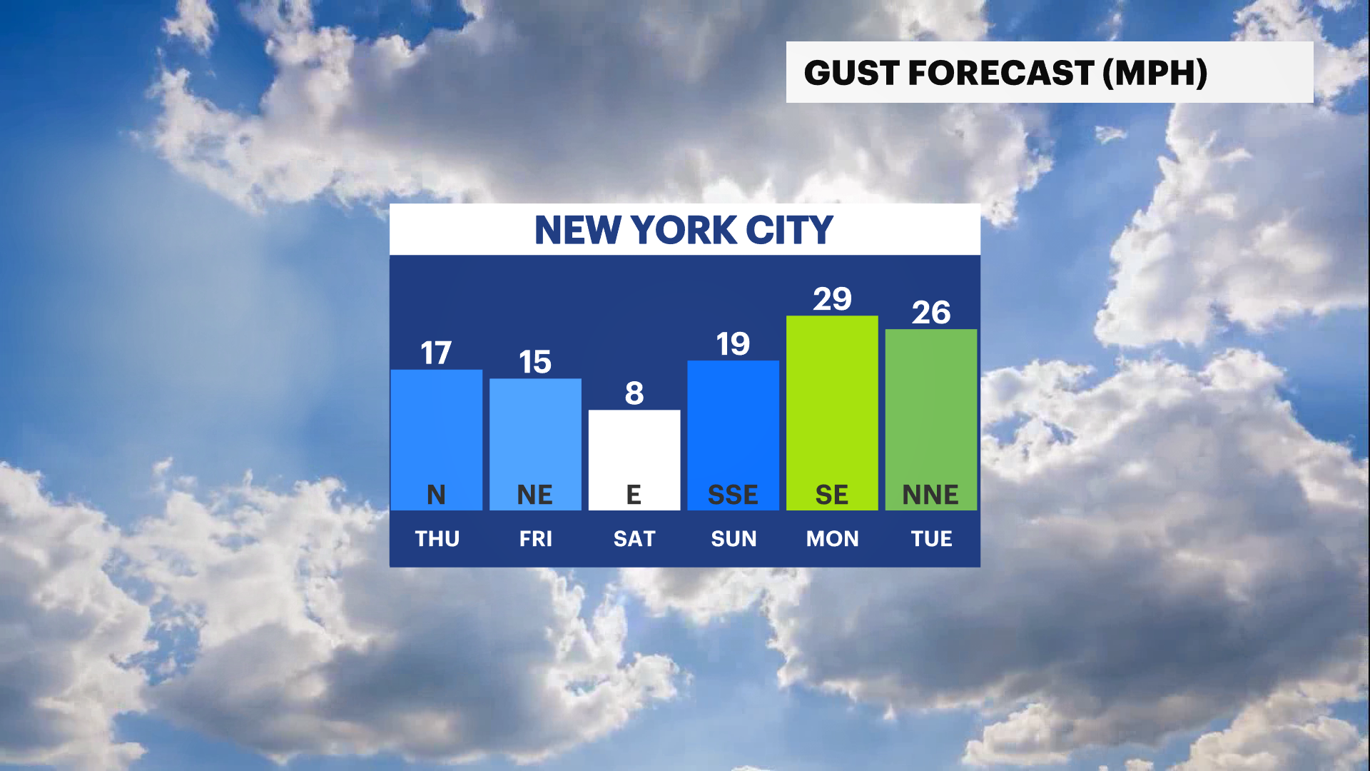
- Today will be a gloomy day with plenty of clouds, damp and breezy conditions. Gusts up to 20mph is expected through this evening. Highs will be in the upper 60s.
- Areas of patchy drizzle will continue through midday mainly along the coast, further inland it will stay cloudy, cool and breezy.
- It dries out tomorrow through this weekend. High temperatures will be in the 70s to near 80 degrees. Low temperatures will be in the 50s to low 60s.
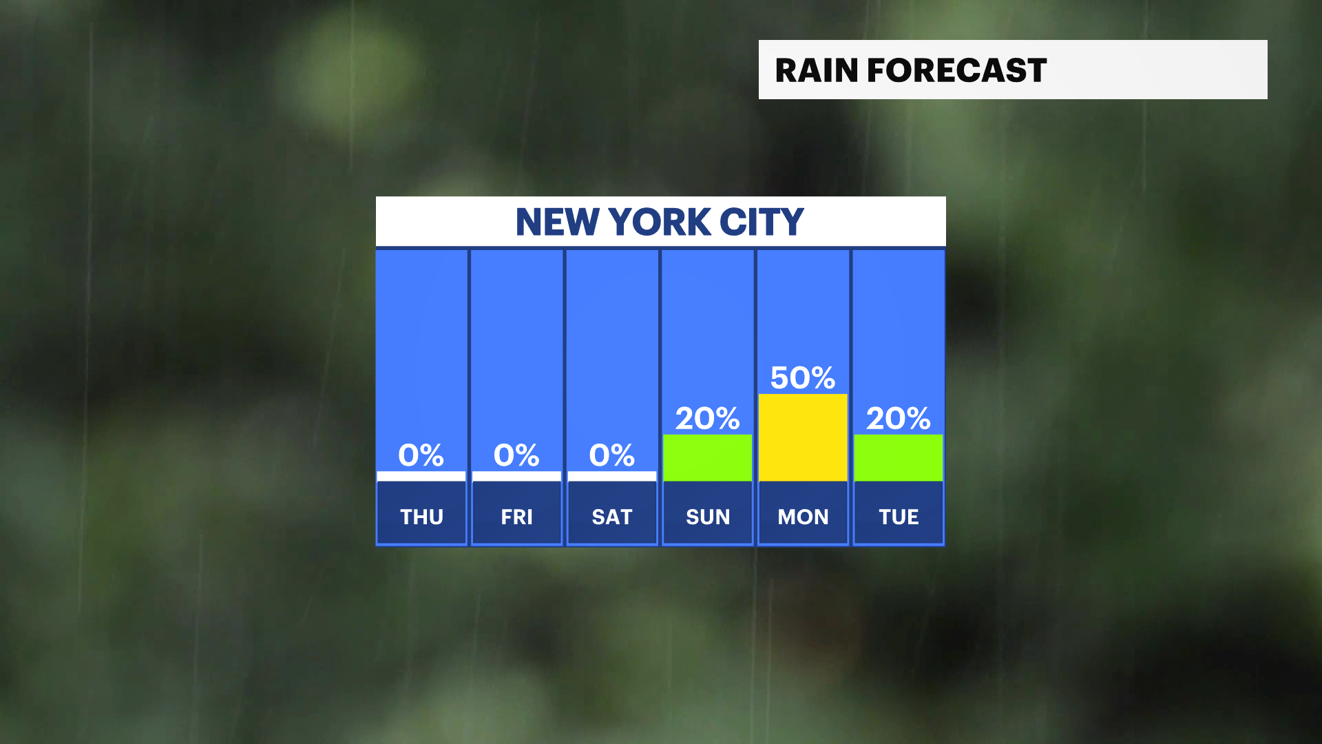
- Our next chance of rain is overnight Sunday into Monday. A weak cold front will move through the area bringing a slight chance for some showers. Stay tuned for updates.
- The latest drought monitor comes out on Thursday. We'll continue to watch if there are any improvements thanks to recent rainfall. Stay tuned for the updates.
- TRACKING THE TROPICS: There are currently no tropical disturbances in the Atlantic over the next 7 days. The peak of hurricane season is today. A combination of dust from the Saharan Desert off the coast of Africa and strong vertical wind shear is weakening tropical development this week. Stay tuned for any updates!
Today: Damp start at the coast. Cloudy, cool, and breezy. Highs near 69.

Tonight: Decreasing clouds with a cool breeze. Lows near 60.
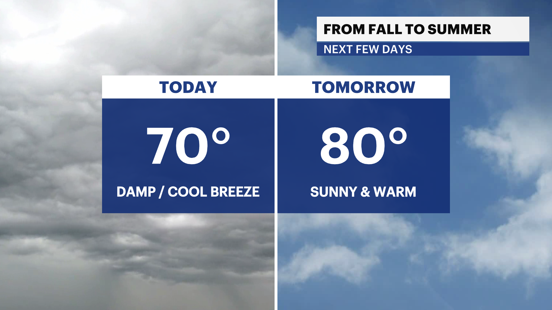
Thursday: Brighter, slightly warmer with low humidity. Highs near 80. Lows near 61.
Friday: Mostly sunny, still mild and pleasant. Highs near 76. Lows near 60.
Saturday: Sunny, beautiful and mild. Highs near 76. Lows near 59.
More from News 12
1:34
Cooler, cloudy and breezy with some areas of drizzle for The Bronx
News 12 weather blog
1:18

Most of The Bronx under extreme heat watch
1:50

Shoppers gear up for winter storm
1:59

'An opportunity to just relax.' Some Brooklyn residents revel in snowfall
2:40
