More Stories
NOW: Unusual record-breaking warmth ends as temperatures drop to 50s overnight into Tuesday.
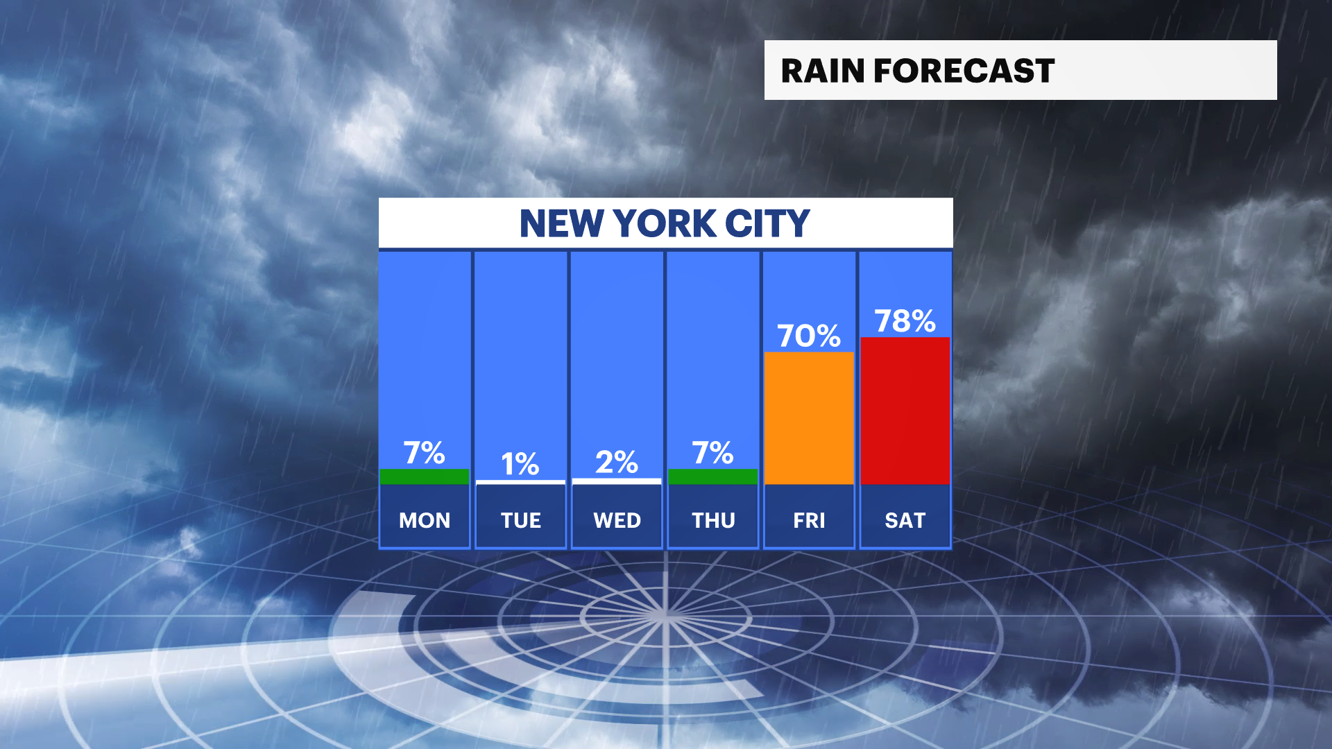
NEXT: Much cooler for the rest of the week. Chances for downpours on Friday and Saturday.
Storm Watch meteorologist Darryl Green says temperatures will crash nearly 30 degrees or more in some parts of the tristate area by Tuesday morning.
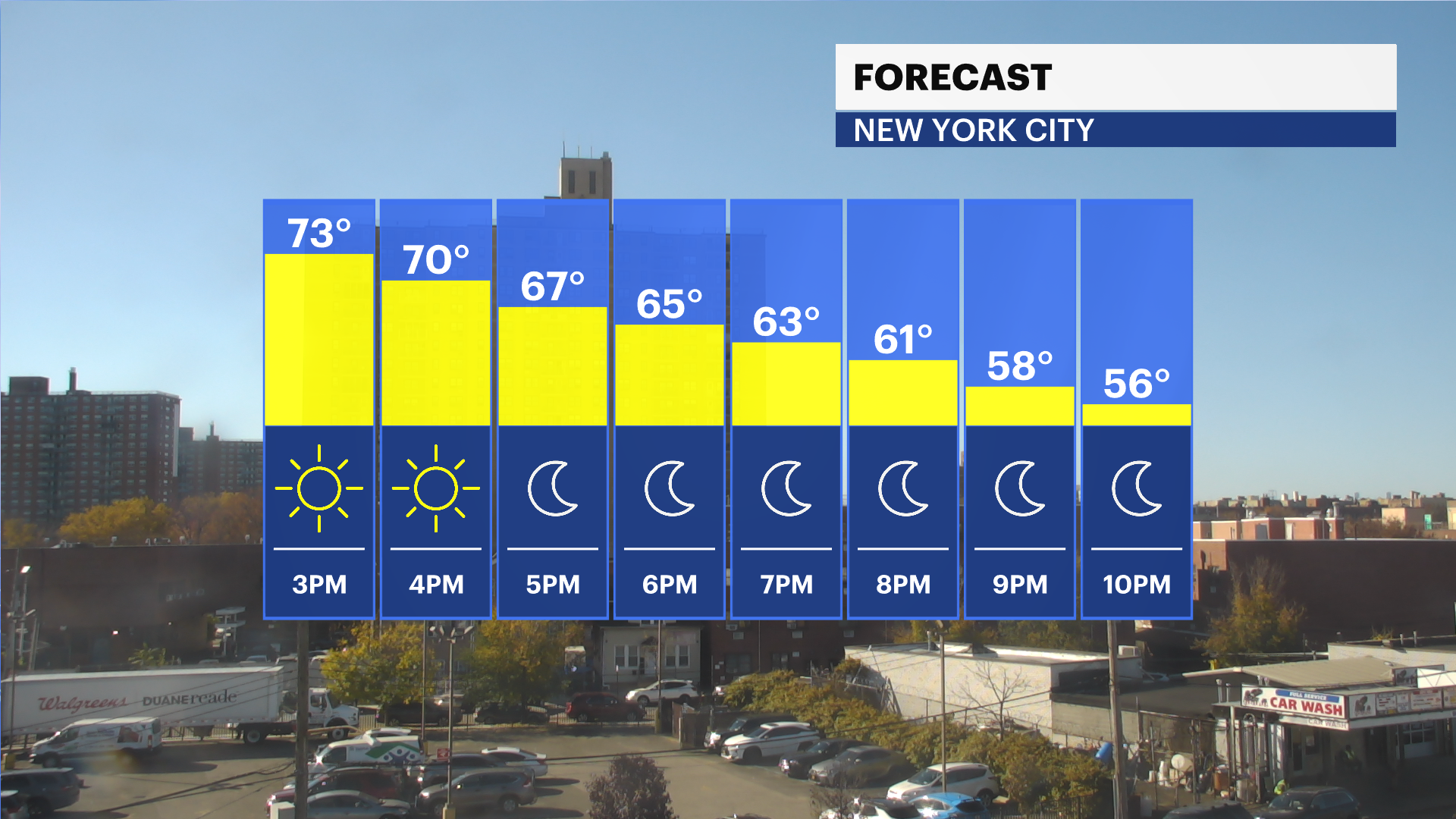
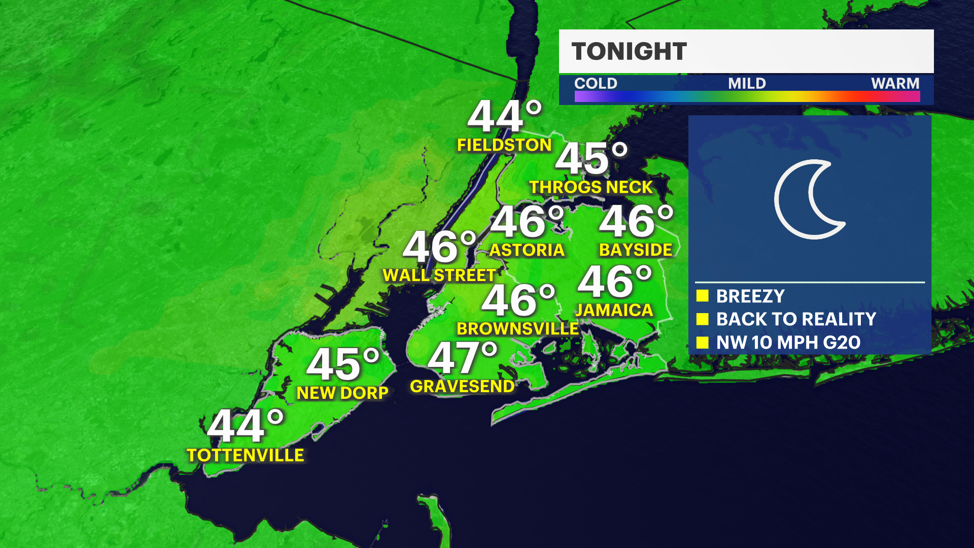
TODAY: Warm, record-breaking temperatures in some spots. Highs near 75-80. Cold crashes overnight. Lows near 40-45 degrees.
TOMORROW: A reality check - it's fall. Highs near 52-57 degrees. Windy. Gusts of 25mph. Mostly sunny.
WEDNESDAY: Calmer wind. Sunny. Autumn-like. Leaves everywhere. Highs near 55. Lows near 45.
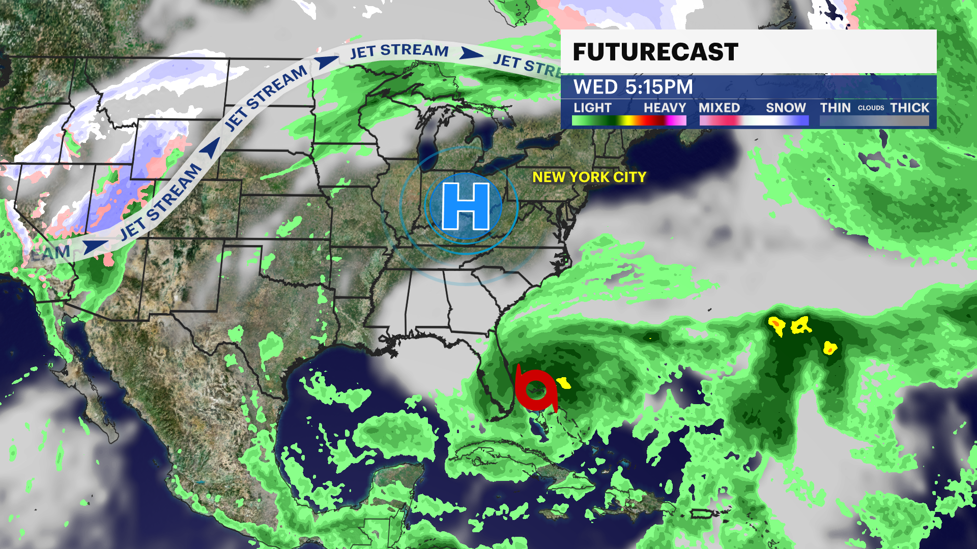
THURSDAY: Mostly sunny. Highs near 65. Lows near 55. Cloudy arrive late.
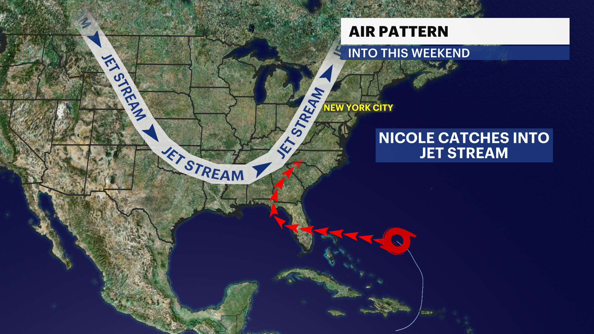
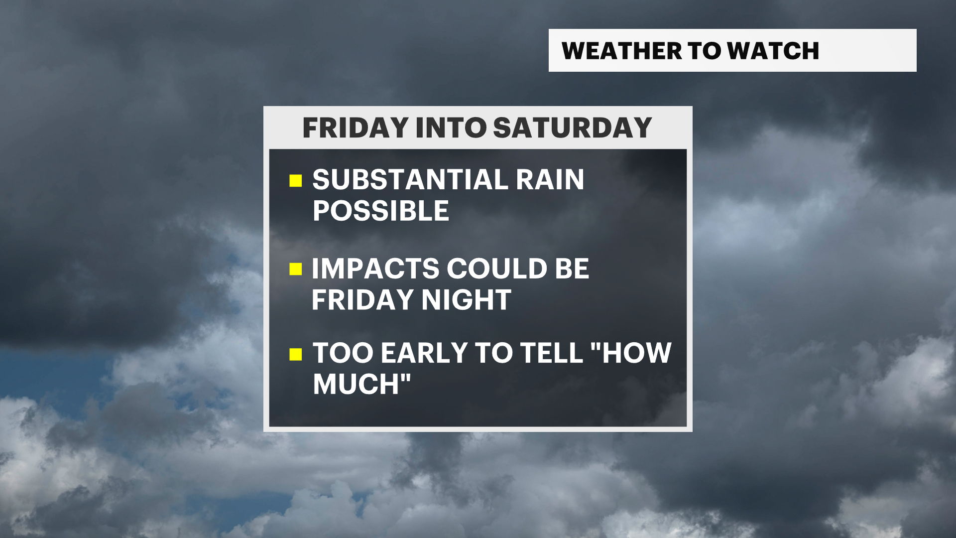
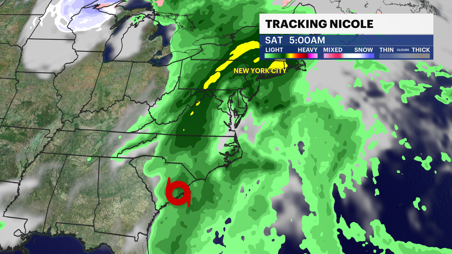
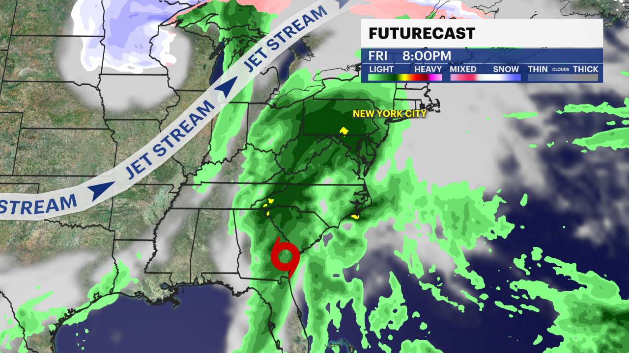
FRIDAY & SATURDAY: Tropical moisture connects with the jet stream to ship big raindrops, tropical downpours, and possible flooding along the east coast. This does threaten the tristate area, but with varying levels of uncertainty.
More from News 12
1:41

Man slashed in attack at Prospect Avenue Station, police searching for knife-wielding duo
1:27

Spring arrives on Friday with spring-like showers and temperatures for The Bronx
2:22

NYC schools facing school safety agent shortage
2:01

TWU Local 100 sues MTA over station booth staffing changes
2:04

NYC creates Office of Community Safety to expand crisis response
2:04
