More Stories
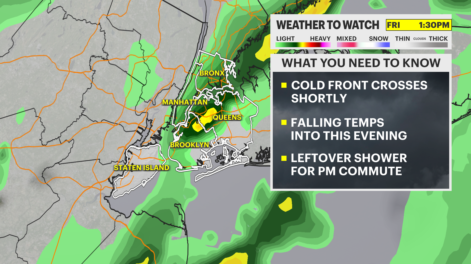
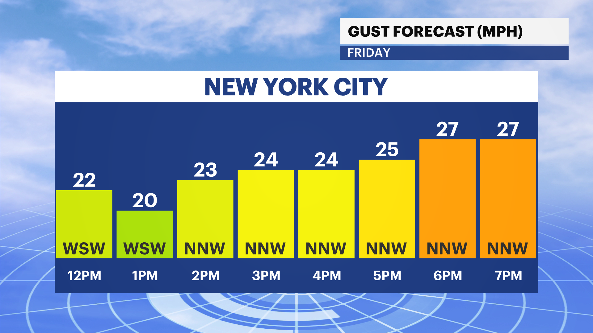
NOW: Showers taper off going into the rest of a breezy Friday.
NEXT: Much colder air returns for the weekend with highs in the 40s.
Storm Watch Team Meteorologist Allan Nosoff says temperatures are expected to drop quickly going into the weekend.
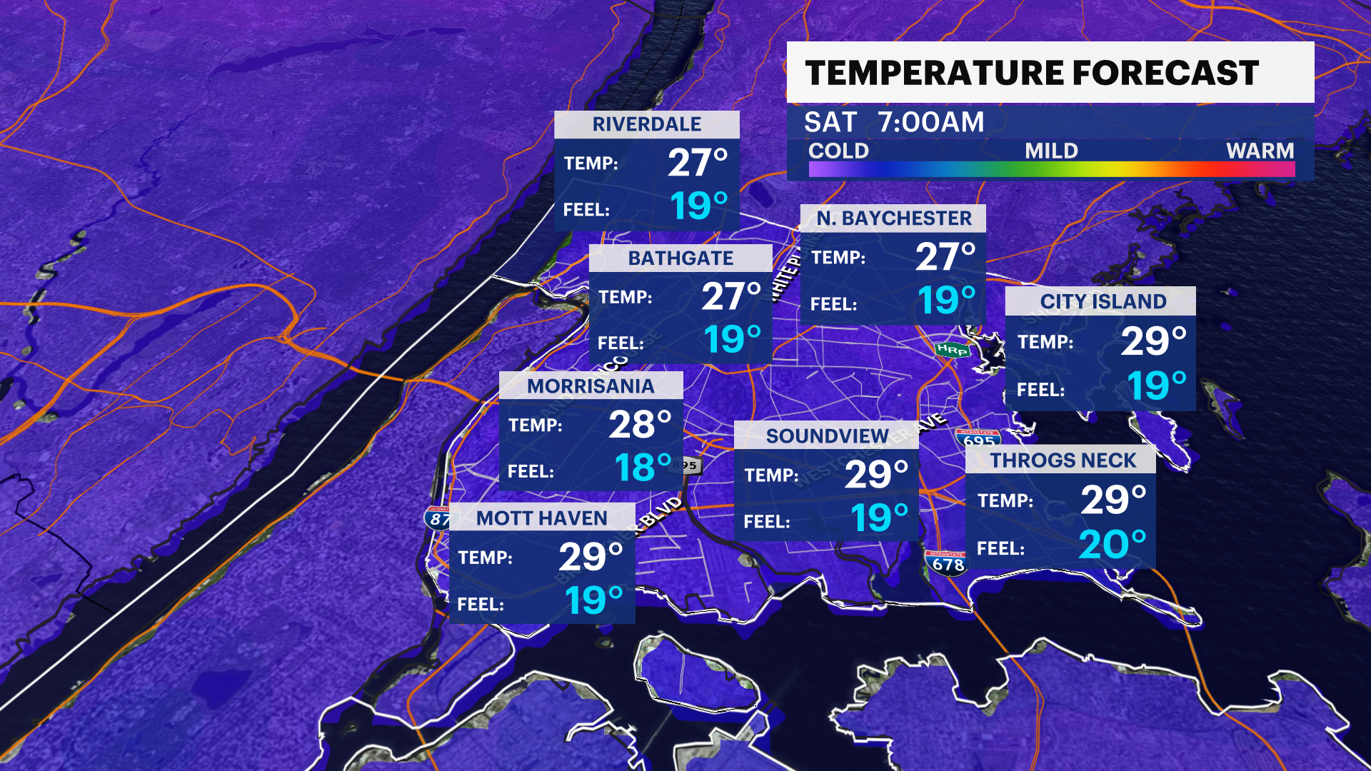
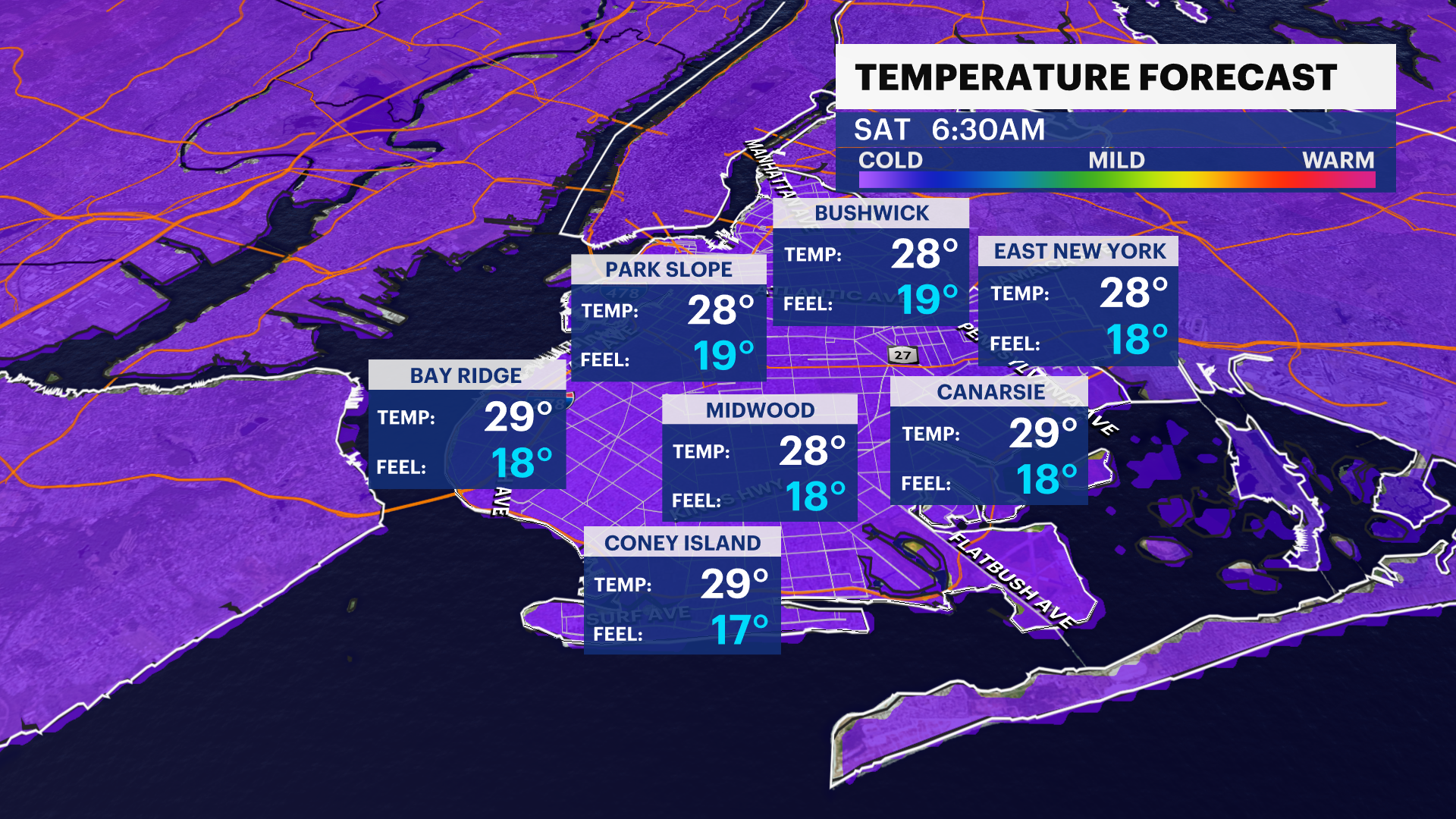
TONIGHT: Becoming mostly clear, cold and blustery. Lows down to 28. Wind gusts 15-30 mph. Feels-like temps in the upper-10s.
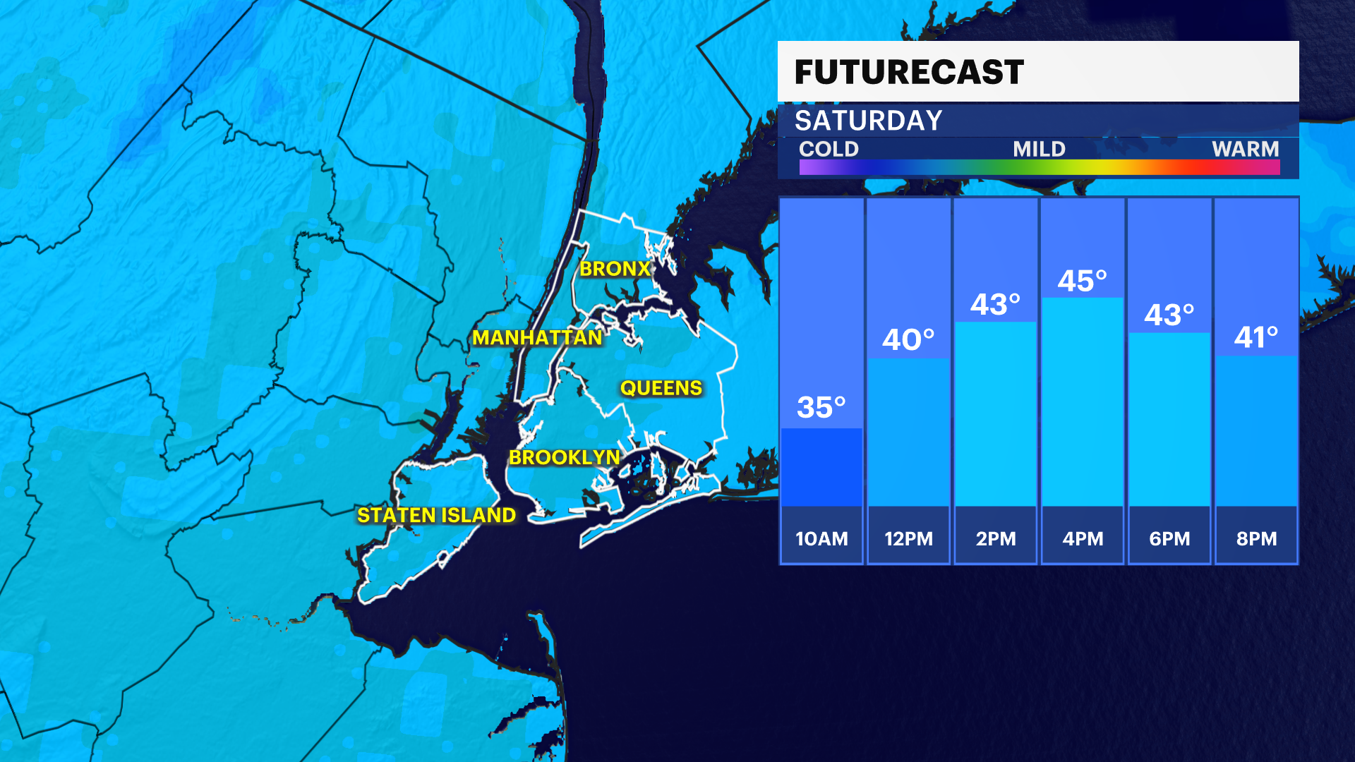
TOMORROW: Very cold start, but sunshine helps warm us up to 45. Not as breezy with a few gusts up to 20 mph. Lows down to 35.
SUNDAY: Milder trend resumes. Mix of sun and clouds, mostly cloudy by sunset. Highs near 52. An isolated shower possible at night, lows near 44.
MONDAY - PRESIDENTS DAY: Partly cloudy and mild. Highs near 58. Lows down to 40.
TUESDAY: Mostly cloudy and cooler. Highs at 53. Lows near 44.
WEDNESDAY: A few showers possible late. Highs up to 55. Lows hover near 50.
THURSDAY: Partly cloudy and warm! Highs near 62, but the potential exists for 70. Lows in the 50s.
More from News 12
1:38

Person seen waving out window as inferno tears through Kingsbridge apartment building, hospitalizing 12
2:07

Irish pride meets political message on Fifth Ave.
2:06

Breezy chill lingers in The Bronx for Wednesday, mild temperatures by the end of the week
1:22

NYPD body-worn camera footage policy standardized, must be released within 30 days of incident
1:56

Police sources: Off-duty officer accused of shooting man in the head in Kingsbridge
1:45
