STORM WATCH: Heavy rain, damaging wind may hamper holiday travel this week in NYC
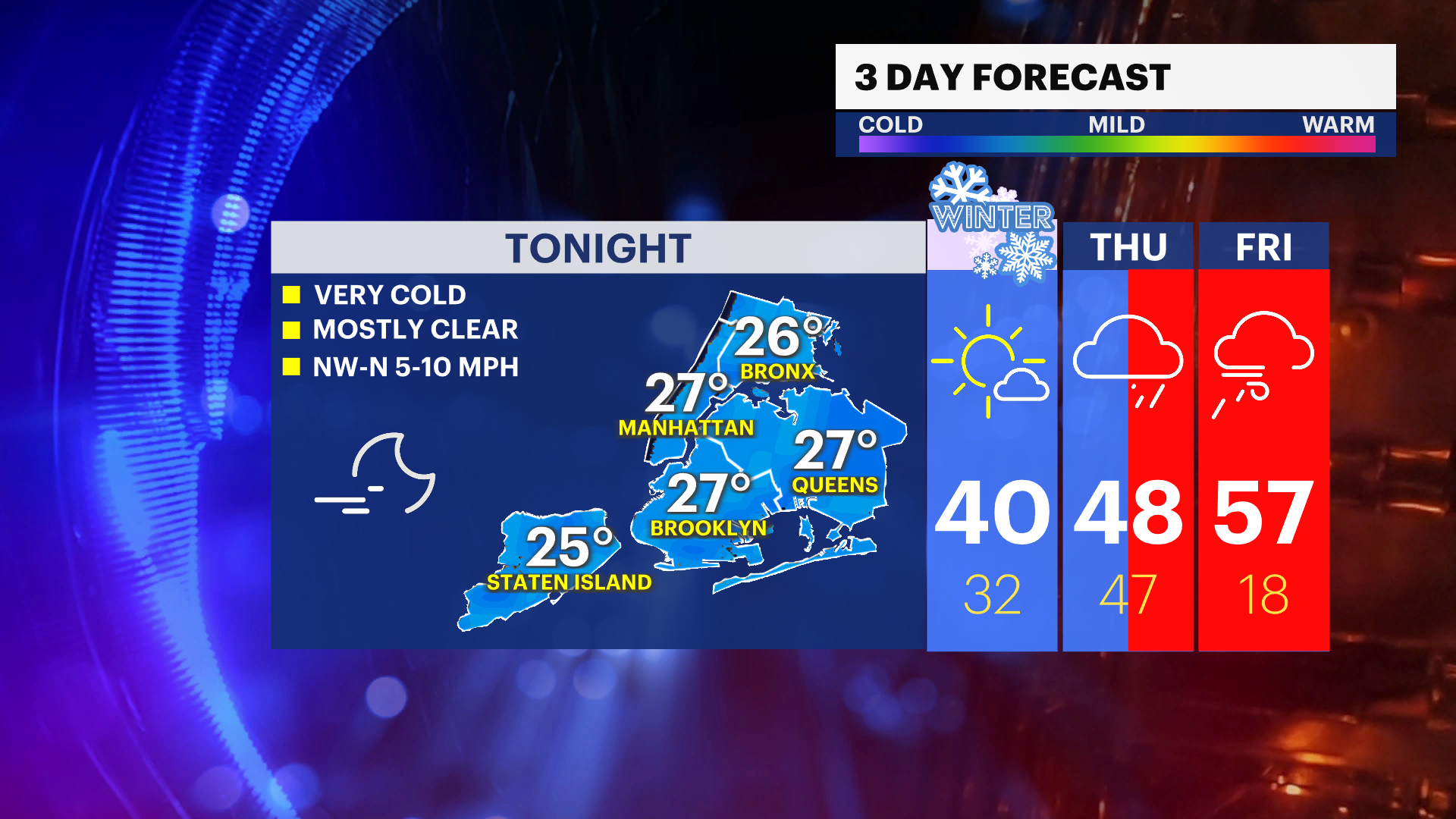
News 12 Storm Watch Team Meteorologist Darryl Green says tonight will have cold temperatures and clear skies, with lows in the upper 20s.
•
Dec 20, 2022, 10:40 AM
•
Updated 784 days ago
Share:
More Stories
1:27

Snow aftermath: Riverdale’s Ewen Park a popular spot for sledders
2ds ago1:10

STORM WATCH: Checking out the weather conditions in Williamsbridge
3ds ago1:57

Planetary parades and a lunar eclipse, here’s what’s in the night sky for February
4ds ago1:50

Shoppers gear up for winter storm
4ds ago1:50

STORM WATCH: The latest on conditions across The Bronx
5ds ago1:31

Thunderbolt 12: Snow, sleet, and freezing rain creates slick roads, dangerous travel in The Bronx
5ds ago1:27
Snow aftermath: Riverdale’s Ewen Park a popular spot for sledders
2ds ago1:10
STORM WATCH: Checking out the weather conditions in Williamsbridge
3ds ago1:57
Planetary parades and a lunar eclipse, here’s what’s in the night sky for February
4ds ago1:50
Shoppers gear up for winter storm
4ds ago1:50
STORM WATCH: The latest on conditions across The Bronx
5ds ago1:31
Thunderbolt 12: Snow, sleet, and freezing rain creates slick roads, dangerous travel in The Bronx
5ds agoNOW: Mostly clear and very cold tonight with lows in the upper-20s.
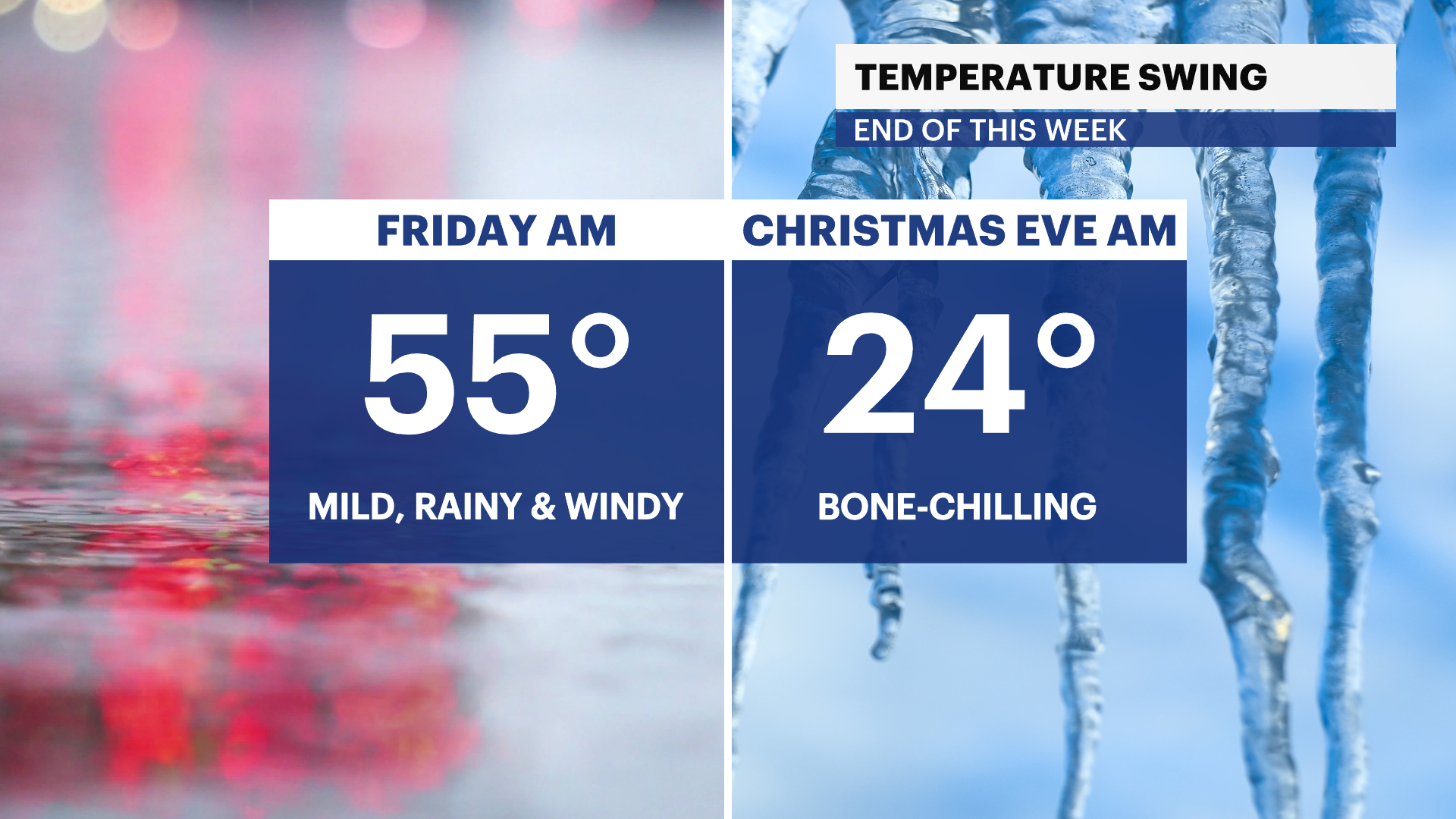
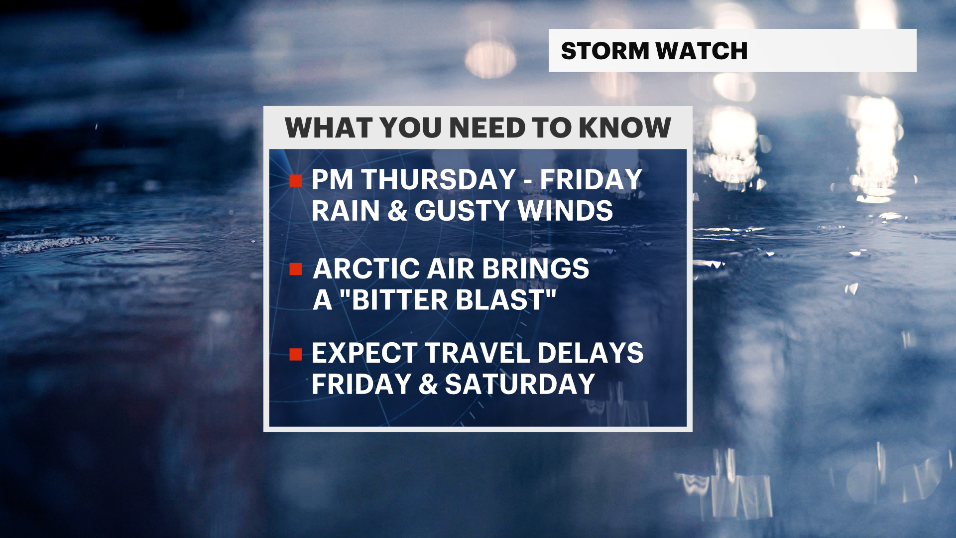
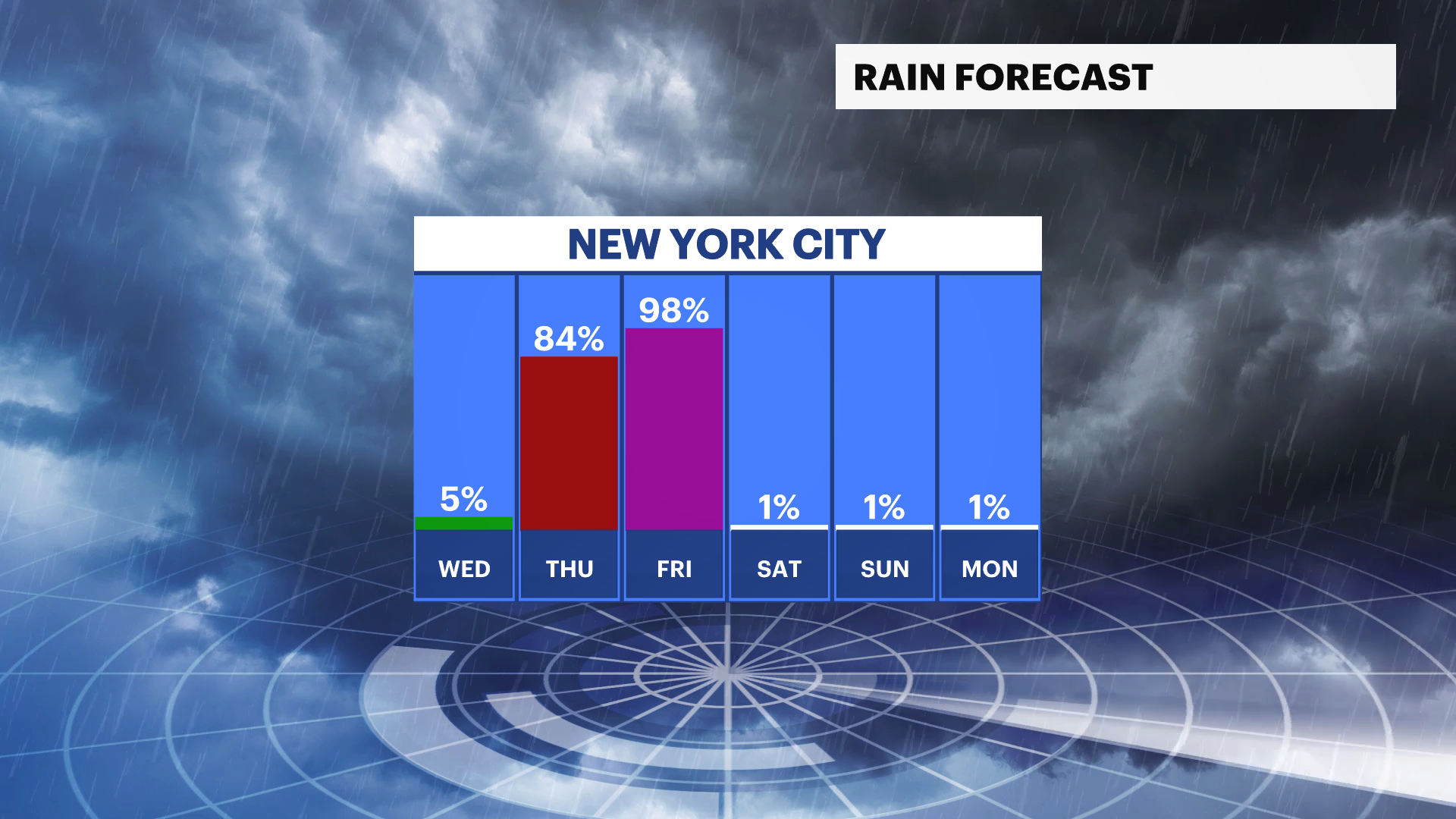
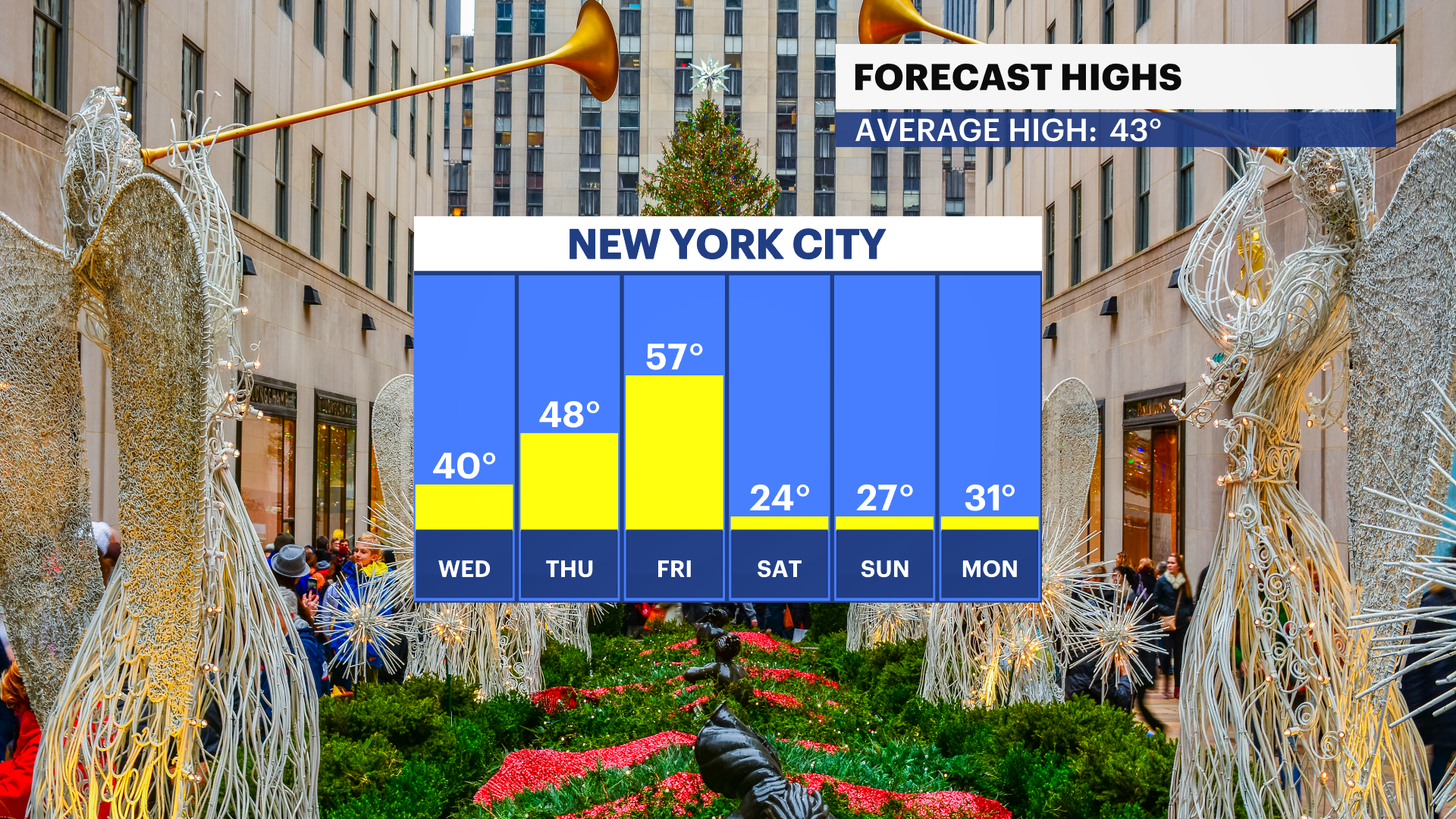
NEXT: Periods of heavy rain, high winds and a drastic drop in temperatures Thursday and Friday. Bitter blast by Christmas weekend with feel-like temps in the single digits. A flash freeze is possible with any standing water on Christmas Eve.
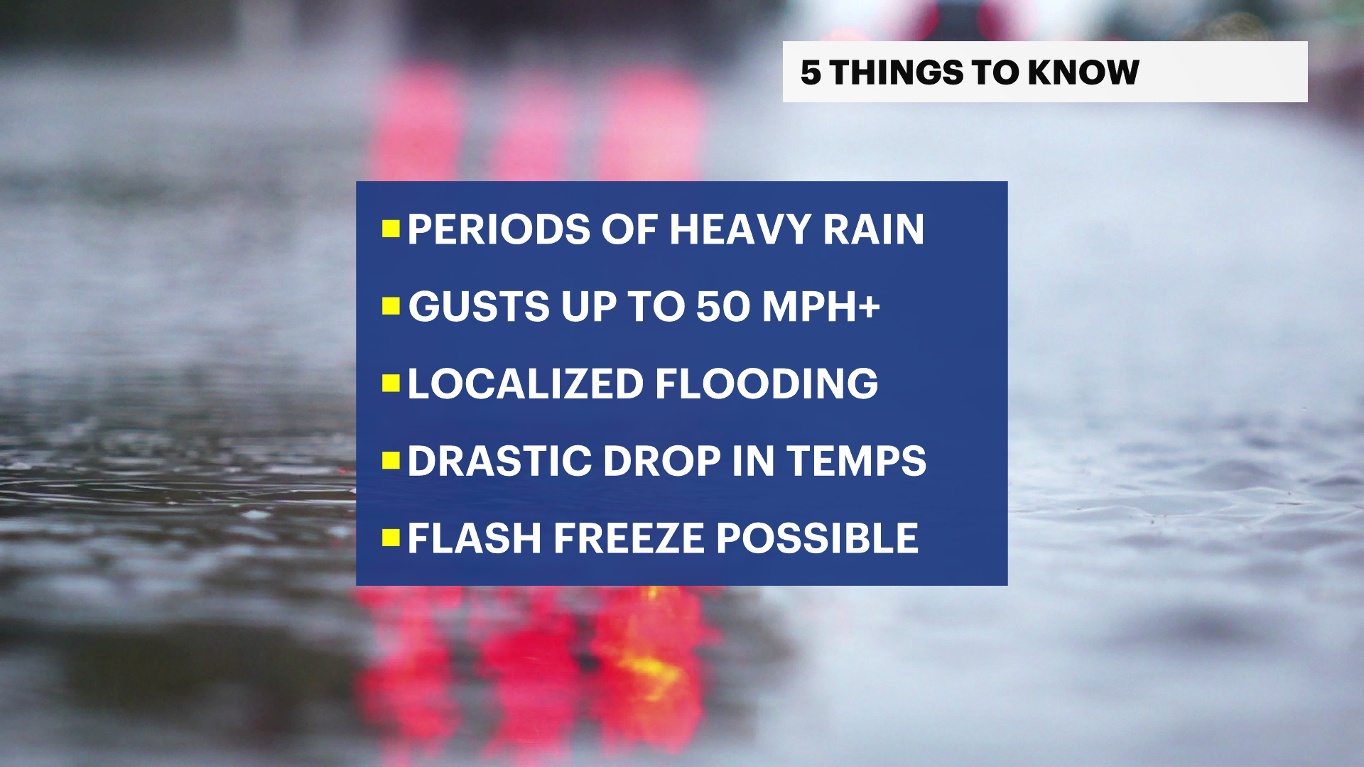
News 12 Storm Watch Team Meteorologist Darryl Green says tonight will have cold temperatures and clear skies, with lows in the upper 20s. 1-2 inches of rainfall is expected Thursday and Friday and will cause localized flooding for low-lying communities and areas that have poor drainage. A widespread moderate to localized major coastal flooding is possible at ocean-facing beaches in NYC during high tide.
Tonight: Very cold and mostly clear, lows in the upper-20s.
Wednesday: Mostly sunny, highs near 40.
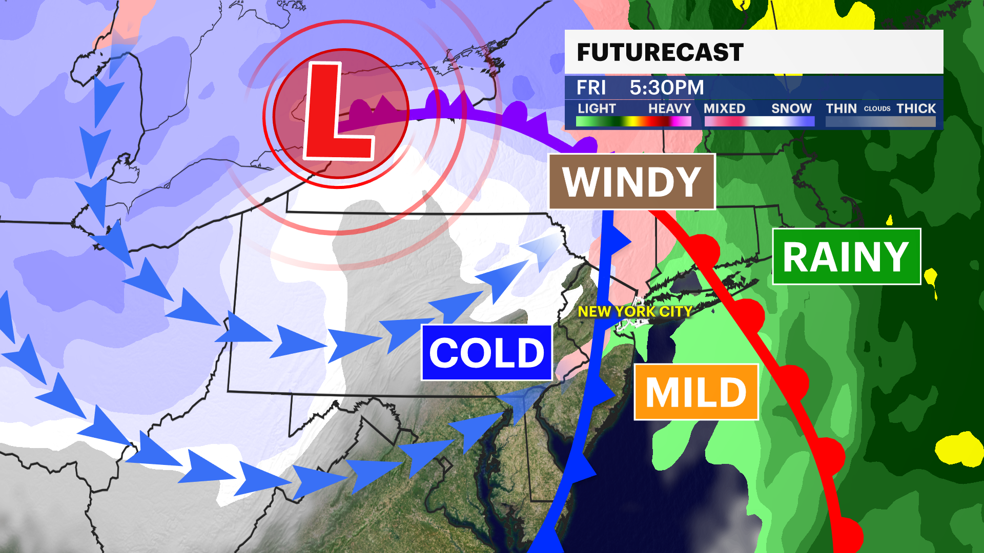
Thursday: A cloudy sky with afternoon showers, then periods of heavy rain and gusty winds at night. Potential gusts to 45 mph.
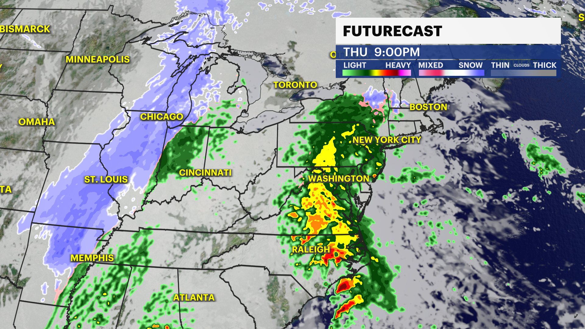
Friday: Morning rain and gusty winds and a slight chance of thunderstorms, highs around the mid-50s and falling early with gusts to 45 mph.
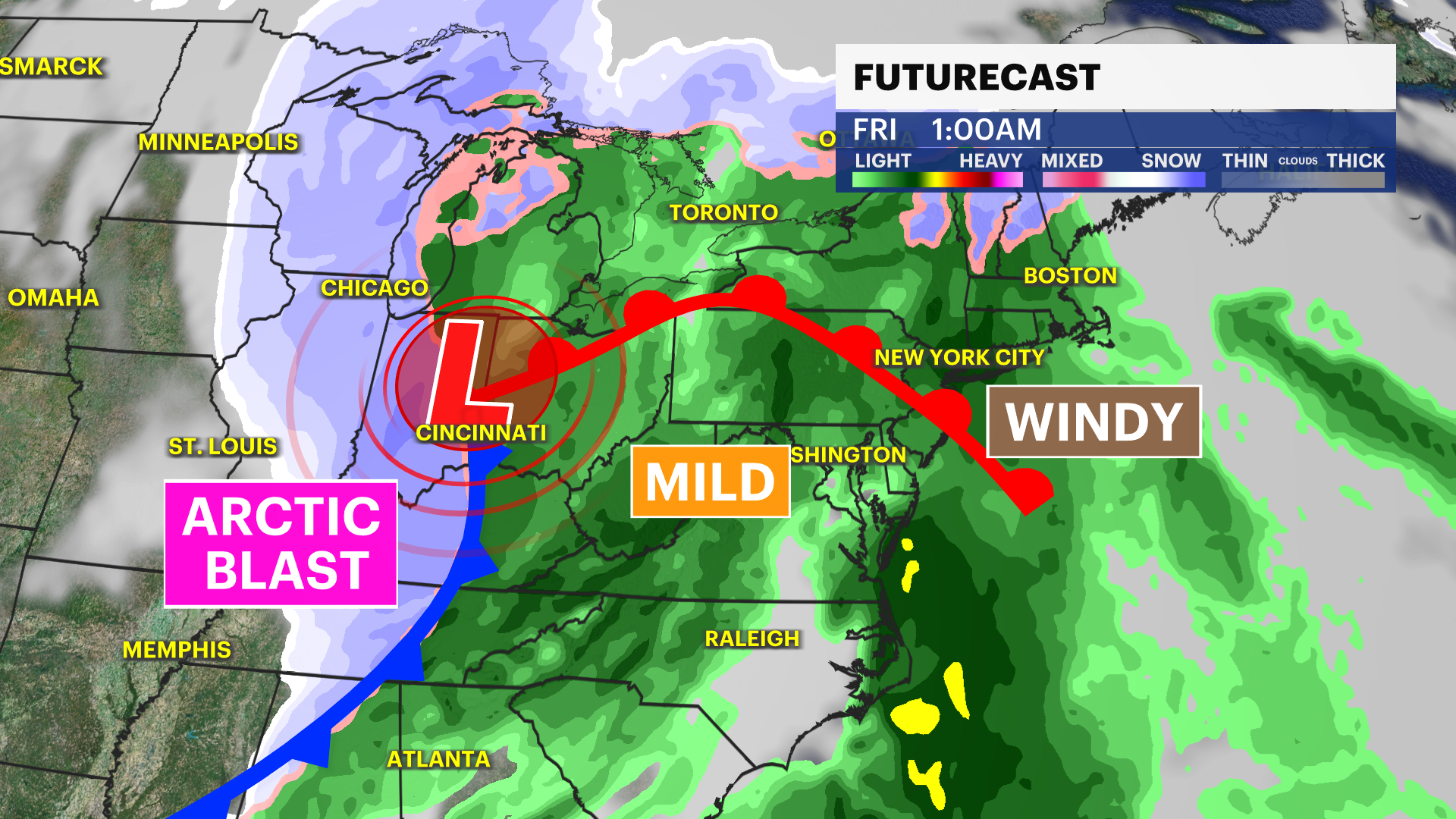
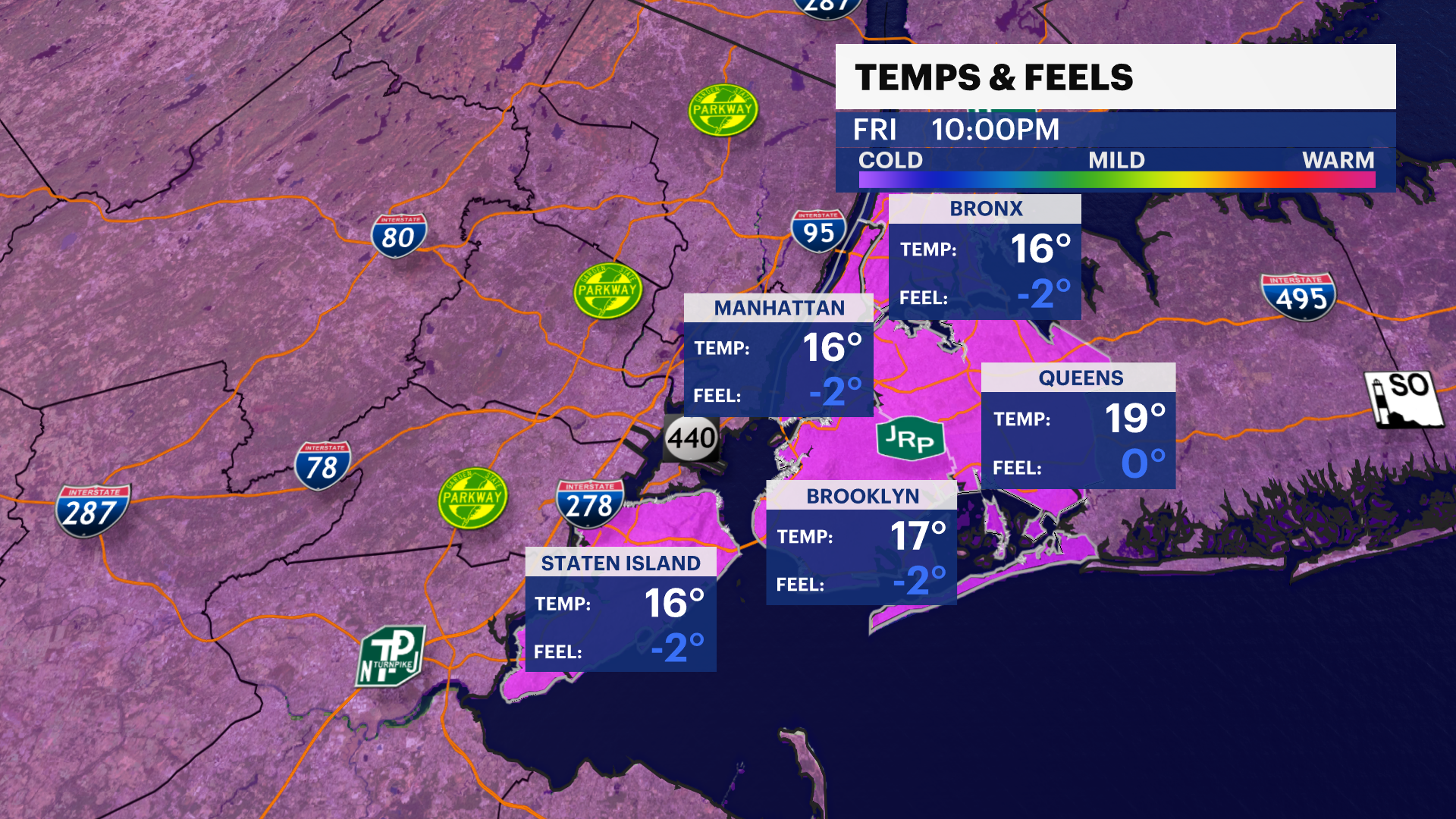
Friday Night: Bitterly cold with lows in the upper teens under a partly cloudy sky. Wind chills from 5 to 10 degrees.
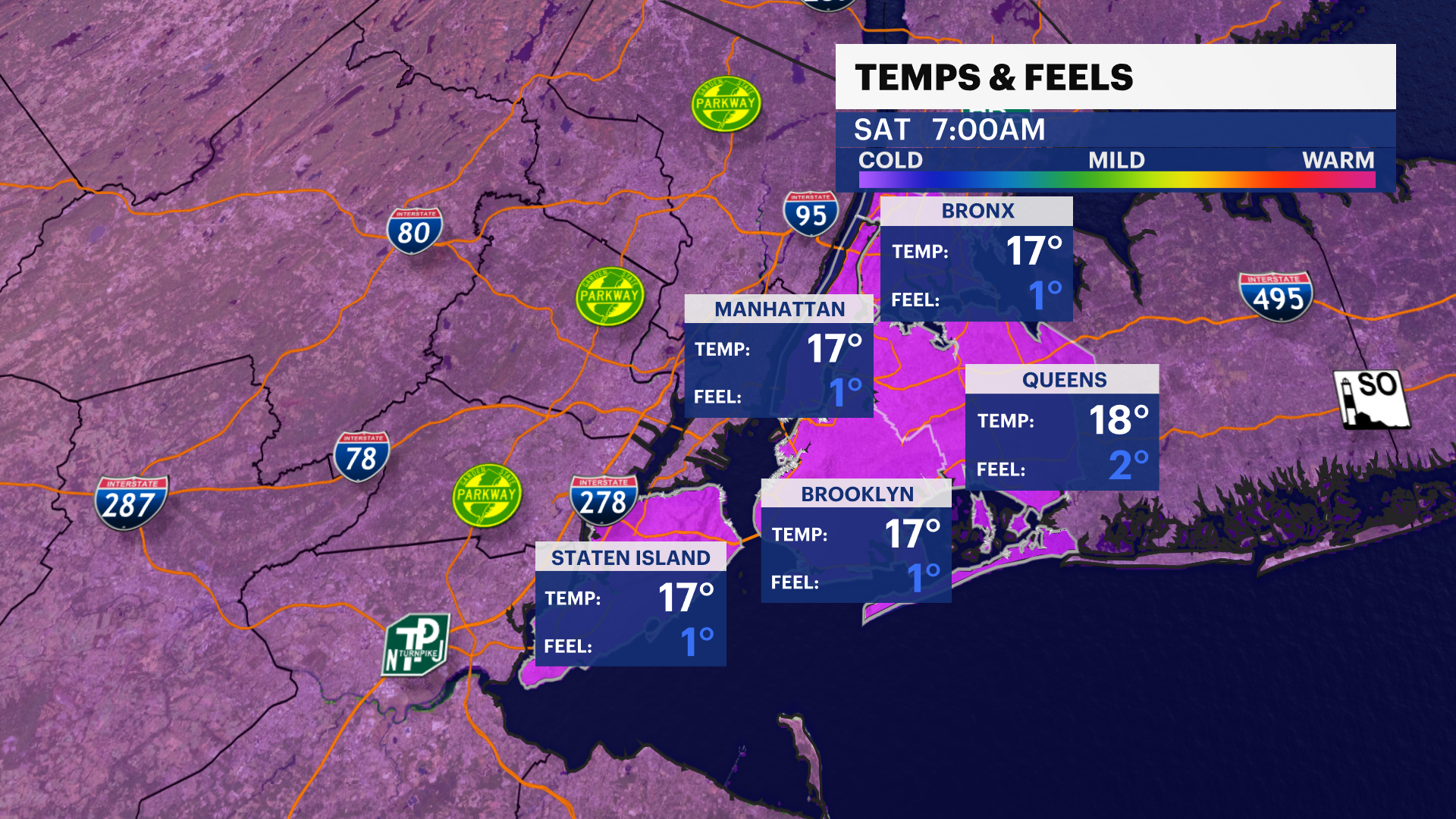
Saturday (Christmas Eve): Partly sunny, highs around the mid-20s. Bitterly cold and mostly clear at night.
Sunday (Christmas): Mostly sunny, highs around the mid-20s. Wind chills from 15 to 20 degrees. Another bitterly cold night
Monday (Kwanza starts): Mostly sunny, breezy and bitterly cold. Highs near 33. Lows near 26.
More from News 12
2:28

STORM WATCH: More snow in The Bronx, the latest in parade of storms this week
1:57

Exclusive: Family demands justice after beloved dog fatally struck by car in Fordham
0:23

Emergency responders battle junkyard fire in Hunts Point
2:09

Residents prep for another round of snow, icy sidewalks
1:31

Concourse Village fire destroys convenience store
21:07
