WEATHER TO WATCH: Flurries linger into the morning commute for Northern New Jersey
News 12 Storm Watch Team Meteorologist Hilda Estevez says there is a possibility of flurries lingering into the morning commute in Northern New Jersey.
•
Dec 11, 2022, 11:26 AM
•
Updated 918 days ago
Share:
More Stories
1:27

Bronx residents try to keep cool in warm temps as summer approaches
4ds ago1:38

June's strawberry moon will be lowest in the sky since 2006
6ds ago2:03

Bronx residents get a taste of summer as they enjoy the sunshine
12ds ago0:26

Tree crushes car in Pelham Parkway
16ds ago
NOAA predicts above-average hurricane season for 2025
24ds ago
News 12 weather blog
31ds ago1:27
Bronx residents try to keep cool in warm temps as summer approaches
4ds ago1:38
June's strawberry moon will be lowest in the sky since 2006
6ds ago2:03
Bronx residents get a taste of summer as they enjoy the sunshine
12ds ago0:26
Tree crushes car in Pelham Parkway
16ds agoNOAA predicts above-average hurricane season for 2025
24ds agoNews 12 weather blog
31ds agoNews 12 Storm Watch Team Meteorologist Hilda Estevez says there is a possibility of flurries lingering into the morning commute in Northern New Jersey.
NOW AND NEW: Wintery mix takes hold of half the Garden State.
NEXT: Monitoring another round of wet and snowy conditions by Thursday and Friday. Could be a larger and more widespread system.
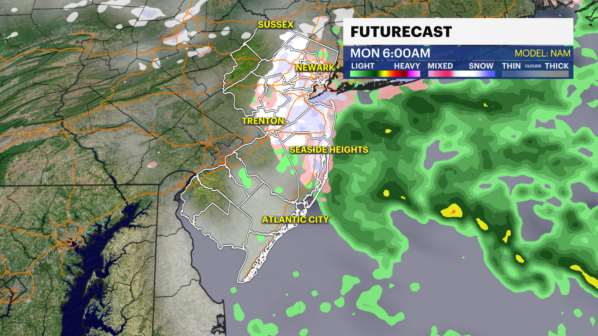
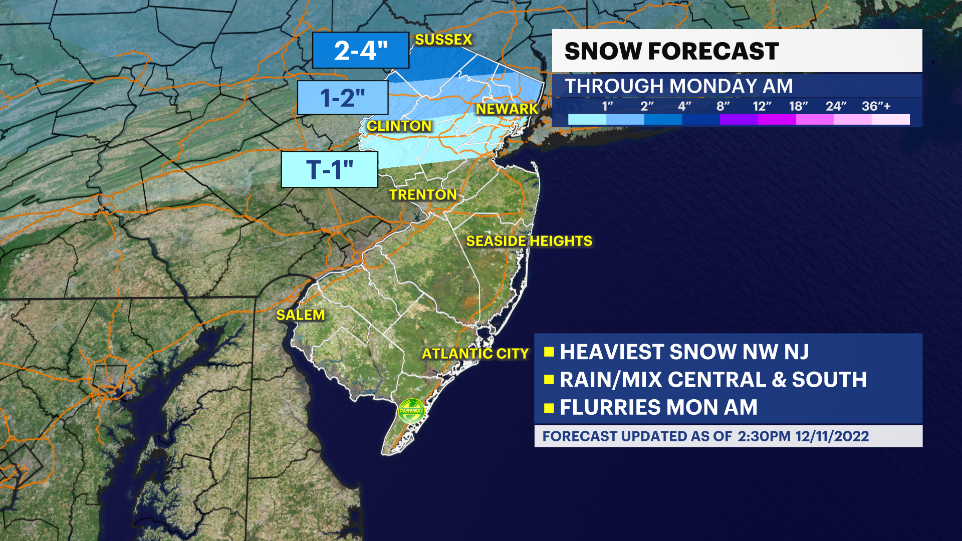
OVERNIGHT: Rainfall south of 80. Rain lingers overnight before switching to snow as temperatures drop over central New Jersey. Overall, a sloppy mess as lows hover 34 degrees. The Jersey Shore and south of 80 runs mild enough to not deal with sticking snow on ground.
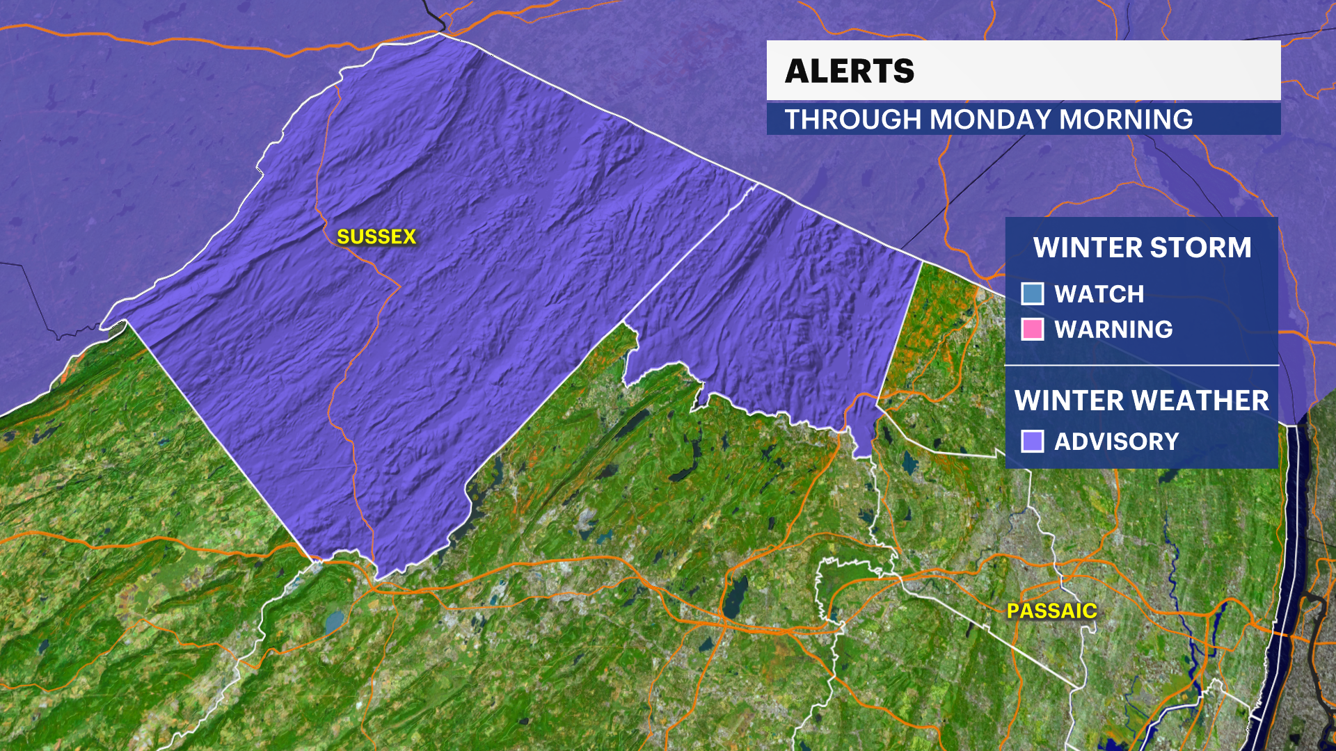
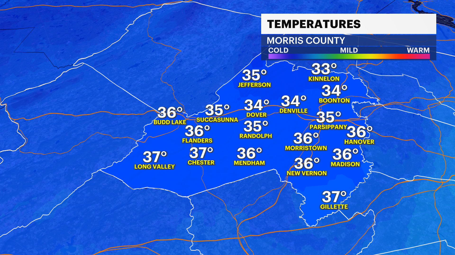
MONDAY: Isolated snow showers throughout the early morning clear west. Morning commute could be a bit dicey with cold temps in place; higher elevations at Sussex County mainly north of I-80. Limited to minor travel impacts on Monday after 8 a.m. Partly sunny skies prevail, ending Weather To Watch branding near 8 a.m. to 10 a.m. Highs near 42. Lows near 25, feels like 20.
TUESDAY: The "better" weather day. A brief break with wet weather under mostly sunny skies and temps in the low 40s. Winds shift north, keeping the December chill. Temperatures in Newark will reach 41 degrees. Lows drop to 25.
WEDNESDAY: Seasonal feel with high temperatures dropping near 40. Another sunny day with lows near 28.
THURSDAY: Watching closely as rain and snow is possible with new system. Highs for now look "mild" with 43 degrees. Lows near 37.
FRIDAY: Mostly cloudy with tail end rain. Highs near 45, lows near 34.
THE WEEKEND: Partly sunny skies with snow flurries possible on Saturday. Highs near 41 with lows between 31 and 29 degrees.
More from News 12
1:16

Loved ones of slain Parkchester Navy veteran hold vigil
1:49

Spotty rain continues overnight in The Bronx; thunderstorm possible Wednesday
1:47

Justin Sanchez seeks to win District 17's City Council seat
1:59

Family considers legal action after father charged with murder of Bronx toddler
1:41

Community pushes for permanent mural honoring 11-year-old killed in Longwood
1:24
